Napanee River
| Napanee River | |
| River | |
| Country | Canada |
|---|---|
| Province | Ontario |
| Region | Eastern Ontario |
| Counties | Lennox and Addington, Frontenac |
| Part of | Great Lakes Basin |
| Tributaries | |
| - left | Depot Creek |
| Source | Camden Lake |
| - location | Stone Mills, Lennox and Addington County |
| - elevation | 146 m (479 ft) |
| - coordinates | 44°26′34″N 76°50′52″W / 44.44278°N 76.84778°W |
| Mouth | Lake Ontario |
| - location | Greater Napanee, Lennox and Addington County |
| - elevation | 74 m (243 ft) |
| - coordinates | 44°11′44″N 77°01′19″W / 44.19556°N 77.02194°WCoordinates: 44°11′44″N 77°01′19″W / 44.19556°N 77.02194°W |
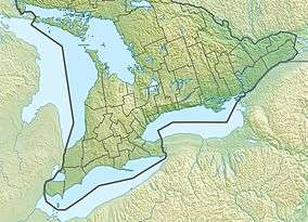 Location of the mouth of the Napanee River in southern Ontario | |
The Napanee River is a river in Lennox and Addington County and Frontenac County in Eastern Ontario, Canada.[1] It is in the Great Lakes Basin and flows from its source at Camden Lake to its mouth at the Bay of Quinte on Lake Ontario at Napanee. It flows through a valley of preglacial origin. The valley of the Napanee is lined with settlements such as Greater Napanee, Newburgh, Camden East, Yarker, and Petworth.
This river was originally called the Appanea. A grist mill was constructed on the river in 1785 near the current site of the town of Greater Napanee. Other mills were added at Yarker and Camden East.
Tributaries
- Varty Creek (right)
- Napanee Lake
- Watson Creek (left)
- Hardwood Creek (left)
- Depot Creek (left)
- Whitman Creek (left)
- Carman Creek (left)
References
- ↑ "Napanee River". Geographical Names Data Base. Natural Resources Canada. Retrieved 2014-08-09.
Other map sources:
- Map 6 (PDF) (Map). 1 : 700,000. Official road map of Ontario. Ministry of Transportation of Ontario. 2014. Retrieved 2014-08-09.
- Restructured municipalities - Ontario map #5 (Map). Restructuring Maps of Ontario. Ontario Ministry of Municipal Affairs and Housing. 2006. Retrieved 2014-08-09.
See also
This article is issued from Wikipedia - version of the 3/19/2016. The text is available under the Creative Commons Attribution/Share Alike but additional terms may apply for the media files.