Nanwalek, Alaska
| Nanwalek, Alaska | |
|---|---|
| CDP | |
| Nickname(s): , Alaska | |
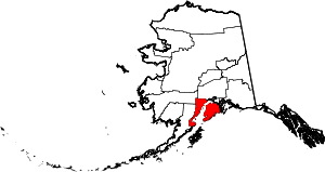
 Location of Nanwalek (AKA English Bay, Alaska) | |
| Coordinates: 59°21′13″N 151°54′45″W / 59.35361°N 151.91250°WCoordinates: 59°21′13″N 151°54′45″W / 59.35361°N 151.91250°W | |
| Country | United States |
| State | Alaska |
| Borough | Kenai Peninsula |
| Government | |
| • Borough mayor | Mike Navarre[1] |
| • State senator | Gary Stevens (R) |
| • State rep. | Louise Stutes (R) |
| Area | |
| • Total | 8.5 sq mi (22.1 km2) |
| • Land | 8.5 sq mi (22.1 km2) |
| • Water | 0.0 sq mi (0.0 km2) |
| Population (2000) | |
| • Total | 177 |
| • Density | 20.8/sq mi (8.0/km2) |
| Time zone | Alaska (AKST) (UTC-9) |
| • Summer (DST) | AKDT (UTC-8) |
| ZIP code | 99603 |
| Area code(s) | 907 |
| FIPS code | 02-52210 |
Nanwalek, formerly Alexandrovsk (Russian: Александровск) and English Bay, is census-designated place (CDP) in the Kenai Peninsula Borough, Alaska, United States that contains a traditional Alutiiq village. The population was 177 at the 2000 census. There is one school located in the community, attended by 76 students.
Subsistence activities are a large part of the culture for indigenous people and Nanwalek is no exception, especially when it comes to salmon and seal harvesting. The sale of alcohol is banned in the village, although importing and possession are allowed.
Geography
Nanwalek and Port Graham are located near the southern tip of the Kenai Peninsula and are separated by less than five miles (8 km). Both villages are accessible only by air or water (they lie 35 miles (56 km) southwest of Homer). The Alaska Marine Highway System provides service to nearby Seldovia (located only 10 miles (16 km) up the coast line). A state-owned 1,850-foot (560 m) by 50-foot (15 m) gravel airstrip sits atop a natural spit which divides the small lagoon from the southern mouth of Cook Inlet. Looking West, one can see Mt. Iliamna and further to the north Mt. Redoubt. Although they are in the vicinity of the village, they do not cause trouble to the villagers, since Iliamna is erupting continuously, emitting only smoke, and Redoubt is so far in the north that the ashes from its eruptions bother mostly Kenai and Anchorage. It is Augustine (the most active volcano of the eastern Aleutian arc), which makes life nasty in Nanwalek, Port Graham, Seldovia and Homer, when it erupts, as it most recently has done in 1986 and 2006.[2][3]
Nanwalek is located at 59°21′13″N 151°54′45″W / 59.353483°N 151.912482°W.[4]
According to the United States Census Bureau, the CDP has a total area of 8.5 square miles (22 km2), all of it land.
Demographics
As of the census[5] of 2000, there were 177 people, 45 households, and 32 families residing in the CDP. The population density was 20.8 people per square mile (8.0/km²). There were 54 housing units at an average density of 6.3/sq mi (2.5/km²). The racial makeup of the CDP was 6.78% White, 89.27% Native American, and 3.95% from two or more races. 1.13% of the population were Hispanic or Latino of any race.
There were 45 households out of which 55.6% had children under the age of 18 living with them, 51.1% were married couples living together, 15.6% had a female householder with no husband present, and 26.7% were non-families. 22.2% of all households were made up of individuals and 2.2% had someone living alone who was 65 years of age or older. The average household size was 3.93 and the average family size was 4.79.
In the CDP the population was spread out with 42.9% under the age of 18, 14.1% from 18 to 24, 31.6% from 25 to 44, 10.7% from 45 to 64, and 0.6% who were 65 years of age or older. The median age was 22 years. For every 100 females there were 113.3 males. For every 100 females age 18 and over, there were 114.9 males.
The median income for a household in the CDP was $42,500, and the median income for a family was $45,750. Males had a median income of $33,750 versus $32,813 for females. The per capita income for the CDP was $10,577. About 14.7% of families and 17.5% of the population were below the poverty line, including 12.6% of those under the age of 18 and none of those 65 or over.
History
Nanwalek is also known as English Bay or Alexandrovski. In 1786, Point Alexandrovski was the first Russian trade post taking Native Alaskan hunters from local Yukon hunting villages to harvest seal/otter pelts for Russian export. Locals changed the community name from English Bay to Nanwalek, meaning "place by lagoon." Many of the current residents are of mixed Russian and Sugpiaq (Alutiiq) heritage. Villagers speak Sugt'stun, an Eskimo language closely related to Yup'ik.
The village was originally the site of a Russian Trading Post called Alexandrovsk during the fur trade. It was later called "Odinochka", meaning a "one man post." A Russian Orthodox Church consecrated to Saints Sergius and Herman of Valaam was built in the community in 1870 (only three years after the sale of Alaska by Russia to the United States). A replacement church building was constructed in 1930 and is listed on the National Register of Historic Places.
The Orthodox Church in Alaska can trace its activities back to early Russian missionaries. The witness of Herman of Alaska, Saint Innocent of Alaska, and Peter the Aleut has contributed to the continuing strong Orthodox community in villages like Nanwalek.
References
- ↑ 2015 Alaska Municipal Officials Directory. Juneau: Alaska Municipal League. 2015. p. 9.
- ↑ Alaska's Volcanoes, Alaska Geographic, Vol. 18 (1991), no. 2, p. 73.
- ↑ "Augustine". Global Volcanism Program. Smithsonian Institution. Retrieved 2009-01-19.
- ↑ "US Gazetteer files: 2010, 2000, and 1990". United States Census Bureau. 2011-02-12. Retrieved 2011-04-23.
- ↑ "American FactFinder". United States Census Bureau. Retrieved 2008-01-31.
External links
- Local News airport sites under consideration for villages
- General Info list of contact phone numbers, etc.
- Nanwalek Public School- attended by 76 students
- SS. Sergius/Herman of Valaam Church
- Alaskan Orthodox Christian texts (Aleut, Tlingit) by St. Innocent (Veniaminov)
- Nanwalek Jukebox (audio files)