Nant-y-moch Reservoir
| Nant y Moch | |
|---|---|
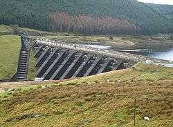 dam spillway | |
| Location | Cambrian Mountains, Wales |
| Coordinates | 52°28′5″N 3°50′22″W / 52.46806°N 3.83944°WCoordinates: 52°28′5″N 3°50′22″W / 52.46806°N 3.83944°W |
| Type | reservoir |
| Basin countries | United Kingdom |
| Surface area | 525 acres |
Nant-y-moch Reservoir ![]() Welsh pronunciation is situated in the Cambrian Mountains in northern Ceredigion, Wales. The reservoir which flooded a part of the valley of the River Rheidol and its headwaters derives its name from a stream, the Nant-y-moch (in English = the pigs stream,), which formerly flowed into the River Rheidol at this spot. The dam is about three miles north of the village of Ponterwyd. The reservoir forms part of the Cwm Rheidol hydroelectric power scheme and the headwaters of the reservoir include the source of the River Rheidol. The Nant-y-moch component of the hydroelectric scheme has an installed capacity of 13 MW generated as the water from Nant-y-moch enters Dinas Reservoir [1]
Welsh pronunciation is situated in the Cambrian Mountains in northern Ceredigion, Wales. The reservoir which flooded a part of the valley of the River Rheidol and its headwaters derives its name from a stream, the Nant-y-moch (in English = the pigs stream,), which formerly flowed into the River Rheidol at this spot. The dam is about three miles north of the village of Ponterwyd. The reservoir forms part of the Cwm Rheidol hydroelectric power scheme and the headwaters of the reservoir include the source of the River Rheidol. The Nant-y-moch component of the hydroelectric scheme has an installed capacity of 13 MW generated as the water from Nant-y-moch enters Dinas Reservoir [1]
History
Nant-y-moch Reservoir was created in 1964. The construction of the dam flooded the valley south of it, which included the hamlet of Nant-y-moch. The contents of the graveyard which was to be submerged were relocated to the chapel at Ponterwyd, and a number of cairns were painstakingly moved, some of which dated back as far as the Iron Age.
References
External links
- Aerial photo of the reservoir
- High definition timelapse video of Nant y Moch dam and reservoir
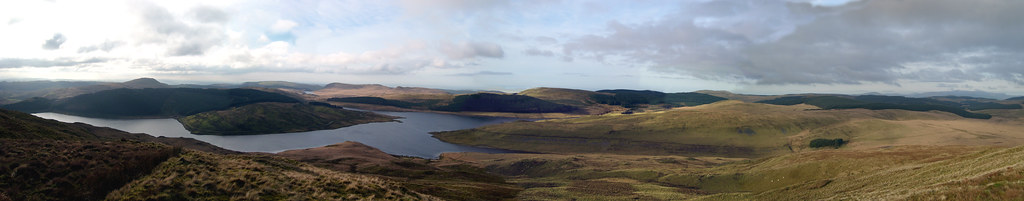
- Panoramic view of Nant y Moch from Drosgol peak