Nandura
| Nandura नांदूरा | |
|---|---|
| city | |
 Nandura Location in Maharashtra, India | |
| Coordinates: 20°50′00″N 76°27′35″E / 20.83333°N 76.45972°ECoordinates: 20°50′00″N 76°27′35″E / 20.83333°N 76.45972°E | |
| Country |
|
| State | Maharashtra |
| District | Buldhana |
| Elevation | 262 m (860 ft) |
| Population (2011) | |
| • Total | 42,167 [1] |
| Postal Index Number | 443404 |
| Area code | +91-07265 |
| Website | www.nandura.info |
Nandura is a town and a municipal council in Buldhana district in the Indian state of Maharashtra. It is the headquarters of Nandura taluka. Situated on the National Highway No. 6 and Mumbai-Howrah railway line, Nandura in an important town in the Buldhana district. Nandura municipality was established during the British Raj in 1931.[2]
Geography
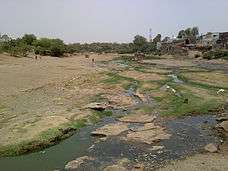
Nandura is a twin town; Nandura Buzruk (Greater Nandura) is separated from a village of the same name (Nandura Khurd or Little Nandura) by the Dnyanganga River, though the village is officially considered as the part of Nandura itself. Nandura is having 105 feet tall statue of lord Hanumana and a historical place Ambadevigad.
History
Nandura is one of the oldest cities of previously Akola[3] district. After August 1905, it became the part of Buldhana district. According to Aine-Akbari, it is an integral part of Gulshan-e-Berar in Muedveal period since khilji dynasty to mughal period. The city remembers various rulers, Saints (Sant) of Maharashtra who ruled on the land and the heart of the people of Nandura. Various links of Peshwas, Peshwe or Peshwa[4] are also found in the history of Nandura. Nawab Amirullah Khan was one of the Nawabs[5] in the late 1800 AD history of Nandura. It relates to Nizams[6] of Deccan[7] also known as Dakkan. When British invaded India, Nawab's rule ceased.
Demographics
As of 2001 India census,[8] Nandura had a population of 37,470. Males constitute 51% of the population and females 49%. Nandura has an average literacy rate of 69%, higher than the national average of 59.5%: male literacy is 76%, and female literacy is 62%. A total of 14% of the population is under 6 years of age.
- Communication=
Nandura is situated on national highway number 6 i.e. Hajira-Dhule-Kolkata National Highway. It is also a railway station of Central Railway on the broad gauge Howrah-Nagpur-Mumbai line.
Nandura has a sub post office and telegraph office with pincode 443404. Modern communication services like telephone and cellphones has now been a common thing. Internet is also evolving as a mean of communication, though it is not in the mainstream yet.
Industries
Nandura has oil mills, dal mills, and jinning and pressing industry along with handlooms. In older days, Nandura was known for cotton products like ropes, handmade cotton dhoti and saris, etc. Nandura's milk products like Khava are famous for its quality and taste and is transported daily to several adjoining districts.
Nandura also acts an important trade center in the locality. Trading of wheat, jowar, pulses, cotton, onion, chilli, lemon and several vegetables like Brinjal are the prominent ones.
Education
Nandura has educational facilities from preschool to graduation level. Some of the institutions are listed below:
- Majidai Urdu Highschool,Chandur Bisw
- Shivaji high school
- Pundlik Maharaj Senior College
- Bharatiya Dnyanpeeth Vidyalaya
- Kothari D.Ed College
- Inayatia high school and Jr.college
- Inayatiya Girls High School, Nawab Pura, Nandura
- Inayatiya Primary School, Gaibi Nagar, Nandura
- Maulana Azad High School
- Smt. Tulsaibai Ranglalji Zambad Senior College ( B.Sc. & B.Com [Eng. Medium])
- Smt. Tulsibai Ranglalji Zambad VidyaNiketan,(C.B.S.E. affiliated School class 1 to 12 in Buldana Dist.)
- Zambad Kids(Nursury, LKG, UKG)
- Jangli maharaj semi English convent
- Computer Education:- STCI Nandura
- Kothari Madhyamik Kanya Shala
- Kothari Boys High School
- Kothari Junior College
Nandura Tehsil
Nandura tehsil is part of Malkapur Sub-Division of Buldhana district, along with Motala and Malkapur tehsils. It has its borders with Malkapur tehsil in the west, Jalgaon Jamod tehsil in the north, Khamgaon and Shegaon tehsils in the east, and Khamgaon and Motala tehsils in the south.
Nandura tehsil has area of 462 square km and consist of 103 villages has a population of around 1,28,000. In 2011, Mr Santosh P.Kharade was elected in municipal election as independent candidate. He was elected because of his wide public work. .[9]
Some of these villages are Chandur Biswa, Wadner, Nimgaon, Takli(Wachpal), Jigaon, Palsoda, Patonda, Mamulwadi, Higana Gavhad, Mominabad, Sawargaon, Sirsodi, Yerali,Belad (Sabe), Alampur, Narakhed, Pimpalkhuta Dhande, Rasulpur, Wadali, Dighi, Khumgaon, Dahigaon,Matoda,sonaj, Danora, Kati, Dahivadi, Potali, Medhali, Wadi, Shegaon, Lonwadi, Malegaon Gond, Wasadi, Khadatgaon, Mahalundi, Jawala Bazar, Takarkhed, Fuli, Khaira, and Shemba, Pimpri Adhao, Kokalwadi, Dighi Wadgaon, Vitali, Nimbola[10]
Tourist attractions

The 105-feet statue of Lord Hanuman is a main tourist attraction in the town. It is situated on the national highway no. 6. About Murti : Height:108 ft. Chest:70 ft. Base:30 ft. Tail:70 ft. Arm:25 ft.(diameter) Gada 30 ft. Sole 34 ft. Nail of sole:15 ft. description: Lord Hanuman is son of Pawan (Air) and Anjani (the woman of highly spiritual native). Lord Hanuman is called PAWANSUT (Son of Air) and ANJANIPUTRA (Son of Anjani). About Murti :Height:108 ft.Chest:70 ft. Base:30 ft. Tail:70 ft. Arm:25 ft.(diameter) Gada 30 ft. Sole 34 ft. Nail of sole:15 ft.
 |
Purna River, Manegaon, Jalgaon Jamod | | ||
| Malkapur, Buldhana | |
Jalamb, Shegaon | ||
| ||||
| | ||||
| Motala | Pimpalgaon Raja | Khamgaon |
References
- ↑ [census 2011]
- ↑ "The Gazetteers Department - Buldhana". Retrieved March 17, 2010.
- ↑ Akola
- ↑ Peshwa
- ↑ Nawab
- ↑ Nizam of Hyderabad
- ↑ Hyderabad Deccan railway station
- ↑ "Census of India 2001: Data from the 2001 Census, including cities, villages and towns (Provisional)". Census Commission of India. Archived from the original on 2004-06-16. Retrieved 2008-11-01.
- ↑ Buldhana District Disaster Plan, Relief & Rehabilitation Division, Revenue and Forest Department, Government of Maharashtra
- ↑ Buldhana district website
| Wikimedia Commons has media related to Nandura. |
| Subdivisions and tehsils |  | |
|---|---|---|
| Cities, towns and villages | ||
| Railway stations |
| |
| Roads | ||
| Historical |
| |
| Geography | ||
| Lok Sabha constituencies | ||
| Vidhan Sabha constituencies |
| |
| Religious | ||
| People |
| |
| See Also |
| |