Nanchang
| Nanchang 南昌市 | |
|---|---|
| Prefecture-level city | |
| Nanchang City | |
|
Clockwise from top: New Fourth Army Headquarter, Star of Nanchang, Bayi Square, Nanchang sunrise, Tengwang Pavilion. | |
| Nickname(s): Hongcheng (洪城, lit. Grand City), Hongdu (洪都, lit. Grand Metropolis), Yuzhang (豫章) | |
.png) Location of Nanchang City jurisdiction in Jiangxi | |
| Coordinates: 28°41′N 115°53′E / 28.683°N 115.883°ECoordinates: 28°41′N 115°53′E / 28.683°N 115.883°E | |
| Country | China |
| Province | Jiangxi |
| Government | |
| • Mayor | Guo An |
| • Secretary | Wang Wentao |
| Area | |
| • Prefecture-level city | 7,194 km2 (2,778 sq mi) |
| • Urban | 617 km2 (238 sq mi) |
| • Metro | 4,588 km2 (1,771 sq mi) |
| Elevation | 37 m (122 ft) |
| Population (2010 census[1]) | |
| • Prefecture-level city | 5,042,565 |
| • Density | 700/km2 (1,800/sq mi) |
| • Urban | 2,357,839 |
| • Urban density | 3,800/km2 (9,900/sq mi) |
| • Metro | 4,171,926 |
| • Metro density | 910/km2 (2,400/sq mi) |
| Time zone | CST (UTC+8) |
| Licence plate prefixes | 赣A, 赣M |
| City Flower | Chinese Rose |
| City Tree | Camphor Laurel |
| Website |
nc |

| Nanchang | |||||||||||||||||||||||||||
|
"Nanchang" in Chinese | |||||||||||||||||||||||||||
| Chinese | 南昌 | ||||||||||||||||||||||||||
|---|---|---|---|---|---|---|---|---|---|---|---|---|---|---|---|---|---|---|---|---|---|---|---|---|---|---|---|
| Literal meaning | "Southern prosperity" | ||||||||||||||||||||||||||
| |||||||||||||||||||||||||||

Nanchang (Chinese: 南昌) is the capital of Jiangxi Province in southeastern China.[2] As of 2010, a population of 5,042,565 live in the prefecture, in which 2,357,838 live in the area made up of all five urban districts.[3] Located in the north-central part of the province, it is bounded on the west by the Jiuling Mountains, and on the east by Poyang Lake. Because of its strategic location connecting the prosperous East and South China, it has become a major railway hub in Southern China in recent decades.
As the Nanchang Uprising in 1927 is distinctively recognized by the ruling Communist Party as "firing the first gunshot against the evil Nationalists",[4] the current regime has therefore named the city since 1949 "the City of Heroes", "the place where the People's Liberation Army was born", and the most widely known "place where the military banner of the People's Liberation Army was first raised".
History
Nanchang is a city of long history. As early as 50,000 years ago, clans inhibited the Anyi region of the Nanchang city. About three thousand years ago, to the north Aixi Lake, south of Qingyun Pu, the arc of the formation of ancient Nanchang gathering area residents.
Han Emperor five years (202 BC), Han Guan Ying the local garrison, located Yu Zhang County, next year the construction of the city, site in this city about 4 kilometres (2.5 miles) southeast of Nanchang Railway Station Huang Temple City, the city perimeter miles eighty-four step, called "Guan Ying City", it was built to create a history of Nanchang city. First built "Nanchang County," Yu Zhang county of Gunji, take "grand southern" and "Southern prosperity," meaning, named "Nanchang." The territories encompassing modern-day Jiangxi Province—including Nanchang—was first incorporated into China during the Qin dynasty, when it was conquered from the Baiyue peoples and organized as Jiujiang Commandery (Chinese: 九江郡).[5] In 201 BC, during the Han dynasty, the city was given the Chinese name Nanchang and became the administrative seat of Yuzhang Commandery (Chinese: 豫章郡), and was governed by Guan Ying (Chinese: 灌嬰), one of Emperor Gaozu of Han's generals.[5] The name Nanchang means "southern flourishing", derived from a motto of developing what is now southern China that is traditionally attributed to Emperor Gaozu himself.[5]
In AD 589, during the Sui dynasty, this commandery was changed into a prefecture named Hongzhou (Chinese: 洪州), and after 763 it became the provincial center of Jiangxi, which was then beginning the rapid growth that by the 12th century made it the most populous province in China.
In 653 the Tengwang Pavilion was constructed, and in 675 Wang Bo wrote the classic "Tengwang Ge Xu", a poetic introductory masterpiece celebrating the building, making the building, the city, and the author himself known to literate Chinese-speaking population ever since.[6] The Pavilion has been destroyed and rebuilt several times throughout history.[7] Its present form was reconstructed in the 1980s after being destroyed in 1929 during the Chinese Civil War.[8]
In 959, under the Southern Tang regime, Nanchang was made superior prefecture and the southern capital. After the conquest by the Song regime in 981 it was reverted to the name Hongzhou. In 1164 it was renamed Longxing prefecture, which name it retained until 1368. At the end of the Yuan (Mongol) period (1279–1368), it became a battleground between Zhu Yuanzhang, the founder of the Ming dynasty (1368–1644), and the rival local warlord, Chen Youliang. At the beginning of the 16th century it was the power base from which Zhu Chenhao, the Prince of Ning, launched a rebellion against the emperor.
During the reign of the Wanli Emperor of the Ming dynasty, it housed relatives of the emperor who had been exiled because they were potential claimants of the imperial throne, members of the imperial family constituting about one quarter of the city's population; as a result of this, Matteo Ricci came here when trying to gain entry to Beijing.[9]
In the 1850s it suffered considerably as a result of the Taiping Rebellion (1850–64), and its importance as a commercial centre declined as the overland routes to Canton were replaced by coastal steamship services in the latter half of the 19th century. Nanchang has, however, remained the undisputed regional metropolis of Jiangxi.
On August 1, 1927, Nanchang was the site of one of a series of insurrections organized by the communists. The Nanchang Uprising, led by pro-communist Kuomintang officers under Russian direction, succeeded in holding the city for only a few days, and provided a core of troops and a method of organization from which the People's Liberation Army (PLA) later developed.
In 1939, the Battle of Nanchang, a ferocious battle between the Chinese National Revolutionary Army and the Imperial Japan Army in the Second Sino-Japanese War took place.[10][11][12]
By 1949 Nanchang was still essentially an old-style administrative and commercial city, with little industry apart from food processing; it had a population of about 275,000. Nanchang first acquired a rail connection in 1915, only connecting to the port city of Jiujiang by the Yangtze. Several other rail links have since been opened. After World War II a line was completed to Linchuan and Gongqi in the Ru River Valley to the south-southeast.
Since 1949 Nanchang has been extensively industrialized. It is now a large-scale producer of cotton textiles and cotton yarn. Paper making is also a major industry, as is food processing (especially rice milling). Heavy industry began to gain prominence in the mid-1950s. A large thermal-power plant was installed and uses coal brought by rail from Fengcheng to the south. A machinery industry also grew up, at first mainly concentrating on the production of agricultural equipment and diesel engines. Nanchang then became a minor centre of the automotive industry in China, producing trucks and tractors and also accessories such as tires. An iron-smelting plant helping to supply local industry was installed in the later 1950s. There is also a large chemical industry, producing agricultural chemicals and insecticides as well as pharmaceuticals.
Geography and climate
Nanchang is located 130 km (81 mi) south of the Yangtze River and is situated on the right bank of the Gan River just below its confluence with the Jin River and some 40 km (25 mi) southwest of its discharge into Poyang Lake.
Nanchang has a monsoon-influenced humid subtropical climate (Köppen Cfa) with distinct four seasons. Winters are short and cool with occasional frosts; it begins somewhat sunny and dry but becomes progressively wetter and more overcast. Spring begins especially gloomy, and from April to June, each month has more than 220 mm (8.7 in) of rainfall. Summer is long and humid, with amongst the highest temperatures of any Chinese provincial capital, and with the sun shining close to 60 percent of the time in July and August, is the sunniest time of year. Autumn is warm to mild with the lowest rainfall levels of the year. The monthly 24-hour average temperature ranges from 5.5 °C (41.9 °F) in January to 29.5 °C (85.1 °F) in July, while the annual mean is 18.00 °C (64.4 °F). Annual precipitation stands at around 1,610 mm (63 in); with monthly percent possible sunshine ranging from 23 percent in March to 60 percent in August, the city receives 1,832 hours of sunshine annually in average. Extremes since 1951 have ranged from −9.7 °C (15 °F) on 29 December 1991 to 40.6 °C (105 °F) on 23 July 1961.[13]
| Climate data for Nanchang (1981–2010) | |||||||||||||
|---|---|---|---|---|---|---|---|---|---|---|---|---|---|
| Month | Jan | Feb | Mar | Apr | May | Jun | Jul | Aug | Sep | Oct | Nov | Dec | Year |
| Record high °C (°F) | 25.3 (77.5) |
28.7 (83.7) |
32.5 (90.5) |
34.6 (94.3) |
36.5 (97.7) |
37.7 (99.9) |
40.6 (105.1) |
39.7 (103.5) |
38.6 (101.5) |
35.4 (95.7) |
32.3 (90.1) |
26.1 (79) |
40.6 (105.1) |
| Average high °C (°F) | 8.8 (47.8) |
11.2 (52.2) |
15.2 (59.4) |
21.7 (71.1) |
26.9 (80.4) |
29.6 (85.3) |
33.7 (92.7) |
33.1 (91.6) |
29.1 (84.4) |
24.1 (75.4) |
17.9 (64.2) |
11.9 (53.4) |
21.9 (71.4) |
| Daily mean °C (°F) | 5.5 (41.9) |
7.7 (45.9) |
11.4 (52.5) |
17.7 (63.9) |
22.8 (73) |
25.9 (78.6) |
29.5 (85.1) |
28.9 (84) |
25.1 (77.2) |
19.9 (67.8) |
13.7 (56.7) |
7.9 (46.2) |
18 (64.4) |
| Average low °C (°F) | 3.0 (37.4) |
5.2 (41.4) |
8.7 (47.7) |
14.6 (58.3) |
19.7 (67.5) |
23.0 (73.4) |
26.1 (79) |
25.8 (78.4) |
22.2 (72) |
16.8 (62.2) |
10.6 (51.1) |
4.9 (40.8) |
15.1 (59.2) |
| Record low °C (°F) | −7.7 (18.1) |
−9.3 (15.3) |
−1.7 (28.9) |
2.4 (36.3) |
10.0 (50) |
14.8 (58.6) |
18.9 (66) |
19.5 (67.1) |
13.3 (55.9) |
3.5 (38.3) |
−0.8 (30.6) |
−9.7 (14.5) |
−9.7 (14.5) |
| Average precipitation mm (inches) | 79.0 (3.11) |
104.8 (4.126) |
176.9 (6.965) |
220.4 (8.677) |
222.9 (8.776) |
299.1 (11.776) |
139.4 (5.488) |
124.6 (4.906) |
70.4 (2.772) |
55.7 (2.193) |
76.4 (3.008) |
44.1 (1.736) |
1,613.7 (63.533) |
| Average precipitation days (≥ 0.1 mm) | 13.3 | 13.6 | 17.3 | 17.2 | 15.7 | 15.0 | 10.5 | 10.3 | 6.9 | 7.6 | 8.5 | 8.2 | 144.1 |
| Average relative humidity (%) | 76 | 77 | 79 | 79 | 78 | 82 | 76 | 76 | 75 | 71 | 71 | 71 | 75.9 |
| Mean monthly sunshine hours | 89.0 | 83.1 | 94.2 | 125.2 | 161.4 | 159.5 | 248.6 | 233.2 | 189.5 | 168.4 | 143.0 | 137.8 | 1,832.9 |
| Percent possible sunshine | 28 | 27 | 23 | 30 | 36 | 39 | 59 | 60 | 50 | 47 | 46 | 44 | 40.8 |
| Source: China Meteorological Administration [14] | |||||||||||||
Demographics
As of 2010 (Census), Nanchang has a population of 5,042,565, of which about 2.3 million live in built-up (urbanized) area consists of five urban districts.[3] 37 ethnic groups were counted amongst its prefecture divisions.
Administration
| Map | |||||||||||
|---|---|---|---|---|---|---|---|---|---|---|---|
| Division code[15] | English | Chinese | Pinyin | Area in km2[16] | Seat | Postal code | Subdivisions[17] | ||||
| Subdistricts | Towns | Townships | Residential communities | Villages | |||||||
| 360100 | Nanchang | 南昌市 | Nánchāng Shì | 7194[18] | Donghu District (Honggutan N.A.) | 330000 | 30 | 49 | 31 | 625 | 1161 |
| 360102 | Donghu District | 东湖区 | Dōnghú Qū | 30 | Gongyuan Subdistrict (公园街道) | 330000 | 10 | 159 | 21 | ||
| 360103 | Xihu District | 西湖区 | Xīhú Qū | 43 | Chaoyangzhou Subdistrict (朝阳洲街道) | 330000 | 10 | 1 | 136 | 13 | |
| 360104 | Qingyunpu District | 青云谱区 | Qīngyúnpǔ Qū | 40 | Sanjiadian Subdistrict (三家店街道) | 330000 | 5 | 1 | 63 | 12 | |
| 360105 | Wanli District | 湾里区 | Wānlǐ Qū | 254 | Zhaoxian (招贤镇) | 330000 | 2 | 4 | 12 | 35 | |
| 360111 | Qingshanhu District | 青山湖区 | Qīngshānhú Qū | 250 | Jingdong (京东镇) | 330000 | 3 | 6 | 116 | 101 | |
| 360112 | Xinjian District | 新建区 | Xīnjiàn Qū | 2160 | Changleng (长堎镇) | 330100 | 10 | 9 | 39 | 300 | |
| 360121 | Nanchang County | 南昌县 | Nánchāng Xiàn | 1811 | Liantang (莲塘镇) | 330200 | 11 | 7 | 47 | 311 | |
| 360123 | Anyi County | 安义县 | Ānyì Xiàn | 660 | Longjin (龙津镇) | 330500 | 7 | 3 | 16 | 105 | |
| 360124 | Jinxian County | 进贤县 | Jìnxián Xiàn | 1946 | Minhe (民和镇) | 331700 | 9 | 2 | 37 | 263 | |

- Honggutan New District (红谷滩新区) is an economic management area and not a formal administrative division.
Economy
Nanchang is a regional hub for agricultural production in Jiangxi province. The yield of grain was 16.146 million tons in 2000. Products such as rice and oranges are economic staples. The Ford Motor Company has a plant in Nanchang, assembling the Ford Transit van as part of the Jiangling Motor joint venture.[19] Many of its industry revolves around aircraft manufacturing, automobile manufacturing, metallurgy, electro-mechanics, textile, chemical engineering, traditional Chinese medicine, pharmaceuticals and others.[20]
The GDP of Nanchang in 2008 was 166 billion Yuan (24.3 billion USD). The GDP per capita was 36,105 Yuan (5,285 USD). The total value of imports and exports was 3.4 billion US dollars. The total financial revenue was 23 billion Yuan.[21]
Industrial zones
National level development zones[22]
- Nanchang Export Processing Zone
Nanchang National Export Expressing Zone is located in Nanchang Hi-Tech Industrial Development Zone, it was approved by the State Council on May 8, 2006, and passed the national acceptance inspection on Sep 7th, 2007. It has a planning area of 1 km2 and now has built 0.31 km2. It enjoys simple and convenient customs clearances, and special preferential policies both for Nanchang National Export Expressing Zone and NCHDZ.[23]
- Nanchang National High-tech Industrial Development Zone
Nanchang National High-tech Industrial Development Zone (NCHDZ for short hereafter) is the only national grade high-tech zoned in Jiangxi, it was established in Mar. 1991. The zone covers an area of 231 km2 (89 sq mi), in which 32 km2 (12 sq mi) have been completed. NCHDZ possesses unique nature condition and sound industry foundation of accepting electronics industry. NCHDZ has brought 25 percent industrial added value and 50 percent industrial benefit and tax to Nanchang city by using only 0.4 percent land area.[24]
- Nanchang Economic and Technological Development Zone[25]
Provincial level development zones[22]
- Jiangxi Sanghai Economic and Technological Development Zone
- Nanchang Yingxiong Economic and Technological Development Zone
Special economic district[22]
Transportation


Rail
The Nanchang is an important rail hub for southeastern China. The Beijing–Kowloon (Jingjiu) Railway, Shanghai–Kunming (Hukun) Railway (formerly Zhejiang–Jiangxi or Zhegan Railway), Xiangtang–Putian Railway and Nanchang–Jiujiang Intercity Railway converge in Nanchang. Nanchang's Bureau of Railways operates much of the railway network in Jiangxi and neighbouring Fujian province.
The Nanchang Railway Station and the Nanchang West Railway Stations are the primary passenger rail stations of the city. Nanchang is connected to Hangzhou, Changsha and Shanghai via CRH (China Railway High-speed) service.
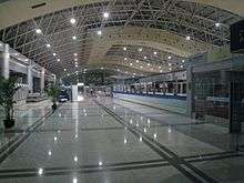
Air
Nanchang Changbei International Airport (KHN) built in 1996 is the main international airport. It is situated in Lehua Town, 26 kilometres north of the CDB area. Changbei International Airport is the only one in Jiangxi Province which has an international air route. The airport is connected to major mainland cities such as Shenzhen, Guangzhou, Haikou, Shanghai and Beijing.[26] There is a military/mixed airport near Liantang, Nanchang County.
Road

The road transport infrastructure in Nanchang is extensive. A number of national highways cross through the city. They are the National roads No.105 from Beijing to Zhuhai, No.320 from Shanghai to Kunming, and No.316 from Fuzhou to Lanzhou. The major transport companies that operate in Nanchang are the Chang'an Transport Company Limited, the Nanchang Long-distance Bus Station, and the Xufang Bus Station. National Highway G70 crosses through Nanchang. Nanchang also built its round-city highway G70_01 opening on 2007.
The Nanchang Long-distance Bus Station serves long distance routes to Nanjing, Shenzhen, Hefei and other cites outside Jiangxi Province. The Xufang Bus Station operates routes to cities, towns and counties within Jiangxi Province.[26]
Metro
The Nanchang Metro has been in service since 26th Dec 2015.
Water
Nanchang is situated on the Gan River, the Fu River, Elephant Lake, Qingshan Lake, and Aixi Lake. Hence the water routes for Nanchang are critically important for the economy, trade and shipping. Nanchang Port is the biggest port on the Gan River. Passengers can take Nanchang Port and travel by boat to the Jinggang Shan and Tengwang Pavilion. There are passenger ships that also visit Poyang Lake, Stone Bell Hill, Poyang Lake Bird Protection Area, Dagu Hill and other attractions.
Landmarks


- Tengwang Pavilion, a towering pavilion dating to 653,on the east bank of the Gan River and is one of "the Four Great Towers of China"
- Poyang Lake, the largest fresh water lake in China, it is also called "the Migrator Birds Paradise".
- Star of Nanchang, which was the world's tallest Ferris wheel from 2006-2008, in Honggu New District[27]
- Qiushui Square, established on 28 January 2004 with the largest music fountain group with music in Asia.
- Jiangxi Provincial Museum and Bada Shanren Exhibition Hall
- People's Park, the largest park in downtown Nanchang[28]
- Bayi Square and Memorial, at the center of Nanchang, commemorates the Nanchang Uprising of 8/1 (Ba Yi in Mandarin) in 1927, which led to the formation of modern China in 1949.
Education
Colleges and universities:
- Jiangxi University of Finance and Economics (江西财经大学)
- Nanchang University (南昌大学)
- Jiangxi Normal University (江西师范大学)
- Nanchang Hangkong University (Nanchang University Of Aeronautics) (南昌航空大学)
- Jiangxi Agricultural University (江西农业大学)
- East China Jiaotong University (华东交通大学)
- Jiangxi Institute of Traditional Chinese Medicine (江西中医学院)
- Nanchang Institute of Technology (南昌工程学院)
- Jiangxi Science and Technology Normal University (江西科技师范学院)
- jiangxi Manufacturing and Vocational College (江西制造职业技术学院)
Note: Institutions without full-time bachelor programs are not listed.
High schools:
- Affiliated Middle School of Jiangxi Normal University (江西师范大学附属中学)
- Nanchang No.2 Middle School (南昌市第二中学)
- Nanchang No.1 Middle School (南昌市第一中学)
- Nanchang No.3 Middle School (南昌市第三中学)
- Nanchang No.10 Middle School (南昌市第十中学)
International schools:
- Nanchang International School (南昌国际学校)
See also
References
- ↑ http://www.citypopulation.de/php/china-jiangxi-admin.php
- ↑ "Illuminating China's Provinces, Municipalities and Autonomous Regions". PRC Central Government Official Website. Retrieved 2014-05-17.
- 1 2 "南昌市2010年第六次全国人口普查主要数据公报". 江西省统计局 (in Chinese). 南昌市统计局. 20 March 2012. Retrieved 23 July 2015.
- ↑ Schwartz, Benjamin, Chinese Communism and the Rise of Mao, Harper & Row (New York: 1951), p. 93.
- 1 2 3 Zhongguo gujin diming dacidian 中国古今地名大词典 ["Dictionary of Chinese Place-names Ancient and Modern"], (Shanghai: Shanghai cishu chubanshe, 2006), p. 2080.
- ↑ Wang: 236-246.
- ↑ Wang: 1.
- ↑ Wang: 31.
- ↑ Mary Laven, Mission to China: Matteo Ricci and the Jesuit Encounter with the East, ISBN 0-571-22517-9, 2011, p. 103
- ↑ Hsu Long-hsuen and Chang Ming-kai, History of the Sino-Japanese War (1937–1945), 2nd Ed., 1971. Translated by Wen Ha-hsiung, Chung Wu Publishing; 33, 140th Lane, Tung-hwa Street, Taipei, Taiwan Republic of China. pp. 293-300 Map. 14-15
- ↑ Peattie, M., Drea, E. & Ven, H. (2011). The battle for China : essays on the military history of the Sino-Japanese War of 1937-1945. Stanford, Calif: Stanford University Press.
- ↑ http://surfcity.kund.dalnet.se/sino-japanese.htm Sino-Japanese Air War 1937–45
- ↑ http://cdc.cma.gov.cn/dataSetLogger.do?changeFlag=dataLogger
- ↑ 中国气象局 国家气象信息中心 (in Chinese). China Meteorological Administration. Retrieved 2010-05-04.
- ↑ 国家统计局统计用区划代码
- ↑ 《贵阳统计年鉴2011》
- ↑ 《中国民政统计年鉴2011》
- ↑ 国土资源局数字为7432.18平方公里
- ↑ "Jiangling Motors Corporation, Ltd. website".
- ↑ Archived April 14, 2010, at the Wayback Machine.
- ↑ "Jiangxi". Unescap.org. Retrieved 2012-01-16.
- 1 2 3 "NanChang China". English.nc.gov.cn. Retrieved 2012-01-16.
- ↑ "Nanchang Export Processing Zone". RightSite.asia. Retrieved 2012-01-16.
- ↑ "Nanchang High-Tech Industrial Development Zone". RightSite.asia. Retrieved 2012-01-16.
- ↑ "Nanchang Economic & Technological Development Zone". RightSite.asia. Retrieved 2012-01-16.
- 1 2 "Nanchang Transportation, Get to the City: by Air, Train, Bus, Water". Travelchinaguide.com. Retrieved 2012-01-16.
- ↑ "China claims world's largest Ferris wheel - Boston.com". Archived from the original on May 1, 2007.
- ↑ 南昌-人民公园 [People's Park, Nanchang] (in Chinese). Xinhua. 2008-04-01. Retrieved 2014-05-04.
- Wang, Qiaolin (Chinese: 王巧林; pinyin: Wáng Qiǎolín) et al. 1996. Jiangnan Famous Site: The Pavilion of Prince Teng (simplified Chinese: 江南名胜 滕王阁; traditional Chinese: 江南名勝 滕王閣; pinyin: Jiāngnán Míngshèng Téngwáng Gé). Baihuazhou Literary Press (Chinese: 百花洲文艺出版社; pinyin: Báihuāzhōu Wényì Chūbǎnshè). 247 pages. ISBN 7-80579-797-8.
External links
| Wikivoyage has a travel guide for Nanchang. |
| Wikimedia Commons has media related to Nanchang. |
|  | |