Namhae County
| Namhae 남해군 | ||
|---|---|---|
| County | ||
| Korean transcription(s) | ||
| • Hangul | 남해군 | |
| • Hanja | 南海郡 | |
| • Revised Romanization | Namhae-gun | |
| • McCune-Reischauer | Namhae-gun | |
| ||
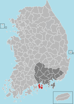 Location in South Korea | ||
| Country |
| |
| Region | Yeongnam | |
| Administrative divisions | 1 eup, 9 myeon | |
| Area | ||
| • Total | 357 km2 (138 sq mi) | |
| Population (2005) | ||
| • Total | 54,392 | |
| • Density | 152.4/km2 (395/sq mi) | |
| • Dialect | Gyeongsang | |

Namhae County (Namhae-gun) is a county in South Gyeongsang Province, South Korea.
Demographics
As of 2005, Namhae had a population of 54,392. However, Namhae has witnessed an aging and decreasing population, having had a population of 137,914 in 1964.
Administrative divisions
Namhae-gun is divided into 1 eup and 9 myeon.
- Namhae-eup
- Changseon-myeon
- Gohyeon-myeon
- Idong-myeon
- Mijo-myeon
- Nam-myeon
- Samdong-myeon
- Sangju-myeon
- Seo-myeon
- Seolcheon-myeon
Namhae in popular culture
- The fictional character Jin-Soo Kwon (portrayed by Daniel Dae Kim) on the ABC television show Lost is from Namhae.
- Korean Drama "Couple or Trouble" aka "Fantasy Couple" was set in Namhae. The German village Dogil Maeul and Hilton Namhae Golf Spa were featured.
- The 2009 documentary “Home from Home” (Endstation der Sehnsüchte), directed by Sung-Hyung Cho, was filmed in the German Village Dogil Maeul (독일 마을).
Geography
Namhae county covers an area of 357 km², covering the main islands of Namhae and Changseon, the smaller islands of Jodo, Hodo and Nodo, and 65 other uninhabited islets.
Namhae county also features several peaks; Mangun (786m), Geum (681m), and Won (627m), all of which are located on Namhae island.
Climate
| Climate data for Namhae (1981–2010) | |||||||||||||
|---|---|---|---|---|---|---|---|---|---|---|---|---|---|
| Month | Jan | Feb | Mar | Apr | May | Jun | Jul | Aug | Sep | Oct | Nov | Dec | Year |
| Average high °C (°F) | 6.8 (44.2) |
9.0 (48.2) |
13.3 (55.9) |
19.2 (66.6) |
23.5 (74.3) |
26.3 (79.3) |
29.0 (84.2) |
30.3 (86.5) |
26.6 (79.9) |
22.1 (71.8) |
15.3 (59.5) |
9.5 (49.1) |
19.3 (66.7) |
| Daily mean °C (°F) | 1.8 (35.2) |
3.7 (38.7) |
7.9 (46.2) |
13.4 (56.1) |
17.8 (64) |
21.4 (70.5) |
24.9 (76.8) |
25.9 (78.6) |
21.8 (71.2) |
16.5 (61.7) |
10.0 (50) |
4.3 (39.7) |
14.1 (57.4) |
| Average low °C (°F) | −2.4 (27.7) |
−1.0 (30.2) |
2.9 (37.2) |
8.1 (46.6) |
12.8 (55) |
17.5 (63.5) |
21.9 (71.4) |
22.7 (72.9) |
18.2 (64.8) |
11.9 (53.4) |
5.4 (41.7) |
−0.3 (31.5) |
9.8 (49.6) |
| Average precipitation mm (inches) | 32.9 (1.295) |
60.8 (2.394) |
99.9 (3.933) |
161.8 (6.37) |
189.7 (7.469) |
268.3 (10.563) |
359.3 (14.146) |
312.2 (12.291) |
213.4 (8.402) |
63.7 (2.508) |
54.1 (2.13) |
23.4 (0.921) |
1,839.4 (72.417) |
| Average precipitation days (≥ 0.1 mm) | 4.9 | 5.6 | 7.5 | 8.6 | 9.0 | 9.9 | 13.5 | 11.4 | 8.7 | 4.7 | 5.3 | 3.9 | 93 |
| Average relative humidity (%) | 58.5 | 58.2 | 59.4 | 61.4 | 66.6 | 72.8 | 79.3 | 77.6 | 73.6 | 65.5 | 63.6 | 60.1 | 66.4 |
| Mean monthly sunshine hours | 195.4 | 191.1 | 213.4 | 226.1 | 236.0 | 193.8 | 176.8 | 197.3 | 182.5 | 222.5 | 191.4 | 196.4 | 2,420.8 |
| Source: Korea Meteorological Administration[1] | |||||||||||||
Sister cities
Namhae is twinned with:
-
 Ganghwa, South Korea
 - Geumcheon-gu, South Korea
- Dongdaemun-gu, South Korea
- Gimhae, South Korea
- Busanjin-gu, South Korea
- Hampyeong, South Korea
-
 Isa, Japan
 -
 Dunhuang, China
 - Yiyang, China
- Jinggangshan, China
-
 Nordfriesland, Germany
See also
References
- ↑ "평년값자료(1981–2010) 남해(295)". Korea Meteorological Administration. Retrieved 2011-05-02.
External links

Coordinates: 34°50′15″N 127°53′32″E / 34.83750°N 127.89222°E
This article is issued from Wikipedia - version of the 3/11/2016. The text is available under the Creative Commons Attribution/Share Alike but additional terms may apply for the media files.