Nacula
Coordinates: 16°53′S 177°25′E / 16.883°S 177.417°E
 A beach on Nacula | |
| Geography | |
|---|---|
| Location | Pacific Ocean |
| Coordinates | 16°53′S 177°25′E / 16.883°S 177.417°E |
| Area | 21.7 km2 (8.4 sq mi) |
| Highest point | 243m |
| Administration | |
|
Fiji | |
| Demographics | |
| Population | 600 approx |
Nacula is a hilly and volcanic island of the Yasawa Group in Fiji's Ba Province.[1] It is the third largest and is the second farthest north in the group of islands.
There are 4 resorts on the island called Blue Lagoon Beach Resort, Safe Landing, Oarsman Bay Lodge and Nabua Lodge. Tourism is the main source of income on the island.
Nacula Island has 4 native villages, in descending order of size; Nacula village, Malakati village, Naisisili village and Navotua village.
The island's beaches have turquoise blue, gin clear lagoons and are popular snorkeling and diving sites.
Gallery
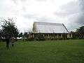 The local church on Nacula
References
- ↑ Starnes, Dean; Nana Luckham (2009). Lonely Planet Fiji. Lonely Planet. p. 163. ISBN 978-1-74104-793-6. Retrieved 15 May 2010.
External links
This article is issued from Wikipedia - version of the 2/27/2016. The text is available under the Creative Commons Attribution/Share Alike but additional terms may apply for the media files.