Mynydd Llangyndeyrn
| Site of Special Scientific Interest | |
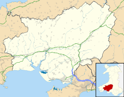 Location within Carmarthenshire | |
| Area of Search | Carmarthenshire |
|---|---|
| Grid reference | SN486134 |
| Coordinates | 51°47′50″N 4°11′50″W / 51.79731°N 4.19721°WCoordinates: 51°47′50″N 4°11′50″W / 51.79731°N 4.19721°W |
| Area | 85.2 hectares (0.8520 km2; 0.3290 sq mi) |
| Notification | 1992 |
Mynydd Llangyndeyrn is a Site of Special Scientific Interest (SSSI)[1] in Carmarthen & Dinefwr, Wales, and a hill reaching 263 metres (863 feet), which is a Marilyn.
Mynydd Llangyndeyrn and the SSSI are located west of Drefach and north of Pontyberem. The SSSI is approximately 1.3 miles (2.1 km) east-west and 0.3 miles (0.48 km) north-south, taking the approximate shape of a horns downwards shallow crescent.[1]
The SSSI citation for Mynydd Llangyndeyrn specifies that it is "notable as one of the larger upland semi-natural areas left in south-west Wales which, unlike most others, remains lightly grazed." The site features marshy grassland, wet heath, and dry heath, and hosts the marsh fritillary butterfly (Euphydryas aurinia).[2]
See also
References
- 1 2 "MAGIC Map Application". DEFRA MAGIC Map. DEFRA.
- ↑ "Site of Special Scientific Interest, Carmarthenshire, Mynydd Llangyndeyrn" (PDF). Natural Resources Wales.
External links
- SSSI Citation for Mynydd Llangyndeyrn
- SSSI Citation Map for Mynydd Llangyndeyrn
- Your Special Site and its Future - Mynydd Llangyndeyrn SSSI overview from Natural Resources Wales
- Mynydd Llangyndeyrn SSSI marked on DEFRA's MAGIC Map
This article is issued from Wikipedia - version of the 4/27/2016. The text is available under the Creative Commons Attribution/Share Alike but additional terms may apply for the media files.