Muzaffarpur
| Muzaffarpur मुज़फ्फरपुर ضلع مظفر پور | |
|---|---|
| Metropolitan City | |
 Muzaffarpur | |
| Coordinates: 26°00′N 85°27′E / 26.0°N 85.45°E | |
| Country | India |
| State | Bihar |
| District | Muzaffarpur district |
| Established | 1875 |
| Government | |
| • Member of Parliament | Ajay Nishad |
| • Member of Legislative Council | Dinesh Prasad Singh |
| • Member of Legislative Assembly | Suresh Sharma |
| • Mayor | Varsha Singh |
| Area | |
| • Total | 3,172 km2 (1,225 sq mi) |
| Elevation | 60 m (200 ft) |
| Population | |
| • Total | 393,724[1] |
| • Rank |
4th (Bihar) 127th (India) |
| Languages | |
| • Spoken | Hindi, English, Maithili, Bajjika, Urdu |
| Time zone | IST (UTC+5:30) |
| PIN | 842001-05 |
| Telephone code | 0621 |
| Vehicle registration | BR-06 |
| Sex ratio | 890 (females per thousand males)[2]♂/♀ |
| Literacy | 85.16[2] |
| Lok Sabha constituency | Muzaffarpur |
| Vidhan Sabha constituency | Muzaffarpur |
| Website |
muzaffarpur |
Muzaffarpur (![]() pronunciation ) is a sub metropolitan city located in Muzaffarpur district in the Tirhut region of Bihar. It also serves as the headquarters of Muzaffarpur district and Tirhut division. It is the fourth largest city in Bihar. It is also amongst the few cities in Bihar other than state capital Patna which fulfills nearly all the criteria to be called a Sub Metropolitan City.
pronunciation ) is a sub metropolitan city located in Muzaffarpur district in the Tirhut region of Bihar. It also serves as the headquarters of Muzaffarpur district and Tirhut division. It is the fourth largest city in Bihar. It is also amongst the few cities in Bihar other than state capital Patna which fulfills nearly all the criteria to be called a Sub Metropolitan City.
It is located at a distance of 67 kilometres from Patna.
Muzaffarpur is famous for Shahi lychees and is known as the Lychee Kingdom.[3] It is situated on the banks of the perennial Burhi Gandak River, which flows from the Someshwar Hills[4] of Himalayas. The present city of Muzaffarpur came into existence in the 18th century and is named after Muzaffar Khan, a Revenue Officer during the British Raj.
History
Muzaffarpur was created in 1875 for the sake of administrative convenience by splitting up the earlier district of Tirhut. The present district of Muzaffarpur came to its existence in the 18th century and named after Muzaffar Khan, an Amil (Revenue Officer) under British Dynasty. Purbi Champaran and Sitamarhi districts on North, on the South Vaishali and Saran districts, on the East Darbhanga and Samastipur districts and on the West Saran and Gopalganj districts surround Muzaffarpur.
According to the Ramayana, King Janaka, the father of Sita ruled Videha, which is a traditional name for the entire region including eastern Nepal and northern Bihar. Sitamarhi, a town in this region, ascribes to the Hindu mythological belief where Sita sprang to life out of an earthen pot at nearby Punaura dham, while Rajarshi Janak was tilling the land from haleshwar to westwards. Sita was to become the wife of Rama, the central figure in the Ramayana.
As per recorded history the Vajji Republic was a confederation of eight clans of which the Licchavis were the most powerful and influential. Even the powerful kingdom of Magadha had to conclude matrimonial alliances in 519 B.C. with the neighbouring estates of the Licchavis.
Ajatashatru invaded Vaishali and extended his sway over Tirhut. It was at this time that Pataliputra (the modern Patna) was founded at the village Patali on the banks of the sacred river Ganges and Ajatashatru built an invincible fortress to keep vigil over the Licchavis on the other side of the river.
Ambarati, 40 km from Muzaffarpur is believed to be the village home of Amrapali, the famous Royal court dancer of Vaishali. Vaishali, a centre of religious renaissance, Baso Kund, the birthplace of Mahavira, the 24th Tirthankara of Jainism and a contemporary of Gautama Buddha, continue to attract visitors from across the international borders.
From the visit of the Chinese traveller Xuanzang's till the rise of the Pala Empire, Muzaffarpur was under the control of Harsha Vardhan. After 647 A.D. the district passed on to the local chiefs. In the 8th century A.D. the Pala kings continued to have their hold over Tirhut until 1019 A.D. Later Chedi kings of Central India ruled till they were replaced by the Sena dynasty in the 11th century.
Between 1210 & 1226, Ghias-u-ddin Iwaz, the ruler of Bengal, was the first Muslim invader of Tirhut. He, however, could not succeed in conquering the kingdom but extorted tributes. It was in 1323 that Ghiyasuddin Tughlaq established his control over the district. The history of Muzaffarpur will remain incomplete without a reference to the Simraon dynasty (in the north-east part of Champaran) and its founder Nanyupa Deva who extended his power over the whole of Mithila and Nepal.
During the regime of Harasimha Deva, the last king of the dynasty, Tughlaq Shah invaded Tirhut in 1323 and gained control over the territory. Tughlaq Shah handed over the management of Tirhut to one Kameshwar Thakur. Thus, the sovereign power of Tirhut passed from the Hindu chiefs to the Muslims but the Hindu chief continued to enjoy complete autonomy.
By the end of the 14th century, the whole of North Bihar including Tirhut passed on to the Rajahs of Jaunpur and remained under their control for nearly a century until defeated by Sikandar Lodi of Delhi. Meanwhile, Alauddin Husain Shah, the Nawab of Bengal, had become so powerful that he exercised his control over large tracts including Tirhut.
The emperor of Delhi advanced against Hussain Shah in 1499 and got control over Tirhut after defeating its Raja. The power of the Nawabs of Bengal began to wane and with the decline and fall of Mahmood Shah, north Bihar including Tirhut formed a part of the mighty Mughal Empire. Though Muzaffarpur with the entire north Bihar had been annexed yet the petty powerful chieftains continued to exercise effective control over this area till the days of Daud Khan, the Nawab of Bengal. Daud Khan had his stronghold at Patna and Hajipur and after his fall a separate Subah of Bihar was constituted under the Mughal Empire and Tirhut formed a part of it.
The East India Company, after the Battle of Buxar in 1764, controlled over whole of Bihar. The success of the insurgents at Delhi in 1857 caused grave concern to the English inhabitants in this district and revolutionary fervor began to permeate the entire district.
In 1908 the young Bengali revolutionary, Khudi Ram Bose, an 18-year-old, was hanged for throwing the bomb at the carriage of Pringle Kennedy who was actually mistaken for Kingsford, the District Judge of Muzaffarpur. After Indian independence in 1947, a memorial to this Bose was constructed at Muzaffarpur. Antarrashtriya Bajjika Parishad in its XII Antarrashtriya Bajjika Sammelan on 2 October 2004, passed unanimously a resolution to rename the city as Khudirampur in presence of local MLA Bijendra Choudhary and MLC Devesh Chandra Thakur. However, such a resolution has only a symbolic significance as the change of name requires administrative approval.
The visit of Mohandas Karamchand Gandhi to Muzaffarpur district in December 1920 and again in January 1927 had political effect in arousing the people and the district continued to play a prominent role in the country's freedom struggle.
The significance of Muzaffarpur in Indian civilisation arises out of its position on the frontier line between two most spiritual influences and is a meeting place of Hindu and Islamic culture and thoughts. Muzaffarpur fostered political leaders and statesmen alike among whom were Rajendra Prasad, George Fernandes and Acharya Kriplani, etc. The language of the region is Bajjika as per George Grierson, some people call it Vajjika, derived from the language of Vajji republic.
In 1972 both Sitamarhi and Vaishali districts were split from Muzaffarpur.[5]
The city was a major centre of anti-emergency movement of Jai Prakash Narayan in the late-1970s. The politics of the city in the 1980s was greatly influenced by the movement as in the rest of Bihar. The significance of caste in politics gained prominence in the 1990s and 2000s when the party of Lalu Prasad gained prominence in the state.
Geography
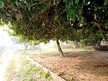
Muzaffarpur is located at 26°07′N 85°24′E / 26.12°N 85.4°E.[6] The city lies in a highly active seismic zone of India. In the disastrous earthquake on 15 January 1934, much of the town suffered severe damage and many lives were lost.[7] It has an average elevation of 47 meters (154 feet). This saucer shaped, low-centered town lies on the great Indo-Gangetic plains of Bihar, over Himalayan silt and sand brought by the glacier-fed and rain-fed meandering rivers of the Himalayas.
Climate
The summer, between April and June, is extremely hot and humid (28/40 °C,90% Max.) and winter is pleasantly cool, around 06/20 °C.
| Climate data for Muzaffarpur | |||||||||||||
|---|---|---|---|---|---|---|---|---|---|---|---|---|---|
| Month | Jan | Feb | Mar | Apr | May | Jun | Jul | Aug | Sep | Oct | Nov | Dec | Year |
| Average high °C (°F) | 22 (72) |
26 (79) |
32 (90) |
37 (99) |
44 (111) |
40 (104) |
36 (97) |
33 (91) |
32 (90) |
32 (90) |
29 (84) |
24 (75) |
32.3 (90.2) |
| Average low °C (°F) | 06 (43) |
12 (54) |
17 (63) |
22 (72) |
25 (77) |
27 (81) |
26 (79) |
26 (79) |
26 (79) |
22 (72) |
15 (59) |
07 (45) |
19.3 (66.9) |
| Average precipitation mm (inches) | 12 (0.47) |
17 (0.67) |
7 (0.28) |
16 (0.63) |
42 (1.65) |
185 (7.28) |
339 (13.35) |
259 (10.2) |
242 (9.53) |
39 (1.54) |
17 (0.67) |
7 (0.28) |
1,182 (46.55) |
| Source: Muzaffarpur Weather | |||||||||||||
Lychee
The litchi crop, which is available from May to June, is mainly cultivated in the districts of Muzaffarpur and surrounding districts. Cultivation of litchi covers approximately an area of about 25,800 hectare producing about 300,000 tonnes every year. Litchi are exported to big cities of India like Bombay, Kolkata, and even to other countries. India's share in the world litchi market amounts to less than 1%. The names of the litchi produced in Muzaffarpur are Shahi and China. The fruits are known for excellent aroma and quality.[8]
Bihar has emerged as brewery hub with major domestic and foreign firms setting up production units in the state. Vijay Mallya's group, United Breweries Group, is setting up a production unit to make litchi-flavoured wine, in Muzaffarpur in 2012. The company has leased litchi gardens.[9]
Economy

In 2006 the Ministry of Panchayati Raj named Muzaffarpur one of the country's 250 most backward districts (out of a total of 640).[10] It is one of the 36 districts in Bihar currently receiving funds from the Backward Regions Grant Fund Programme (BRGF).[10]
Muzaffarpur is famous for exporting lychee. Long ago, the area was famous for hand-woven textiles, sugar cane, and other products. The district has a few sugar mills, which are now old and dilapidated. It is the commercial hub of North Bihar and the wholesale market of Mumbai, Surat and Ahmedabad. Textile mills in the famous Marwari community dominate Suta Patti. The commercial hub of the City is Motijheel, Kalyani Chowk, SarriyaGanj, Jawaharlal Road, Bela Industrial Area, Club Road, Islampur, Shafi Daudi Market, Aam Gola, Chata Bazar, Company Bagh, Tilak Maidan Road, Juran Chapra, Bank Road, Mithanpura.

The land use around Muzaffarpur is mainly agricultural and horticultural. While litchee and mangoes are abundantly grown, principal crops are rice, wheat, pulses, jute, maize and oil seeds. Vegetables like cauliflower, cabbage, onion, tomato, radish, carrot, beetroot, among others, are also grown. Sugar cane, potato and barley are some of the non-cereal crops grown.
The main livestock of the town are cows, buffalo, goats, and poultry.
Muzaffarpur City has several industries, big and small. The railway wagon industry is one of the City landmarks. Muzaffarpur is an important centre for the wholesale cloth trade.
Demographics
As of the 2011 India census,[11] Muzaffarpur had a population of 393,724.[1] Males constituted 52.96%(208,509) of the population and females 47.04%(185,215).[1] Muzaffarpur had a literacy rate of 85.07%. Male literacy was 88.77%, and female literacy was 80.91%.[12]
Industry
Muzaffarpur is the main Industrial hub of the Mithila region. It has many industries ranging from small to big. Prabhat Zarda Factory, Ganesh Foundries Limited, Bharat Wagon and Engineering Ltd., N.T.P.C., Bihar Drugs & Organic Chemicals Ltd., Muzaffarpur – a unit of IDPL, units of Leather Development Corporation, Muzaffarpur Dairy, a unit of the Bihar State Dairy Corporation unit Bihar State Cooperative Milk Producers’ Federation Ltd, Muzaffarpur producing Sudha brand packaged milk, Parle Agro are the major industries located in Muzaffarpur. The above industries have generated considerable employment and have also been helpful in establishing a number of small industries including a few cottage industries. The most important item that is manufactured in Muzaffarpur is railway wagon. Muzaffarpur is an important centre for the wholesale cloth trade. Agro-based Industries likes Sugar mills, Britannia Biscuits have newly been established in City.[13] The mention of Muzaffarpur would remain incomplete without mentioning of Jawahar Picture Palace,a centrally airconditioned cinema hall having three cinema screens in a single building from as back as early 1980's when the term multiplex was not even known in India and quite peculiarly the first proclaimed multiplex of India - being PVR- Saket in New Delhi happened to come into existence as late as in the year 1998-99.
Education
Muzaffarpur is on of the leading centre of education in Bihar. It has a medical (Sri Krishna Medical College and Hospital) and an engineering college (Muzaffarpur Institute of Technology) and is seat of one of the oldest universities of Bihar (Bihar University, now known as B. R. Ambedkar Bihar University). The headquarters of Bihar University was at Patna.People of Muzaffarpur demanded shifting of its headquarters to Muzaffarpur. A steering committee was formed under convenorship of Dr. Maghfoor Ahmad Ajazi, other members of committee included Acharya J.B.Kripalani, Ashok Mehta,Mahamaya Pd,Mahesh pd Sinha. People movement succeeded & UGC directed Bihar Govt. to shift HQ of BU to Muzaffarpur. The first president of the Indian Republic, Dr Rajendra Prasad was a teacher in the Greer Bhumihar Brahman College, Muzaffarpur.
Transport
Railways
MFP/Muzaffarpur Junction is a main railway junction, with two suburban stations, Ram Dayalu Nagar and Narayanpur Anant (Sherpur). It is well connected to major cities of Bihar like Patna, Bhagalpur, Gaya, and Darbhanga.

.
Muzaffarpur is amongst the top hundred booking stations of Indian Railways.[14] It handles over 150 trains and about 1,00,000 passengers daily.
Trains

Sonpur is the divisional headquarters all the trains passing through this route have stoppages here. Several electrified local passenger trains and express trains run from Muzaffarpur to neighbouring destinations. The following is a list of all the trains passing from Muzaffarpur Junction (as of 10 May 2012). The Muzaffarpur Junction railway station, is well connected to most of the major cities in India by the railway network and serves the city with numerous number of trains. Muzaffarpur is well connected to Patna, New Delhi, Mumbai, Kolkata, Howrah, Chennai, Bangalore, Ajmer, Kanpur, Guwahati, Surat, Lucknow, Chandigarh, Jammu, Vishakhapatnam, Raipur, Allahabad, Ranchi, Gwalior, Ahmedabad, Rajkot, Jaipur, Porbander, Kochi and other cities. It is also the originating station for many superfasts and express trains like Muzaffarpur - Anand Vihar Garib Rath Express, 12538/Bapudham SF Express, Sapt Kranti Express, Maur Dhawaj Express etc. Dibrugarh-New Delhi Rajdhani Express crosses the junction once a week.:[15][16]
Roads

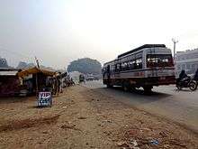
National Highway 57 (India) comes via Gorakhpur, Motihari and crosses Muzaffarpur and National Highway 57 (India) goes to Darbhanga, Purnia. The EAST-WEST CORRIDORS crosses Muzaffarpur thus connecting it to all the major towns and cities in India. The National Highway 77 (India) starting from Hajipur passes through Muzaffarpur and connects Muzaffarpur to Sitamarhi. Recently, the National Highway 102 (India) has been constructed which connects Muzaffarpur to Chhapra. The National Highway 28 (India) connects Muzaffarpur to Barauni. All 6 National Highways having junction here. Currently, a Ring Road is under construction all around Muzaffarpur and a new bridge over Burhi Gandak river. Bus, Taxi, Rickshaw, Auto Rickshaws, etc. are used for local transportation.
Airport
The nearest airport is in Patna, whereas city own airport, Patahi Airport, is under construction. Muzaffarpur Airport (IATA: MZU, ICAO: VEMZ) is an under-construction civil airport at Muzaffarpur, in the state of Bihar, India. It was to be built for the arrival of Indira Gandhi, the then Prime Minister of India. The airport is to be built over 102 acres, located five kilometers west of the city on State Highway 46. In a bid to give a boost to civil aviation sector and enhance air connectivity to Tier-II and Tier-III cities, the government has proposed to set up a low-cost airport here.
The airport is located at an elevation of 174 feet (53 m) above mean sea level. It has one paved runway designated 10/28 which measures 3,990 (1,216 m) with asphalt surface.
Notable people
- Janakdhari Prasad Indian Freedom Movement Activist
- Yogendra Shukla Revolutionary, Indian Freedom Movement Activist, served Kalapani
- Basawon Singh (Sinha) Revolutionary, Indian Freedom Movement Activist
- Rajendra Prasad, India's first President
- Baikunth Shukla Revolutionary hanged by the British in 1934
- Rambriksh Benipuri Indian Freedom Movement Activist, eminent writer of Hindi Literature
- Maghfoor Ahmad Ajazi, political activist
- Janki Ballabh Shastri, Hindi poet, writer and critic
- Chandeshwar Prasad Narayan Singh, diplomat and freedom fighter
- Devaki Nandan Khatri, the author of Chandrakanta (in Hindi)
- Jubba Sahni - freedom fighter
- Mridula Sinha, Governor of Goa (2014–present)
- Manish Chaudhary, Radio Professional
- J. B. Kripalani, politician
- Veena Devi, Indian Politician
- Dinesh Prasad Singh, Indian Politician
- George Fernandes, trade unionist and politician
- Aishwarya Nigam, a Bollywood playback singer
- Shahbaz Nadeem, Indian cricketer
- Sudhir Kumar Chaudhary, sports spectator and fan of the Indian Cricket Team
See also
- Baba Garib Sthan Mandir
- Muzaffarpur district
- List of cities in Bihar
- Sujini embroidery work of Bihar
References
<div class="reflist columns references-column-width" style="-moz-column-width: refs [2]
[1]; -webkit-column-width: refs [2]
[1]; list-style-type: decimal;">
- 1 2 3 4 5 6 "Urban Agglomerations/Cities having population 1 lakh and above" (PDF). Provisional Population Totals, Census of India 2011. Government of India. Retrieved 2012-04-16.
- 1 2 3 4 5 "Cities having population 1 lakh and above" (PDF). Provisional Population Totals, Census of India 2011. Government of India. Retrieved 2012-04-16.
- ↑ Destinations :: Vaishali ::Bihar State Tourism Development Corporation. Bstdc.bih.nic.in. Retrieved on 2011-01-09.
- ↑ "bihar". Scribd.com. Retrieved 2014-08-02.
- ↑ Law, Gwillim (2011-09-25). "Districts of India". Statoids. Retrieved 2011-10-11.
- ↑ Falling Rain Genomics, Inc – Muzaffarpur
- ↑ Bihar India Earthquake Movie, 15 January 1934. Harappa.com (15 January 1934). Retrieved on 2011-01-09.
- ↑ "7. LYCHEE PRODUCTION IN INDIA". Fao.org. 1992-05-31. Retrieved 2014-08-02.
- ↑ "Bihar emerging as brewery hub". Economic Times. Retrieved 16 January 2012.
- 1 2 Ministry of Panchayati Raj (8 September 2009). "A Note on the Backward Regions Grant Fund Programme" (PDF). National Institute of Rural Development. Retrieved 27 September 2011.
- ↑ "Census of India 2001: Data from the 2001 Census, including cities, villages and towns (Provisional)". Census Commission of India. Archived from the original on 2004-06-16. Retrieved 2008-11-01.
- ↑ Muzaffarpur City Census 2011 data Census2011.co.in
- ↑ http://www.mymuzaffarpur.com/about_muzaffarpur.html
- ↑ "Indian Railways Passenger Reservation Enquiry". Availability in trains for Top 100 Booking Stations of Indian Railways. IRFCA. Retrieved 21 June 2013.
- ↑ "Sonpur Junction Details". indiantrains.org. Retrieved 18 April 2012.
- ↑ "Trains at Muzaffarpur Junction". India Rail Info. Retrieved 18 April 2012.
| Wikimedia Commons has media related to Muzaffarpur. |