Murray County, Georgia
| Murray County, Georgia | |
|---|---|
 Murray County courthouse in Chatsworth | |
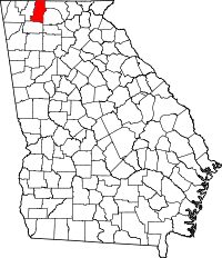 Location in the U.S. state of Georgia | |
 Georgia's location in the U.S. | |
| Founded | 1832 |
| Seat | Chatsworth |
| Largest city | Chatsworth |
| Area | |
| • Total | 347 sq mi (899 km2) |
| • Land | 344 sq mi (891 km2) |
| • Water | 2.2 sq mi (6 km2), 0.6% |
| Population | |
| • (2010) | 39,628 |
| • Density | 115/sq mi (44/km²) |
| Congressional district | 14th |
| Time zone | Eastern: UTC-5/-4 |
| Website |
www |
Murray County is a county located in the northwestern part of the U.S. state of Georgia. As of the 2010 census, the population was 39,628.[1] The county seat is Chatsworth.[2]
Murray County is part of the Dalton, GA Metropolitan Statistical Area, which is also included in the Chattanooga-Cleveland-Dalton, TN-GA-AL Combined Statistical Area.
History
In December, 1832 the Georgia General Assembly designated the extreme northwestern corner of the state as Murray County. Formerly part of Cherokee County, the area was named for a distinguished Georgia statesman from Lincoln County, Mr. Thomas W. Murray, a former speaker of the Georgia House. Within a short time the legislature found the county was too large to administer properly as the population grew, for the county then included what is now Dade, Walker, Catoosa, Whitfield, Murray, Gordon and parts of Bartow and Chatooga Counties, so further division became necessary. Within two decades, Murray County came to be 342 square miles (886 km2) of land with Spring Place as its county seat until the railroad was built through Chatsworth. With Chatsworth more accessible, the county seat was moved there.
Cherokees
The area was in the heart of the Cherokee Nation at the time the boundary lines were drawn through the territory. Not until after the Cherokees were removed in 1838–39 did white settlers enter the county in large numbers. Spring Place had been established in 1801 as a Moravian mission to the Cherokee and had been a post office since 1810 – the second oldest in North Georgia. Soon after the Cherokee "Trail of Tears", the Americans who had drawn or purchased Murray County land lots of 160 acres (0.6 km2) in the Georgia Land Lottery were pouring into the area.
Civil War
At the outbreak of the American Civil War Murray County had no industry and very little wealth. When Georgia seceded from the Union, hundreds of men and boys from Murray enlisted in the Confederate Army. The following units were from Murray County:
- 3rd Battalion, Georgia Infantry, Company B, Spring Place Volunteers
- 11th Regiment, Georgia Infantry, Company C, Murray Rifle Company
- 22nd Regiment, Georgia Infantry, Company D
- 37th Regiment, Georgia Infantry, Company A
- 39th Regiment, Georgia Infantry, Company A, Cohutta Rangers
- 39th Regiment, Georgia Infantry, Company B
- 19th State Troops – Capt. John Oats Company
In 1864, two skirmishes between Union and Confederate soldiers took place just to the west of Spring Place, one of which took place on June 25, 1864 with the 8th Michigan Cavalry US. The First Tennessee Cavalry CS also skirmished about 5 miles north of Spring Place on April 19, 1864. Another skirmish took place near Westfield late during the night of August 22, 1864. Captain Woody of the Murray County Home Guard was reported wounded.
On February 27, 1865 and April 20, 1865 there was a skirmish at Spring Place between Confederates and the 145th Indiana Infantry US. This was followed by a skirmish on Holly Creek on March 1, 1865. By 1865 Spring Place was known as an area occupied by Confederate Guerrillas. During March 20–22, 1865 Union soldiers made an attempt to suppress this activity.
Railroad
In 1906, after two earlier attempts at building a railroad in Murray County had failed, the Louisville and Nashville line was built to run north to south through the entire length of the county. Murray grew, with new towns developing along the railroad. One of these new towns was named Chatsworth. With the new railroad line in place, timber could be shipped out of the mountains, and talc deposits, discovered in the 1870s, was able to be mined and the ore shipped throughout the country.
The old county seat of Spring Place was bypassed by the railroad. Some Murray Countians began an effort to move the county seat to the more central and accessible railroad town of Chatsworth. Much dissention was caused by this effort. A county-wide referendum was held on the matter in 1912, which resulted in Chatsworth being named as the seat of local government, where it remains to present day.
Into the twentieth century, Murray remained predominantly agricultural. Shortly after World War II the textile industry, prevalent in neighboring Whitfield County, began move into Murray. Today, the carpet industry is the predominant employer in Murray County.
Geography
According to the U.S. Census Bureau, the county has a total area of 347 square miles (900 km2), of which 344 square miles (890 km2) is land and 2.2 square miles (5.7 km2) (0.6%) is water.[3]
The majority of Murray County is located in the Conasauga River sub-basin in the ACT River Basin (Coosa-Tallapoosa River Basin), and the southeastern corner of the county is located in the Coosawattee River sub-basin of the same larger ACT River Basin.[4]
Major highways
Adjacent counties
- Polk County, Tennessee (northeast)
- Fannin County (east-northeast)
- Gilmer County (east)
- Gordon County (south)
- Whitfield County (west)
- Bradley County, Tennessee (northwest)
National protected area
Demographics
| Historical population | |||
|---|---|---|---|
| Census | Pop. | %± | |
| 1840 | 4,695 | — | |
| 1850 | 14,443 | 207.6% | |
| 1860 | 7,083 | −51.0% | |
| 1870 | 6,500 | −8.2% | |
| 1880 | 8,269 | 27.2% | |
| 1890 | 8,461 | 2.3% | |
| 1900 | 8,623 | 1.9% | |
| 1910 | 9,763 | 13.2% | |
| 1920 | 9,490 | −2.8% | |
| 1930 | 9,215 | −2.9% | |
| 1940 | 11,137 | 20.9% | |
| 1950 | 10,676 | −4.1% | |
| 1960 | 10,447 | −2.1% | |
| 1970 | 12,986 | 24.3% | |
| 1980 | 19,685 | 51.6% | |
| 1990 | 26,147 | 32.8% | |
| 2000 | 36,506 | 39.6% | |
| 2010 | 39,628 | 8.6% | |
| Est. 2015 | 39,565 | [5] | −0.2% |
| U.S. Decennial Census[6] 1790-1960[7] 1900-1990[8] 1990-2000[9] 2010-2013[1] | |||
2000 census
As of the census[10] of 2000, there were 36,506 people, 13,286 households, and 10,256 families residing in the county. The population density was 41/km² (106/mi²). There were 14,320 housing units at an average density of 16/km² (42/mi²). The racial makeup of the county was 95.30% White, 0.62% Black or African American, 0.29% Native American, 0.25% Asian, 0.01% Pacific Islander, 2.64% from other races, and 0.88% from two or more races. 5.49% of the population were Hispanic or Latino of any race.
There were 13,286 households out of which 39.00% had children under the age of 18 living with them, 60.80% were married couples living together, 11.10% had a female householder with no husband present, and 22.80% were non-families. 18.80% of all households were made up of individuals and 6.00% had someone living alone who was 65 years of age or older. The average household size was 2.73 and the average family size was 3.10.
In the county the population was spread out with 28.00% under the age of 18, 9.50% from 18 to 24, 33.00% from 25 to 44, 21.50% from 45 to 64, and 8.00% who were 65 years of age or older. The median age was 33 years. For every 100 females there were 99.90 males. For every 100 females age 18 and over, there were 97.50 males.
The median income for a household in the county was $36,996, and the median income for a family was $42,155. Males had a median income of $29,812 versus $23,035 for females. The per capita income for the county was $16,230. About 9.20% of families and 12.70% of the population were below the poverty line, including 15.90% of those under age 18 and 19.40% of those age 65 or over.
2010 census
As of the 2010 United States Census, there were 39,628 people, 14,080 households, and 10,677 families residing in the county.[11] The population density was 115.0 inhabitants per square mile (44.4/km2). There were 15,979 housing units at an average density of 46.4 per square mile (17.9/km2).[12] The racial makeup of the county was 89.1% white, 0.6% black or African American, 0.4% American Indian, 0.3% Asian, 0.1% Pacific islander, 7.9% from other races, and 1.6% from two or more races. Those of Hispanic or Latino origin made up 13.0% of the population.[11] In terms of ancestry, 40.1% were American, 8.8% were Irish, 7.8% were English, and 5.0% were German.[13]
Of the 14,080 households, 39.9% had children under the age of 18 living with them, 56.6% were married couples living together, 12.8% had a female householder with no husband present, 24.2% were non-families, and 19.8% of all households were made up of individuals. The average household size was 2.80 and the average family size was 3.20. The median age was 36.2 years.[11]
The median income for a household in the county was $38,226 and the median income for a family was $45,420. Males had a median income of $33,543 versus $27,797 for females. The per capita income for the county was $16,925. About 14.3% of families and 17.1% of the population were below the poverty line, including 23.1% of those under age 18 and 12.9% of those age 65 or over.[14]
Attractions

The Chief Vann House Historic Site at Spring Place. Constructed in 1805 for James Vann, a Cherokee chief, the two-story red brick home was built alongside the Federal Road, a major early path in northwest Georgia.
Fort Mountain State Park. A 3,712-acre (15 km2) park in the Cohutta Mountains.
Another major asset is the Chattahoochee National Forest, which occupies a large portion of northeastern Murray County. Within the forest is the Cohutta Wilderness Area, a roadless, mountainous landscape featuring several of Georgia's premier backpacking trails.
Carters Lake, on the Coosawatee River, was formed by the Carter Dam, which is the largest earth-rock dam east of the Mississippi. The 3,200-acre (13 km2) lake attracts fishermen, boaters and campers.
Lake Conasauga located near the summit of Grassy Mountain was built by the Civilian Conservation Corps in 1940 and is the highest lake in Georgia at 3,150 feet (960 m) above sea level.
Communities
City
Town
Unincorporated communities
Media
Murray County, Georgia has been featured in an Independent Lens series documenting bullying.[15]
See also
References
- 1 2 "State & County QuickFacts". United States Census Bureau. Retrieved June 24, 2014.
- ↑ "Find a County". National Association of Counties. Retrieved 2011-06-07.
- ↑ "US Gazetteer files: 2010, 2000, and 1990". United States Census Bureau. 2011-02-12. Retrieved 2011-04-23.
- ↑ "Georgia Soil and Water Conservation Commission Interactive Mapping Experience". Georgia Soil and Water Conservation Commission. Retrieved 2015-11-19.
- ↑ "County Totals Dataset: Population, Population Change and Estimated Components of Population Change: April 1, 2010 to July 1, 2015". Retrieved July 2, 2016.
- ↑ "U.S. Decennial Census". United States Census Bureau. Retrieved June 24, 2014.
- ↑ "Historical Census Browser". University of Virginia Library. Retrieved June 24, 2014.
- ↑ "Population of Counties by Decennial Census: 1900 to 1990". United States Census Bureau. Retrieved June 24, 2014.
- ↑ "Census 2000 PHC-T-4. Ranking Tables for Counties: 1990 and 2000" (PDF). United States Census Bureau. Retrieved June 24, 2014.
- ↑ "American FactFinder". United States Census Bureau. Retrieved 2011-05-14.
- 1 2 3 "DP-1 Profile of General Population and Housing Characteristics: 2010 Demographic Profile Data". United States Census Bureau. Retrieved 2015-12-30.
- ↑ "Population, Housing Units, Area, and Density: 2010 - County". United States Census Bureau. Retrieved 2015-12-30.
- ↑ "DP02 SELECTED SOCIAL CHARACTERISTICS IN THE UNITED STATES – 2006-2010 American Community Survey 5-Year Estimates". United States Census Bureau. Retrieved 2015-12-30.
- ↑ "DP03 SELECTED ECONOMIC CHARACTERISTICS – 2006-2010 American Community Survey 5-Year Estimates". United States Census Bureau. Retrieved 2015-12-30.
- ↑ "INDEPENDENT LENS: Bully". Public Broadcasting System. Retrieved 2015-09-12.
External links
- http://www.murraycountychamber.org/history2.htm
- http://www.ourchatsworth.com
- http://www.murraycountymuseum.com
- http://www.chatsworthtimes.com
- Murray County Genealogy & History
- Murray County Website
 |
Bradley County, Tennessee | Polk County, Tennessee | | |
| Whitfield County | |
Fannin County and Gilmer County | ||
| ||||
| | ||||
| Gordon County |
Municipalities and communities of Murray County, Georgia, United States | ||
|---|---|---|
| City | | |
| Town | ||
| Unincorporated communities | ||
Template:Georgia
Coordinates: 34°47′N 84°45′W / 34.78°N 84.75°W