Municipal Borough of Leyton
| Leyton | |
|---|---|
 Leyton Town Hall | |
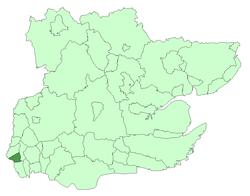 Leyton within Essex in 1961 | |
| Area | |
| • 1901 | 2,594 acres (10.5 km2) |
| • 1931 | 2,594 acres (10.5 km2) |
| • 1961 | 2,595 acres (10.5 km2) |
| Population | |
| • 1901 | 98,912 |
| • 1931 | 128,313 |
| • 1961 | 93,959 |
| Density | |
| • 1901 | 38.1/acre |
| • 1931 | 49.5/acre |
| • 1961 | 36.2/acre |
| History | |
| • Origin | Leyton St Mary ancient parish |
| • Created | 1873 |
| • Abolished | 1965 |
| • Succeeded by | London Borough of Waltham Forest |
| Status |
Local government district (1873–1894) Urban district (1894–1926) Municipal borough (1926–1965) |
| Government |
Leyton Local Board (1873–1894) |
| • HQ | High Road, Leyton |
| • Motto | MINISTANDO DIGNITAS (Dignity in service) |
| Subdivisions | |
| • Type | Civil parishes |
| • Units |
Leyton (1873–1965)[note a] Wanstead (part) (1883–1894) Cann Hall (1894–1965) |
Leyton was a local government district in southwest Essex, England, from 1873 to 1965. It included the neighbourhoods of Leyton, Leytonstone and Cann Hall. It was suburban to London, forming part of the London postal district and Metropolitan Police District. It now forms the southernmost part of the London Borough of Waltham Forest in Greater London.
Background
Leyton St Mary, sometimes known as Low Leyton, was an ancient parish in the Becontree hundred of Essex, England. It included a detached part to the north of 588 acres, separated from the main part of the parish by a long, narrow exclave of Walthamstow. To the south, the parish of Wanstead formed a long protrusion meeting with the marshes of the River Lea and divided Leyton from West Ham.
Formation
The local government of Leyton was controlled by the parish vestry. Through house building and construction of the railway the parish expanded as an extra-metropolitan suburb of London. The parish authorities resisted earlier attempts to form a local board of health, but finally adopted the Public Health Act 1872 for the parish of Leyton and Walthamstow Slip, creating a local government district in 1873. It was extended to include part of the parish of Wanstead to the south, known as Wanstead Slip or Cann Hall, from 1875.[1]
Change
Leyton became an urban district in 1894 under the Local Government Act 1894. The portion of Wanstead in the district was reconstituted as a new parish of Cann Hall. The urban district was incorporated as a municipal borough in 1926. The borough ran Leyton Urban District Council Tramways tram services until they became the responsibility of the London Passenger Transport Board in 1933.[2]
Abolition
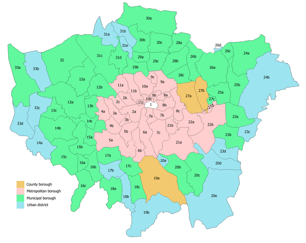
In 1965 the municipal borough was abolished by the London Government Act 1963 and its former area transferred to Greater London from Essex. Its former area was combined with that of the Municipal Borough of Chingford and the Municipal Borough of Walthamstow to form the present-day London Borough of Waltham Forest.
Notes
- ^note a : The whole parish, except 1883—1887
References
- ↑ http://www.nationalarchives.gov.uk/nra/onlinelists/GB0093%20L%2047%202.pdf
- ↑ Reed, J., London Tramways, (1997)
External links
Local government districts abolished or transferred by the London Government Act 1963 | ||
|---|---|---|
| London | ||
| Essex | ||
| Hertfordshire | ||
| Middlesex, CC | ||
| Kent | ||
| Surrey | ||
| Transfers | Middlesex to Hertfordshire: Potters Bar
| |
Coordinates: 51°33′28″N 0°0′6″E / 51.55778°N 0.00167°E