Mulanje Massif
| Mount Mulanje | |
|---|---|
 Composite satellite image of Mt. Mulanje | |
| Highest point | |
| Elevation | 3,002 m (9,849 ft) [1] |
| Prominence | 2,319 m (7,608 ft) [1] |
| Listing |
Country high point Ultra |
| Coordinates | 15°56′59″S 35°35′37″E / 15.94972°S 35.59361°ECoordinates: 15°56′59″S 35°35′37″E / 15.94972°S 35.59361°E [1][2] |
| Geography | |
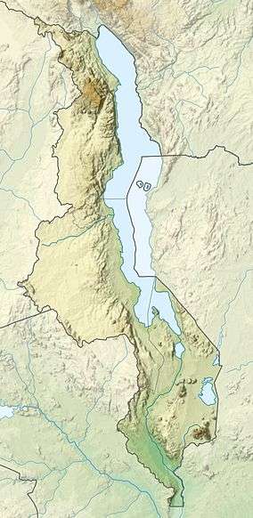 Mount Mulanje Location of Mount Mulanje in Malawi | |
| Location | Malawi |
| Geology | |
| Mountain type | Inselberg |
The Mulanje Massif, also known as Mount Mulanje, is a large monadnock in southern Malawi only 65 km east of Blantyre,[3]:2 rising sharply from the surrounding plains of Chiradzulu, and the tea-growing Mulanje district. It measures approximately 13x16 miles (22x26 kilometres) and has a maximum elevation of 3,002 m at its highest point, Sapitwa Peak.
Much of the Massif consists of rolling grassland at elevations of 1800–2200 m, intersected by deep forested ravines. It has many individual peaks reaching heights of over 2500 m, including Chambe Peak, the West Face of which is the longest rock climb in Africa.
The Massif was formed by the intrusion of magma into the Earth's crust about 130 million years ago. The surrounding rock eroded away over time, leaving behind the erosion-resistant igneous rock of the Mulanje Massif. The first European to report seeing the Massif was David Livingstone in 1859, but archeological investigation reveals evidence of human visits to the Massif from the Stone Age onwards. The elevation of the mountain is high enough for it to disturb upper level air flow and induce rain clouds to form around it, making it an important source of rain water at the head of almost every river that runs through this part of Malawi.
The forested slopes of the Massif support a sizable timber industry. At one time there was a cableway to transport timber from the edge of the plateau down to the Likhubula Forestry Station but it fell into disrepair and currently planks are carried down manually.
The mountain itself is part of the protected Mulanje Mountain Forest Reserve. The native Mulanje cypress (Widdringtonia whytei) has been so heavily logged that it is considered endangered and the park contains the last remaining stands of this tree, as well as a number of other plant and animal species—many of them endemic to the area. Examples include forest butterflies, birds such as the cholo alethe and white-winged apalis, a dwarf chameleon, geckos, skinks, the squeaker frog, and a rare limbless burrowing skink species. The land around the park is threatened by growing population, land use patterns such as forest clearing for farming and firewood, and invasive species such as Mexican pine and Himalayan raspberry.
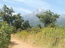
The Massif is popular for hiking and climbing, and has several mountain huts scattered across it which are maintained by the Malawi Mountain Club and the Malawi Forestry Department. Sapitwa peak was first climbed in 1894, and is now the most popular climb on the plateau.
In 2014 the site was unsuccessfully nominated for World Heritage Status.[4]
The human history of the Mulanje Area
The first recorded people to live around Mulanje were the Batwa or Akafula, who were related to the southern African San Bushmen.
Although yet to be found on Mulanje, their rock art has been discovered on the nearby hills at Machemba and Mikolongwe. Recent work by the Catholic University has unearthed tool-making sites along the Thuchila shelf dating back to the Middle Stone Age, some 100,000 years ago.
The main Bantu immigration came from the Congo Basin in the 1600s, with the Mang'anja people settling in a number of sites around the Mulanje Area. These were peaceful people who built a livelihood from the soil and local natural resources. There was contact with the outside world through the coastal Arabs and Portuguese, and Yao traders who brought in goods to exchange for ivory and slaves.
The peacefulness came to an end with the migration of Yao people from the north-east into the southern shore of Lake Malawi (then Lake Nyasa) and Highlands area of Malawi in the 1800s, escaping from their own internal tribal strife. With the strong coastal demand, slave raiding into the Mang'anja villages sharply increased and the settlements were often scattered. This was the appalling situation that David Livingstone found when he travelled up into this area in the middle of the nineteenth century.
Livingstone’s call for help in ending the slave trade brought Scottish missionaries and settlers into the area who established themselves by setting up a mission on the slopes of the mountain and in estate agriculture, respectively. Despite attempts at developing an amicable relationship, conflict with the Yao increased and this soon led to violence. By the 1890s, the British had seen the need to establish a protectorate and they set up a military administration at the north of the mountain at Fort Lister and to the south at Fort Anderson. The staffing of these forts with Indian soldiers started Malawi’s now longstanding links with the Indian sub-continent.
From this time, there were also inward migrations of the Lomwe people from the Portuguese east, escaping both colonial and Yao strife, who largely settled among the European estates and the Catholic missions. This immigration has continued to recent times during the Mozambican independence and civil wars.
Today, these three tribal cultures continue to live around the Mountain in one of the highest rural population densities in Africa. Although there is territorial distinction through their tribal traditional authorities, there is a widespread inter-mixing of the peoples.
European settlement flourished to develop the extensive tea estates that represent the first significant cultivation of this crop outside its countries of origin. The missions also continue to expand their services in education and health for the community.[3]:5
Climate

The climate of the larger Mulanje area is strongly influenced by the equatorial low pressure area, where the north-east trades of the Northern Hemisphere converge with the south-east trades of the Southern Hemisphere. This area is known as the Inter-Tropical Convergence Zone (ITCZ). On satellite Images the ITCZ is mostly seen as a long band of clouds in the Equatorial region, the main effect of the ITCZ is the creation of dry- and rainy-seasons in the Equatorial area.
If we focus on equatorial and central Africa, we can see, that the ITCZ moves as far south as northern Zimbabwe. Therefore, also the greater Mulanje area is affected by the ITCZ despite of is location, roughly 1800 kilometres south of the Equator.
Most affected by the ITCZ in the Mulanje Area, is the Mulanje Massif, because its unique position as a “mountain island” rising more than 2,500 metres above the surrounding plains. This setting is responsible for the Massifs' role as a rain barrier that forces the clouds to come down in the form of rain. This becomes very visible when comparing the annual normal rainfalls, on and around the massif. The plateau level, at around 2,000 metres above sea level, annually experiences more than 250 mm (100 inches) of rain, however, in the low plains around the foot of the Massif, the annual rainfalls, range around 40 inches. In the plains around the Mountain, it normally only rains in the rainy season, while it rains all year-long on the plateau level. The rains here are just more intense and frequent then in the dry season.
There are still differences in the amounts of rain around the Massif. The south-west face of the Mountain is the weather side, around Likhubula, Lichenya and Mulanje Boma. This experiences the highest amounts of rain due to the south-east trades of the southern hemisphere that drive the moist air from Zambia and the Democratic Republic of the Congo into the Mulanje region. The North-west face of the Massif experiences lesser rains, as it is situated in the shadows of the high peaks.
Temperature-wise, the months of the dry season (May–August) are the coolest months of the year and probably the nicest climate to go hiking in the massif. The wet season (November–April) is not recommended for hiking in the Massif, as the hiker faces heavy rains on the plateau and high temperatures during the ascent.

Snow is a very rare event. Brief snowfalls are possible but the last major snowfall with ground accumulation was in June 1954. [5]
The Mulanje Cedar
The Mulanje Cedar (Widdringtonia whytei) was proclaimed the National Tree of Malawi in 1984 by the late president Hastings Banda. This tall tree, Widdringtonia whytei, was named after Alexander Whyte, who was the first to document the species in 1894 and it is unique to Mount Mulanje. However, for many years scientists disagreed about whether this was a distinct species or a giant form of the other cedar found on the mountain, Widdringtonia nodiflora, which is common across Southern Africa. The cedar forests on Mulanje are mow limited to a total area of only 8.5 km2, a fraction of the original forest cover This area is diminishing as a result of continued illegal cutting.
The Widdringtonia whytei is a large evergreen tree, growing up to 40–50 m tall, whereas Widdringtonia nodiflora is more rounded, with a lower canopy height. On the Mountain, the Mulanje Cedar is limited to altitudes between 1,800-2,550 m and is normally confined to hollows and valleys where there is some protection from fire.
Cedar timber is pale red, straight grained and pleasantly fragrant. Its major qualities are that it is worked easily and is extremely durable, being naturally resistant to attacks from termites, wood-boring insects and fungi. The sap is poisonous to insects. For these reasons, the timber achieved commercial significance during the past three decades, when it was the principal resource for building and woodworking. Currently the timber is most used in the making of local arts and crafts, fishing boats for Lake Malawi, and in the construction and decoration of many prestigious buildings.
As the demand for its timber is high, the tree is under threat of extinction. Mulanje Cedar is a pioneer species, not a climax species, meaning that it is good at taking advantage of sites that become that become free of other competing species but it is not successful in open competition. When fire destroys the trees in an area of woodland, Mulanje Cedar will normally be the first tree species to re-establish itself. Other species will come in later, but because the cedar is relatively fast growing, it will not face much competition for sunlight.
The Malawi Department of Forestry is responsible for protecting the cedar forests from damaging fires. Each year, at the beginning of the dry season, firebreaks are cleared of vegetation to provide barriers that will impede the advance of wildfires. In addition, controlled early burning is carried out to reduce the build-up of combustible material that might cause intense and damaging fires later in the dry season. For further safety, gangs equipped with fire-fighting equipment are stationed on each of the main plateau areas whenever there is a fire hazard.
As well as providing protection from fires, the Department of Forestry is responsible for controlling the use of the trees for timber. In the past the department issued annual sawing licences but, due to a sharp increase in illegal harvesting, the sawing season has been closed since 2007. However, the illegal market for cedar is strong and cedar harvesting has not yet been stopped. All cedar wood sawn after 2007 is illegal wood, and can be confiscated by Forestry and the Malawi Police. In recent years, there has been a significant increase in law enforcement action involving armed forestry teams patrolling the cedar forests and clusters to stop the illegal pit sawyers.
There has also been a substantial planting programme to reforest Mulanje Cedar seedlings in the plastic-covered greenhouses that can be seen across the mountain. In the 2008/09 rainy season, nurseries were established on the mountain to raise over 50,000 seedlings that were then planted out with an estimated survival rate of over 30%. In the 2009/10 season, nursery plans were to raise more than 20,000 seedlings, with an improved planting-out strategy to ensure an even higher success rate.
The cedar problem is far from being solved, however, and conservation efforts desperately need to be intensified. Mulanje Cedar continues to be listed as ‘Threatened-Endangered (IUCN 2.3)’ in the annual Red List published by the International Union for Conservation of Nature (ICN). In addition to the risk of losing this tree, there is the greater potential loss of extinction of all the other endemic plant and animal species that inhabit these unique forests. If the conservation work is not continued, the noble Mulanje Cedar, Malawi’s national tree will probably become extinct in less than ten years.[3]:8
References
- 1 2 3 "Africa Ultra-Prominences" Peaklist.org
- ↑ http://www.wikimapia.org/#lat=-15.966667&lon=35.633333&z=12&l=0&m=b&show=/9853584/Sapitwa-Peak-3003m
- 1 2 3 Mount Mulanje Global Biosphere Reserve. Mulanje Mountain Conservation Trust.
- ↑ UNESCO World Heritage Committee, 38th Session, Doha: Decision : 38 COM 8B.18 Mount Mulanje Cultural Landscape (Malawi)
- ↑ https://books.google.co.th/books?ei=lkUEVcuvOcGUuASd3oHgDw&id=IHwrAQAAMAAJ&dq=snow+Mulanje+June+1954&focus=searchwithinvolume&q=June+1954
- "Mount Mulanje, Malawi". NASA Earth Observatory. Retrieved 2006-05-22.