Mueang Ang Thong District
| Mueang Ang Thong เมืองอ่างทอง | |
|---|---|
| Amphoe | |
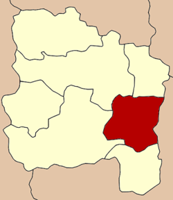 Amphoe location in Ang Thong Province | |
| Coordinates: 14°35′19″N 100°27′12″E / 14.58861°N 100.45333°ECoordinates: 14°35′19″N 100°27′12″E / 14.58861°N 100.45333°E | |
| Country |
|
| Province | Ang Thong |
| Area | |
| • Total | 102.8 km2 (39.7 sq mi) |
| Population (2007) | |
| • Total | 55,974 |
| • Density | 540/km2 (1,400/sq mi) |
| Time zone | THA (UTC+7) |
| Postal code | 14000 |
| Geocode | 1501 |
Mueang Ang Thong (Thai: เมืองอ่างทอง) is the capital district (Amphoe Mueang) of Ang Thong Province, central Thailand.
History
In the past, the district was called Mueang district. It was established contemporarily with the construction of the Ang Thong province hall building, opposite to Wat Chai Songkhram, Tambon Ban Hae, on the west bank of the Chao Phraya River.
In 1813 King Rama II ordered Chao Phraya Aphai Phuthon (เจ้าพระยาอภัยภูธร) to build a dam in the Chao Phraya River to leverage water level in Khlong Bang Kaeo for transportation all the year. But the project did not succeed. So the province hall was moved to opposite the mouth of Khlong Bang Kaeo on the east bank of the Chao Phraya River. The Mueang district office was moved at the same time. In 1917 the district was renamed from Mueang to Bang Kaeo after the name of the central tambon.[1] The district office was moved out of Ang Thong province hall in 1926 to a new location about 300 m southward from the province hall. In 1938 the government renamed the district name back to Mueang Ang Thong district.[2]
Geography
Neighboring districts are (from the south clockwise) Pa Mok, Wiset Chai Chan, Pho Thong, Chaiyo of Ang Thong Province and Maha Rat of Ayutthaya Province.
The important water resource are the Chao Phraya River and Khlong Bang Kaeo.
Administration
The district is subdivided into 14 subdistricts (tambon), which are further subdivided into 81 villages (muban). Ang Thong itself is a town (thesaban mueang) and covers the complete tambon Talat Luang and Bang Kaeo as well as parts of the tambon Sala Daeng, Ban Hae, Ban It, Pho Sa and Yansue. The subdistrict municipality (thesaban tambon) Phosa covers the whole tambon Phosa, and Sala Daeng those parts of the tambon Sala Daeng not covered by the town Ang Thong. There are further 8 Tambon administrative organizations (TAO).
| No. | Name | Thai | Pop. |
|---|---|---|---|
| 1. | Talat Luang | ตลาดหลวง | 7,741 |
| 2. | Bang Kaeo | บางแก้ว | 2,584 |
| 3. | Sala Daeng | ศาลาแดง | 6,701 |
| 4. | Pa Ngio | ป่างิ้ว | 4,972 |
| 5. | Ban Hae | บ้านแห | 3,826 |
| 6. | Talat Kruat | ตลาดกรวด | 2,172 |
| 7. | Mahat Thai | มหาดไทย | 1,668 |
| 8. | Ban It | บ้านอิฐ | 6,540 |
| 9. | Hua Phai | หัวไผ่ | 4,307 |
| 10. | Champa Lo | จำปาหล่อ | 3,634 |
| 11. | Phosa | โพสะ | 4,391 |
| 12. | Ban Ri | บ้านรี | 1,952 |
| 13. | Khlong Wua | คลองวัว | 2,139 |
| 14. | Yan Sue | ย่านซื่อ | 3,347 |
References
- ↑ ประกาศกระทรวงมหาดไทย เรื่อง เปลี่ยนชื่ออำเภอ (PDF). Royal Gazette (in Thai). 34 (0 ก): 40–68. 1917-04-29.
- ↑ พระราชกฤษฎีกาเปลี่ยนนามจังหวัด และอำเภอบางแห่ง พุทธศักราช ๒๔๘๑ (PDF). Royal Gazette (in Thai). 55 (0 ก): 658–666. 1938-11-14.
External links
- amphoe.com (Thai)