Surin Islands

The Surin Islands (Thai: หมู่เกาะสุรินทร์, Thai pronunciation: [mùː kɔ̀ʔ sùʔrin]) is an archipelago of five islands in the Andaman Sea, 60 km from the Thai mainland.[1] Administratively, the islands are part of Tambon Ko Phra Thong, Amphoe Khura Buri, in Phang Nga Province, Thailand.
Mu Ko Surin National Park (อุทยานแห่งชาติหมู่เกาะสุรินทร์) encompasses the islands and their surrounding waters. The park covers an area of approximately 141.25 km2. It contains the Surin Islands and the surrounding waters. Of the protected area, 108 km2 or 80 percent is ocean. The park was gazetted as the 29th national park of Thailand on 9 July 1981. The park is closed during rainy season, 1 May-31 October, every year.[1]
Geography
The five islands are Ko Surin Nuea, Ko Surin Tai, Ko Ri, Ko Kai, and Ko Klang, with Ko Surin Nuea and Ko Surin Tai being the two main islands of the group.[2] The Thai-Burmese oceanic border is a few kilometers north of the park. Christie Island, Burma's southernmost point, lies 18 km to the north of Ko Surin Nuea and about 100 km to the south is Mu Ko Similan National Park.[1]
Richelieu Rock, a rock in the middle of the sea, about 10 km southwest of the Ko Surin,[2] is commonly referred to one as one of the ten best dive spots in the world. Named after Andreas du Plessis de Richelieu, the first (and only foreign) commander-in-chief of the Thai Navy, the remote rock is home to some of the largest marine life species in Thailand. Other popular dive sites include Hin Kong, Ko Torinla, and Ko Chi.
Climate
A hot season runs from mid-February to May. The rainy season is from mid-May to October, the rainiest month. The yearly average rainfall is more than 3,000 millimetres with average humidity is 83 percent. The park is closed during rainy season, 1 May-31 October, every year.[1]
Moken people
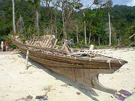
The Surin Islands host two small communities of the small ethnic Moken minority, known as "chao lay" or "sea gypsies". The Moken population of the Surin Island averages around 150 persons.[3][4]
Flora
Primary rain forest covers most area of the park. Beach forest can be found in beach areas where Barringtonia and Cerbera odollam abound. Mangrove forest can be found in the mud and brackish water of Mae Yai Bay.[1]
Fauna
Surveys have found:[1]
- Ninety-one types of birds including 57 local species. Others are migrating species.
- Twenty-two mammal species including 12 types of bat.
- Six species of reptiles such as Indian or Bengal monitor, water monitor, skinks, and reticulated pythons.
- Sea turtles still nest on the Surin islands, with two species coming ashore to lay their eggs, hawksbill, and green turtles. In the early-1990s some rare Olive Ridley turtle were spotted.
See also
References
- 1 2 3 4 5 6 "Mu Ko Surin National Park". Department of National Parks (DNP). Retrieved 23 May 2016.
- 1 2 "Mu Koh Surin National Park". Tourism Authority of Thailand (TAT). Retrieved 23 May 2016.
- ↑ "ENVIRONMENTAL, SOCIAL AND CULTURAL SETTINGS OF THE SURIN ISLANDS". Environment and development in coastal regions and in small islands. UNESCO. Retrieved 23 May 2016.
- ↑ "Attractions; Culture and Tradition; Sea gypsies". Department of National Parks (DNP). Retrieved 23 May 2016.
External links
| Wikimedia Commons has media related to Mu Ko Surin National Park. |
 Surin Islands travel guide from Wikivoyage
- Phang Nga Tourist Association
- Map of Surin Islands
- Presentation of Surin and Similan in French
Coordinates: 9°25′N 97°52′E / 9.417°N 97.867°E