Mount Tongariro
| Mount Tongariro | |
|---|---|
 | |
| Highest point | |
| Elevation | 1,978 m (6,490 ft) [1] |
| Coordinates | 39°08′00″S 175°38′30″E / 39.13333°S 175.64167°ECoordinates: 39°08′00″S 175°38′30″E / 39.13333°S 175.64167°E [1] |
| Geography | |
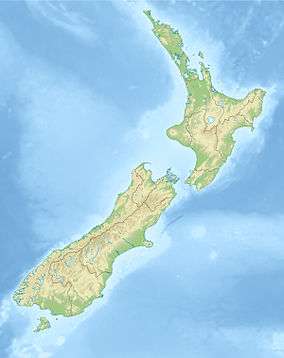 Mount Tongariro New Zealand | |
| Geology | |
| Age of rock | 275,000 Years [2] |
| Mountain type | Complex volcano |
| Volcanic arc/belt | Taupo Volcanic Zone |
| Last eruption | 21st November 2012 13:50 [3] |
| Climbing | |
| Easiest route | Tongariro Alpine Crossing |
Mount Tongariro (/ˈtɒŋɡəˌrɛ.roʊ/; Māori pronunciation: [tɔŋaɾiɾɔ]) is a compound volcano in the Taupo Volcanic Zone of the North Island of New Zealand. It is located 20 kilometres (12 mi) to the southwest of Lake Taupo, and is the northernmost of the three active volcanoes that dominate the landscape of the central North Island.
Geology
Mount Tongariro is part of the Tongariro volcanic centre, which consists of four massifs made of andesite: Tongariro, Kakaramea, Pihanga, and Ruapehu.[4] The andesitic eruptions formed Tongariro, a steep stratovolcano, reaching a height of 1,978 metres (6,490 ft). Tongariro is composed of layers of both lava and tephra and first erupted 275,000 years ago.[2]
Tongariro consists of at least 12 cones. Ngauruhoe, while often regarded as a separate mountain, is geologically a cone of Tongariro. It is also the most active vent, having erupted more than 70 times since 1839, the last episode in 1973 to 1975.[5]
Activity has also been recorded at other vents in recent history. Te Māri Craters erupted in 2012, for the first time since 1897. Red Crater last erupted ash in 1926 and contains active fumaroles. There are many explosion craters on the massif; water has filled some of these to form the Blue Lake and the Emerald Lakes.
The high altitude and severe alpine climate between March and October cause snowfall in the winter (there are commercial ski-fields at neighbouring Mount Ruapehu) and rain can freeze, causing verglas; in contrast in the mid to late summer, the mountains can be bare apart from remnant patches of snow in south-facing gullies. Unlike nearby Mt. Ruapehu, no glaciers exist on Tongariro today. However, geomorphological evidence in the form of moraines and cirques indicates the former presence of mountain glaciers. Dating of moraines on western Tongariro show that valley glaciers were present at several times during the last glacial cycle, before melting away at the end of the Last Glacial Maximum approximately 18,000 years ago.[6]
History
Mount Tongariro is in the Tongariro National Park, New Zealand's first national park and one of the earliest in the world. It was set aside (literally "made sacred") in 1887 by Te Heuheu Tukino IV (Horonuku), paramount chief of the Māori Ngati Tuwharetoa iwi and made a national park in order to preserve its natural beauty. The park also includes the peaks of Ngauruhoe and Ruapehu, both of which lie to the southwest of Tongariro. The national park is a dual World Heritage Site for its outstanding natural and intangible cultural values.
The popular hiking route called Tongariro Alpine Crossing passes between Tongariro and Ngauruhoe.
Mount Tongariro and its surroundings are also one of the several locations which Peter Jackson chose to shoot the The Lord of the Rings film trilogy.
2012 Te Māri eruptions

At 11:50 pm (NZST, UTC+12) on 6 August 2012, Mt Tongariro had what was initially believed to be a hydrothermal eruption after a month of increased activity. The eruption occurred at the Te Māri Craters,[7] which had been dormant since 1897.[8]
The eruption occurred in a new vent below the Upper Te Māri crater, and sent blocks as big as 1 metre (3 ft 3 in) in size up to 2 kilometres (1.2 mi) from the vent.[9]
An ash cloud 6.1 kilometres (3.8 mi) high deposited ash into the surrounding area, especially to the east of the volcano. The ash cloud travelled 250 kilometres (160 mi) in four hours. NIWA reported the ash cloud contained about 10,000 cubic metres (350,000 cu ft) of ash, and that the ash cloud was 25 kilometres (16 mi) long and 15 kilometres (9.3 mi) wide 39 minutes after the eruption. Ash and the smell of sulphur was reported in Napier and Hastings.[10] The smell of sulphur was also reported in Wellington, Nelson and Blenheim.[11]
State Highway 1 to the east and State Highway 46 to the north of the mountain each received up to 5 centimetres (2.0 in) of ash cover, and were closed until the following morning due to ash and low visibility.[12] A layer of ash 10–15 mm thick settled on farmland 5 to 10 kilometres (3.1 to 6.2 mi) east of Mount Tongariro. Particle sizes were between 2 and 3mm. The airspace within a 12 kilometres (7.5 mi) radius of the mountain was closed after the eruption, but later reopened to visual flights only. Air New Zealand cancelled some flights in and out of Rotorua, Taupo, Gisborne, Napier, Wanganui and Palmerston North due to the risk of volcanic ash clogging the engines on their aircraft serving those airports.[13]
No injuries were reported, and the only significant property damage was to the Department of Conservation's Ketetahi Hut, which is located 1.5 kilometres (0.93 mi) west of the Te Māri Craters.[13] There was no official evacuation but 24 people living along State Highway 46 fled their homes for fear of being isolated.
Mount Tongariro erupted again at 1:20pm on 21 November, ejecting an ash cloud 4000 metres into the air.[14][15] Flights in the area were cancelled, as were several the following morning.[16] Geologists had no warning before the eruption, saying it wasn't linked to warnings the week before of elevated activity at nearby Mount Ruapehu.[17][18]
See also
- List of mountains of New Zealand by height
- Volcanism of New Zealand
- List of volcanoes in New Zealand
- Tongariro Northern Circuit
References
- 1 2 "Tongariro". Global Volcanism Program. Smithsonian Institution. Retrieved 2010-03-07.
- 1 2 "About Tongariro". GeoNet Hazards Monitoring Network. Archived from the original on 2012-08-08. Retrieved 7 August 2012.
- ↑ "Mt Tongariro Erupts Again". Stuff.co.nz. Retrieved 21 November 2012.
- ↑ Cole, J.W. (March 1978). "Andesites of the Tongariro volcanic centre, North Island, New Zealand". Journal of Volcanology and Geothermal Research. 3 (1–2): 121–153. doi:10.1016/0377-0273(78)90007-0.
- ↑ McSaveney, Eileen; Stewart, Carol; Leonard, Graham (2007-11-05). "Historic volcanic activity: Tongariro and Ngāuruhoe". Te Ara - the Encyclopedia of New Zealand. Retrieved 2008-01-01.
- ↑ Eaves, Shaun R.; N. Mackintosh, Andrew; Winckler, Gisela; Schaefer, Joerg M.; Alloway, Brent V.; Townsend, Dougal B. (2016-01-15). "A cosmogenic 3He chronology of late Quaternary glacier fluctuations in North Island, New Zealand (39°S)". Quaternary Science Reviews. 132: 40–56. doi:10.1016/j.quascirev.2015.11.004.
- ↑ "Tongariro erupts, alert level raised". GeoNet. August 7, 2012. Retrieved 2015-04-07.
- ↑ "Volcanic Alert Bulletin TON-2012/03". GeoNet. July 21, 2012.
- ↑ "Volcanic Alert Bulletin TON-2012/10". Geonet. August 8, 2012. Retrieved 8 August 2012.
- ↑ "Tongariro eruption: 1km ash radius". The New Zealand Herald. August 7, 2012. Retrieved 7 August 2012.
- ↑ "Tongariro eruption: Sulphur smell in Blenheim". Stuff.co.nz. August 8, 2012. Retrieved 9 August 2012.
- ↑ "Scientists: Tongariro eruption 'unexpected'". 3 News. August 7, 2012.
- 1 2 "Eruption activity subsided for now - civil defence". Television New Zealand. August 7, 2012. Retrieved 7 August 2012.
- ↑ "VIDEO: Mt Tongariro erupts, huge ash cloud". 3 News NZ. November 21, 2012.
- ↑ Williams, Dave; Robson, Sarah (November 21, 2012). "More Tongariro eruptions forecast". Nz.news.yahoo.com. Newswire. Retrieved 21 November 2012.
- ↑ "Flights cancelled after Tongariro eruption". 3 News NZ. November 22, 2012.
- ↑ "Scientists had no warning before Mt Tongariro eruption". 3 News NZ. November 21, 2012.
- ↑ "Ruapehu eruption more likely". 3 News NZ. November 26, 2012.
Further reading
- Hill, H. (1893) The Volcanic Outburst at Te Māri, Tongariro, in November, 1892., Transactions of the New Zealand Institute, 26, 388-391.
External links
| Wikimedia Commons has media related to: |
- Tongariro National Park at the Department of Conservation
- Tongariro Alpine Crossing at the Department of Conservation
- Tongariro Alpine Crossing photos at Virtual Oceania