Mpigi
| Mpigi | |
|---|---|
 Mpigi Location in Uganda | |
| Coordinates: 00°13′48″N 32°19′48″E / 0.23000°N 32.33000°E | |
| Country |
|
| Region | Central Uganda |
| District | Mpigi District |
| Population (2014 Census) | |
| • Total | 44,274[1] |
Mpigi is a town in Mawokota County, Mpigi District, in Central Uganda. Mpigi is the municipal, administrative and commercial headquarters of Mpigi District. The district is named after the town.
Location
Mpigi is an important transit town located approximately 37 kilometres (23 mi) west of Kampala, Uganda's capital and largest city, on the highway to Masaka.[2] The location of Mpigi town makes it an access location to Mpigi District, Wakiso District, Butambala District, Gomba District, Mityana District, Kalungu District and Kalangala District, through various fishing landing sites on the shores of Lake Victoria. On Mbale Hill, which lies within the town, resides one of Buganda's most renowned Mythical Legends or traditional gods; Kibuuka Omumbaale. This hill is the Ancestral Home of the "Ndiga" (Sheep) Clan.
Population
During the 2002 national census, the population of Mpigi town was estimated at 34,400. In 2010, the Uganda Bureau of Statistics (UBOS), estimated the population of the town at 38,300. In 2011, UBOS estimated the population of Mpigi at 38,800.[3] In 2014, the national population census put the population of Mpigi at 44,274.[1]
Points of interest
The following points of interest are located in Mpigi, or near its borders:
- The headquarters of Mpigi District Administration
- Planet Property Agents
- The offices of Mpigi Town Council
- Mpigi central market
- Mpigi Chief Magistrate's Court.
- Mpigi Military Barracks - An establishment of the Uganda People's Defence Force
- Mpigi Police Barracks - An establishment of the Uganda Police Force
- Mpigi Prison - An establishment of the Uganda Prisons Department
- Mpigi Hospital - A 100-bed hospital administered by the Uganda Ministry of Health[4]
Drums
The town is well known as the capital of the drum factories such as the ngoma drums. All drums here are handmade.
See also
References
- 1 2 UBOS, . (27 August 2014). "The Population of The Regions of the Republic of Uganda And All Cities And Towns of More Than 15,000 Inhabitants". Citypopulation.de Quoting Uganda Bureau of Statistics (UBOS). Retrieved 23 February 2015.
- ↑ "Road Distance Between Kampala And Mpigi With Map". Globefeed.com. Retrieved 16 April 2014.
- ↑ "Estimated Population of Mpigi In 2002, 2010 & 2011" (PDF). Uganda Bureau of Statistics. Retrieved 16 April 2014.
- ↑ Lule, Jeff (14 April 2011). "Mpigi Health Centre Upgraded To Hospital". Retrieved 17 April 2014.
External links
Capital: Mpigi | ||
| Counties and sub-counties | Mawokota County | 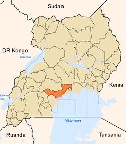 |
| Towns and villages | ||
| Geography | ||
| Economy | ||
| Notable landmarks | ||
| Transport | ||
| Health | ||
| Education | ||
| Notable people | ||
Coordinates: 00°13′48″N 32°19′48″E / 0.23000°N 32.33000°E