Moylussa
| Moylussa | |
|---|---|
|
View of Moylussa (on horizon right) from Killaloe | |
| Highest point | |
| Elevation | 532 m (1,745 ft) |
| Prominence | 502 m |
| Listing | Marilyn, County Top |
| Coordinates | 52°50′01″N 8°31′21″W / 52.833502°N 8.522366°WCoordinates: 52°50′01″N 8°31′21″W / 52.833502°N 8.522366°W |
| Geography | |
 Moylussa Location in Ireland | |
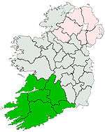
| Location | County Clare, Republic of Ireland |
| Parent range | Slieve Bernagh Mountains |
| OSI/OSNI grid | R6484375917 |

Moylussa is a mountain[1] in the Slieve Bernagh range in western Ireland, and the highest point in County Clare at 532 metres (1,745 ft).[2]
It is situated in Ogonnelloe, between the villages of Killaloe and Tuamgraney, in the east of the county and to the west of Lough Derg and the River Shannon.[3]
There are a number of routes to the summit; one of the most popular ascents starts from the forest car park at Ballycuggaran, Ogonnelloe.[4] The route passes through one of the conifer plantations that have been created on the shoulder of the mountain and other nearby hills by Coillte, the state owned forestry company. The route then follows part of the long distance path known as the East Clare Way which runs in a circular route from Killaloe and passes along the eastern flanks of Moylussa, but does not ascend to its highest point.[5]
Beyond this the path climbs up into the open area of moorland. Originally this followed a bog road, but this has been improved by Coillte with a new shale track that extends all of the way to the summit, where a new marker stone has also been added.[4][6]
There are good views from the summit of Lough Derg, Killaloe and the surrounding countryside.[4] It is sometimes listed as having a twin summit, but recent surveys have shown that the second peak at R6511 7557 is slightly lower.[2] The area around the summit is known to be very boggy especially after heavy rain.[4]
Slieve Bernagh Mountains
Moylussa is the highest point in the Slieve Bernagh range, other nearby summits includes Cragnamurragh[1] at 526 metres (1,726 ft), Glennagalliagh at 446 metres (1,463 ft), and Ballykildea at 412 metres (1,352 ft).[3]
See also
References
- 1 2 Listed as an Arderin – a category of Irish mountains greater than 500m high with 30m prominence.
- 1 2 Simon Edwardes (2013). "Moylussa". The Mountains of England and Wales. Retrieved 10 May 2014.
- 1 2 "Moylussa". MountainViews. Retrieved 10 May 2014.
- 1 2 3 4 "Walk 7 – Ballycuggaran to Moylussa". Walking in Ireland. Walking in Ireland. Retrieved 10 May 2014.
- ↑ "East Clare Way". IrishTrails. Irish Sports Council. Retrieved 10 May 2014.
- ↑ "3.4 Community, recreation and tourism Proposals" (PDF). Mid West Business Area Plan Strategic Plan. Coillte. Retrieved 10 May 2014.
Lists of Marilyns | |
|---|---|