Mount Sefton
| Mount Sefton | |
|---|---|
_at_sunrise.jpg) Mount Sefton at sunrise, from Mount Cook Village | |
| Highest point | |
| Elevation | 3,151[1] m (10,338 ft) |
| Prominence | 1,063 m (3,488 ft) |
| Listing | List of mountains of New Zealand by height |
| Coordinates | 43°40′56″S 170°2′32″E / 43.68222°S 170.04222°ECoordinates: 43°40′56″S 170°2′32″E / 43.68222°S 170.04222°E |
| Geography | |
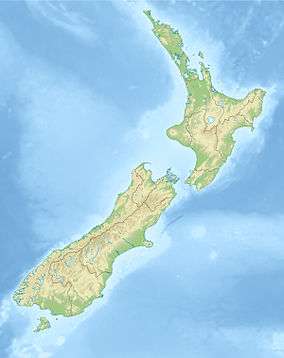 Mount Sefton South Island, New Zealand | |
| Parent range | Southern Alps |
| Climbing | |
| First ascent | 1894 by Edward FitzGerald |
Mount Sefton (Māori: Maukatua) is a mountain in the Aroarokaehe Range[2] of the Southern Alps of New Zealand, just 12 kilometres (7.5 mi) south of Aoraki / Mount Cook. To the south lies Mount Brunner, and to the north The Footstool, both more than 400 metres (1,300 ft) shorter.[1]
The mountain is prominently visible from Mount Cook Village in the Hooker Valley, with Tuckett Glacier flowing down the south-eastern side of the mountain and Mueller Glacier in the valley below it.[3][4] With a height of 3,151 metres (10,338 ft), Mount Sefton is the 13th-highest peak in the Southern Alps, and the 4th-highest mountain in New Zealand when excluding peaks of little prominence that are closer than a kilometre to a higher peak.
The Douglas River (formerly known as the Twain River) begins on Mount Sefton.[3]
An early resident, Charles French Pemberton, named the area, whilst the geologist Julius von Haast named the mountain after William Sefton Moorhouse, the second Superintendent of Canterbury Province.[4] The Māori name of the mountain is Maukatua, which translates as 'mountain of the gods'.[4]
Edward FitzGerald, with Matthias Zurbriggen as his guide, completed the first recorded climb to the summit shortly after Christmas 1894.[5]
References
- 1 2 "Mount Sefton, Canterbury - NZ Topo Map". NZ Topo Map. Land Information New Zealand. Retrieved 2016-08-25.
- ↑ Matthew Littlewood (3 Apr 2013). "Dual names accepted in Aoraki-Mt Cook". The Timaru Herald. Retrieved 2016-08-25.
- 1 2 Harper, Arthur Paul (1896). Pioneer Work in the Alps of New Zealand: A Record of the First Exploration of the Chief Glaciers and Ranges of the Southern Alps. T. F. Unwin. pp. 16ff. Retrieved 23 May 2015.
- 1 2 3 Reed, A. W. (2010). Peter Dowling, ed. Place Names of New Zealand. Rosedale, North Shore: Raupo. p. 362. ISBN 9780143204107.
- ↑ Rose, John Holland (1929). The Cambridge History of the British Empire. CUP Archive. pp. 43ff. Retrieved 23 May 2015.