Mount Pleasant National Scenic Area
| Mount Pleasant National Scenic Area | |
|---|---|
|
IUCN category V (protected landscape/seascape) | |
|
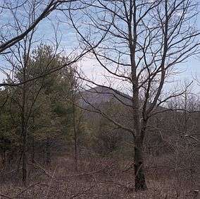
A view of Mount Pleasant from the Scenic Area | |
 | |
| Location | Amherst County, Virginia, USA |
| Nearest city | Lynchburg, Virginia |
| Coordinates | 37°45′30″N 79°10′00″W / 37.75833°N 79.16667°WCoordinates: 37°45′30″N 79°10′00″W / 37.75833°N 79.16667°W |
| Area | 7,580 acres (30.7 km2) |
| Established | 2009 |
| Governing body | U.S. Forest Service |
Mount Pleasant National Scenic Area is a federally designated National Scenic Area within George Washington National Forest in Virginia, USA, to the north of Lynchburg. The 7,580-acre (3,070 ha) scenic area is administered by the U.S. Forest Service. The scenic area includes a portion of the Appalachian Trail as it crosses Mount Pleasant (4,071 feet (1,241 m)) and Pompey Mountain (4,032 feet (1,229 m)). The area was designated a scenic area as an alternative to federal wilderness designation.[1]
The National Scenic Area was established in 1994.[1]
References
- 1 2 "National Scenic Areas Near and Far—A Path for the High Country?". High Country Press. July 21, 2011. Retrieved 9 July 2012.
This article is issued from Wikipedia - version of the 11/19/2016. The text is available under the Creative Commons Attribution/Share Alike but additional terms may apply for the media files.