Mount Passaconaway
| Mount Passaconaway | |
|---|---|
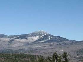 Mt. Passaconaway as seen from Great Hill | |
| Highest point | |
| Elevation | 4,043 ft (1,232 m) [1] |
| Prominence | 803 ft (245 m) [1] |
| Coordinates | 43°57′17″N 71°22′53″W / 43.95472°N 71.38139°WCoordinates: 43°57′17″N 71°22′53″W / 43.95472°N 71.38139°W |
| Geography | |
| Location | Grafton County, New Hampshire, U.S. |
| Parent range | Sandwich Range, White Mountains |
| Topo map | USGS Mount Tripyramid |
| Climbing | |
| Easiest route | Hike |
Mount Passaconaway is a mountain in the Sandwich Range Wilderness of the White Mountain National Forest near the eastern boundary of Waterville Valley. It is named after Passaconaway, a 16th-century sachem of the Pennacook tribe, whose name was also attached to a small village in Albany, where the northern trailhead is now located.
It is ranked 42d in elevation on the list of 48 White Mountains four-thousand footers. On the original 1931 list of 4000-footers, it was ranked 26th, with an elevation of 4,116 feet, although the 1931 topographic map shows it as 4,060 feet. The 1987 USGS topographic map indicates it is 4,043, while the elevation recorded in the USGS Geographic Names Information System is 4,019 ft.
The thickly wooded, unmarked summit may be approached from trailheads to the north (on the Kancamagus Highway) or from Wonalancet to the south. Old maps show a "Passaconaway Lodge" or "shelter" on the southeast aspect of the mountain, and the 4,000-footer guidebook mentions that it was built in 1891. It was rebuilt several times, evolving into the Wonalancet Out Door Club's Camp Rich. After its collapse in 2000 it was removed, consistent with Wilderness regulations.[2]
See also
References
- 1 2 "Mount Passaconaway, New Hampshire". Peakbagger.com. Retrieved 2007-01-18.
- ↑ "Shelters". Wonalancet Out Door Club. Retrieved 2007-01-18.
- Smith, Stephen; Dickerman, Mike (2001). The 4,000 Footers of the White Mountains. Littleton: Bondcliff Books. ISBN 1-931271-01-1.
- USGS Topographic map, Chocorua Quadrangle, 1931, northeast segment, viewed at UNH historic map collection
- U.S. Geological Survey Geographic Names Information System: Mount Passaconaway
External links
- Mt. Passaconaway - FranklinSites.com Hiking Guide
- Passaconaway - NHMountainHiking.com
- AMC: Mount Passaconway