Mount Logan (Washington)
- For other mountains named Mount Logan see Mount Logan (disambiguation).
| Mount Logan | |
|---|---|
 Mount Logan | |
| Highest point | |
| Elevation | 9,087 ft (2,770 m) [1] |
| Prominence | 1,487 ft (453 m) [1] |
| Coordinates | 48°32′12″N 120°57′07″W / 48.53667°N 120.95194°WCoordinates: 48°32′12″N 120°57′07″W / 48.53667°N 120.95194°W [2] |
| Geography | |
| Location | North Cascades National Park, Washington, U.S. |
| Parent range | Cascade Range |
| Topo map | USGS Mount Logan |
| Climbing | |
| First ascent | 1926 Wernstedt |
| Easiest route | Scramble/glacier traverse/class 3[3] |
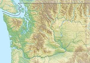
Mount Logan (9,087 feet (2,770 m)) is located in North Cascades National Park in the U.S. state of Washington.[4] Mount Logan is in a remote location of North Cascades National Park that requires hiking 20 mi (32 km) from a trailhead to reach the peak. The mountain itself is not a difficult climb, though the easiest approaches require traversing glaciers and ropes are recommended.[3] The peak supports three glaciers including Banded Glacier to the north, Fremont Glacier to the southwest and Douglas Glacier on the southeast slopes.
References
- 1 2 "Mount Logan, Washington". Peakbagger.com. Retrieved 2013-01-12.
- ↑ "Mount Logan". Geographic Names Information System. United States Geological Survey. Retrieved 2013-01-12.
- 1 2 Smoot pp. 93–97
- ↑ Mount Logan, WA (Map). TopoQwest (United States Geological Survey Maps). Retrieved 2013-1-12. Check date values in:
|access-date=(help)
- Sources
Smoot, Jeff (2002). Climbing Washington's Mountains. Falcon Guides. ISBN 978-0762710867. Retrieved 2014-05-19.
This article is issued from Wikipedia - version of the 2/25/2016. The text is available under the Creative Commons Attribution/Share Alike but additional terms may apply for the media files.