Mount Hope, Wisconsin
| Mount Hope, Wisconsin | |
|---|---|
| Village | |
 | |
| Coordinates: 42°58′51″N 90°50′4″W / 42.98083°N 90.83444°WCoordinates: 42°58′51″N 90°50′4″W / 42.98083°N 90.83444°W | |
| Country | United States |
| State | Wisconsin |
| County | Grant |
| Area[1] | |
| • Total | 0.31 sq mi (0.80 km2) |
| • Land | 0.31 sq mi (0.80 km2) |
| • Water | 0 sq mi (0 km2) |
| Elevation[2] | 1,047 ft (319 m) |
| Population (2010)[3] | |
| • Total | 225 |
| • Estimate (2012[4]) | 224 |
| • Density | 725.8/sq mi (280.2/km2) |
| Time zone | Central (CST) (UTC-6) |
| • Summer (DST) | CDT (UTC-5) |
| Area code(s) | 608 |
| FIPS code | 55-54700[5] |
| GNIS feature ID | 1583762[2] |
Mount Hope is a village in Grant County, Wisconsin, United States. The population was 225 at the 2010 census. The village is located within the Town of Mount Hope.
Geography
Mount Hope is located at 42°58′4″N 90°51′31″W / 42.96778°N 90.85861°W (42.967871, -90.858694).[6]
According to the United States Census Bureau, the village has a total area of 0.31 square miles (0.80 km2), all of it land.[1]
Demographics
| Historical population | |||
|---|---|---|---|
| Census | Pop. | %± | |
| 1880 | 75 | — | |
| 1920 | 215 | — | |
| 1930 | 256 | 19.1% | |
| 1940 | 256 | 0.0% | |
| 1950 | 232 | −9.4% | |
| 1960 | 218 | −6.0% | |
| 1970 | 176 | −19.3% | |
| 1980 | 197 | 11.9% | |
| 1990 | 173 | −12.2% | |
| 2000 | 186 | 7.5% | |
| 2010 | 225 | 21.0% | |
| Est. 2015 | 222 | [7] | −1.3% |
2010 census
As of the census[3] of 2010, there were 225 people, 92 households, and 51 families residing in the village. The population density was 725.8 inhabitants per square mile (280.2/km2). There were 98 housing units at an average density of 316.1 per square mile (122.0/km2). The racial makeup of the village was 92.0% White, 0.4% Asian, 7.1% from other races, and 0.4% from two or more races. Hispanic or Latino of any race were 7.6% of the population.
There were 92 households of which 33.7% had children under the age of 18 living with them, 43.5% were married couples living together, 7.6% had a female householder with no husband present, 4.3% had a male householder with no wife present, and 44.6% were non-families. 37.0% of all households were made up of individuals and 10.9% had someone living alone who was 65 years of age or older. The average household size was 2.45 and the average family size was 3.31.
The median age in the village was 33.5 years. 33.3% of residents were under the age of 18; 5.3% were between the ages of 18 and 24; 28.9% were from 25 to 44; 20.5% were from 45 to 64; and 12% were 65 years of age or older. The gender makeup of the village was 54.7% male and 45.3% female.
2000 census
At the 2000 census,[5] there were 186 people, 80 households and 50 families residing in the village. The population density was 583.9 per square mile (224.4/km²). There were 92 housing units at an average density of 288.8 per square mile (111.0/km²). The racial makeup of the village was 100.00% White. 1.61% of the population were Hispanic or Latino of any race.
There were 80 households of which 30.0% had children under the age of 18 living with them, 51.3% were married couples living together, 7.5% had a female householder with no husband present, and 37.5% were non-families. 33.8% of all households were made up of individuals and 20.0% had someone living alone who was 65 years of age or older. The average household size was 2.33 and the average family size was 3.00.
22.6% of the population were under the age of 18, 9.1% from 18 to 24, 28.0% from 25 to 44, 24.7% from 45 to 64, and 15.6% who were 65 years of age or older. The median age was 39 years. For every 100 females there were 102.2 males. For every 100 females age 18 and over, there were 105.7 males.
The median household income was $37,813, and the median family income was $39,583. Males had a median income of $26,500 versus $18,214 for females. The per capita income for the village was $15,141. None of the families and 1.4% of the population were living below the poverty line, including no under eighteens and 15.0% of those over 64.
Notable people
- Rufus M. Day, Wisconsin State Assemblyman and farmer, lived in Mount Hope.[9]
References
- 1 2 "US Gazetteer files 2010". United States Census Bureau. Retrieved 2012-11-18.
- 1 2 "US Board on Geographic Names". United States Geological Survey. 2007-10-25. Retrieved 2008-01-31.
- 1 2 "American FactFinder". United States Census Bureau. Retrieved 2012-11-18.
- ↑ "Population Estimates". United States Census Bureau. Retrieved 2013-06-24.
- 1 2 "American FactFinder". United States Census Bureau. Retrieved 2008-01-31.
- ↑ "US Gazetteer files: 2010, 2000, and 1990". United States Census Bureau. 2011-02-12. Retrieved 2011-04-23.
- ↑ "Annual Estimates of the Resident Population for Incorporated Places: April 1, 2010 to July 1, 2015". Retrieved July 2, 2016.
- ↑ "Census of Population and Housing". Census.gov. Retrieved June 4, 2015.
- ↑ 'Wisconsin Blue Book 1887,' Biographical Sketch of Rufus M. Day, pg. 498
Municipalities and communities of Grant County, Wisconsin, United States | ||
|---|---|---|
| Cities | 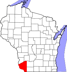 | |
| Villages | ||
| Towns |
| |
| CDPs | ||
| Unincorporated communities |
| |
| Ghost town | ||
| Footnotes | ‡This populated place also has portions in an adjacent county or counties | |