Mount Hope, West Virginia
| Mount Hope, West Virginia | |
|---|---|
| City | |
|
Main Street (West Virginia Route 211) in Mount Hope in 2007 | |
| Motto: Gateway to the Summit | |
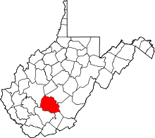
 Location of Mount Hope, West Virginia | |
| Coordinates: 37°53′33″N 81°10′4″W / 37.89250°N 81.16778°WCoordinates: 37°53′33″N 81°10′4″W / 37.89250°N 81.16778°W | |
| Country | United States |
| State | West Virginia |
| County | Fayette |
| Government | |
| • Mayor | Michael Martin |
| Area[1] | |
| • Total | 1.33 sq mi (3.44 km2) |
| • Land | 1.33 sq mi (3.44 km2) |
| • Water | 0 sq mi (0 km2) |
| Elevation | 1,722 ft (525 m) |
| Population (2010)[2] | |
| • Total | 1,414 |
| • Estimate (2012[3]) | 1,401 |
| • Density | 1,063.2/sq mi (410.5/km2) |
| Time zone | Eastern (EST) (UTC-5) |
| • Summer (DST) | EDT (UTC-4) |
| ZIP code | 25880 |
| Area code(s) | 304 |
| FIPS code | 54-56404[4] |
| GNIS feature ID | 1543656[5] |

Mount Hope is a city in Fayette County, West Virginia, United States. The population was 1,414 at the 2010 census.
History
The community took its name from the local Mount Hope School.[6]
The Mount Hope Historic District and New River Company General Office Building are listed on the National Register of Historic Places.[7]
Geography
Mount Hope is located at 37°53′33″N 81°10′4″W / 37.89250°N 81.16778°W (37.892595, -81.167687).[8]
According to the United States Census Bureau, the city has a total area of 1.33 square miles (3.44 km2), all of it land.[1]
The Summit
10,600 acres (43 km2) of property known locally as Garden Ground was purchased by the Boy Scouts of America for development into The Summit: Bechtel Family National Scout Reserve, a high adventure base and site for the national Scout jamboree.[9][10]
Demographics
| Historical population | |||
|---|---|---|---|
| Census | Pop. | %± | |
| 1900 | 351 | — | |
| 1910 | 494 | 40.7% | |
| 1920 | 1,989 | 302.6% | |
| 1930 | 2,361 | 18.7% | |
| 1940 | 2,431 | 3.0% | |
| 1950 | 2,588 | 6.5% | |
| 1960 | 2,000 | −22.7% | |
| 1970 | 1,829 | −8.5% | |
| 1980 | 1,849 | 1.1% | |
| 1990 | 1,573 | −14.9% | |
| 2000 | 1,487 | −5.5% | |
| 2010 | 1,414 | −4.9% | |
| Est. 2015 | 1,377 | [11] | −2.6% |
2010 census
As of the census[2] of 2010, there were 1,414 people, 626 households, and 362 families residing in the city. The population density was 1,063.2 inhabitants per square mile (410.5/km2). There were 737 housing units at an average density of 554.1 per square mile (213.9/km2). The racial makeup of the city was 77.0% White, 18.0% African American, 0.5% Native American, 0.4% Asian, 0.4% from other races, and 3.7% from two or more races. Hispanic or Latino of any race were 1.6% of the population.
There were 626 households of which 30.0% had children under the age of 18 living with them, 34.7% were married couples living together, 16.8% had a female householder with no husband present, 6.4% had a male householder with no wife present, and 42.2% were non-families. 37.1% of all households were made up of individuals and 12% had someone living alone who was 65 years of age or older. The average household size was 2.26 and the average family size was 2.95.
The median age in the city was 37.5 years. 24.8% of residents were under the age of 18; 9.1% were between the ages of 18 and 24; 25.4% were from 25 to 44; 26.1% were from 45 to 64; and 14.6% were 65 years of age or older. The gender makeup of the city was 47.6% male and 52.4% female.
2000 census
As of the census[4] of 2000, there were 1,487 people, 635 households, and 419 families residing in the city. The population density was 1,142.9 people per square mile (441.6/km²). There were 750 housing units at an average density of 576.4 per square mile (222.8/km²). The racial makeup of the city was 73.77% White, 22.33% African American, 0.34% Native American, 0.07% Asian, 0.27% Pacific Islander, 0.94% from other races, and 2.29% from two or more races. Hispanic or Latino of any race were 1.41% of the population.
There were 635 households out of which 31.0% had children under the age of 18 living with them, 38.1% were married couples living together, 23.9% had a female householder with no husband present, and 34.0% were non-families. 30.2% of all households were made up of individuals and 15.9% had someone living alone who was 65 years of age or older. The average household size was 2.34 and the average family size was 2.87.
In the city the population was spread out with 27.2% under the age of 18, 8.5% from 18 to 24, 24.6% from 25 to 44, 23.7% from 45 to 64, and 16.0% who were 65 years of age or older. The median age was 37 years. For every 100 females there were 82.2 males. For every 100 females age 18 and over, there were 76.2 males.
The median income for a household in the city was $18,375, and the median income for a family was $23,333. Males had a median income of $25,833 versus $16,500 for females. The per capita income for the city was $11,147. About 35.1% of families and 36.0% of the population were below the poverty line, including 57.3% of those under age 18 and 7.1% of those age 65 or over.
Notable native
- Bob Elkins - Character actor
- John Edward McClung - Old-time musician born here.
- Lt Col Robert (Bob) Taggart - liberator of Dachau, April 29, 1945 [13]
- Lonnie Warwick- NFL Linebacker, Minnesota Vikings, Atlanta Falcons, Washington Redskins
References
- 1 2 "US Gazetteer files 2010". United States Census Bureau. Retrieved 2013-01-24.
- 1 2 "American FactFinder". United States Census Bureau. Retrieved 2013-01-24.
- ↑ "Population Estimates". United States Census Bureau. Retrieved 2013-06-26.
- 1 2 "American FactFinder". United States Census Bureau. Retrieved 2008-01-31.
- ↑ "US Board on Geographic Names". United States Geological Survey. 2007-10-25. Retrieved 2008-01-31.
- ↑ Kenny, Hamill (1945). West Virginia Place Names: Their Origin and Meaning, Including the Nomenclature of the Streams and Mountains. Piedmont, WV: The Place Name Press. p. 432.
- ↑ National Park Service (2010-07-09). "National Register Information System". National Register of Historic Places. National Park Service.
- ↑ "US Gazetteer files: 2010, 2000, and 1990". United States Census Bureau. 2011-02-12. Retrieved 2011-04-23.
- ↑ "The Summit: Bechtel Family National Scout Reserve" (PDF). Boy Scouts of America. Retrieved April 8, 2010.
- ↑ "Boy Scouts to Bring World-Class Center of Scouting Excellence to West Virginia". Boy Scouts of America. November 18, 2009. Retrieved June 29, 2010.
- ↑ "Annual Estimates of the Resident Population for Incorporated Places: April 1, 2010 to July 1, 2015". Retrieved July 2, 2016.
- ↑ "Census of Population and Housing". Census.gov. Retrieved June 4, 2015.
- ↑ "Friends gather to honor beloved Sisters veteran". The Nugget. Sisters, Oregon. 30 March 2010. Retrieved 9 April 2013.