Mount Hibok-Hibok
| Hibok‑Hibok | |
|---|---|
| Catarman Volcano | |
 | |
| Highest point | |
| Elevation | 1,332 m (4,370 ft) [1] |
| Prominence | 700 m (2,300 ft) [2] |
| Coordinates | 9°12′02″N 124°40′05″E / 9.20056°N 124.66806°ECoordinates: 9°12′02″N 124°40′05″E / 9.20056°N 124.66806°E |
| Geography | |
.svg.png) Hibok‑Hibok Location within the Philippines | |
| Location | Camiguin |
| Country | Philippines |
| Region | Northern Mindanao |
| Province | Camiguin |
| Geology | |
| Mountain type | Stratovolcano |
| Volcanic arc/belt | Central Mindanao Volcanic Arc |
| Last eruption | 1948-1953 |
| Climbing | |
| Easiest route | from Ardent Hot Springs |

Mount Hibok-Hibok (also known as Catarman Volcano[3][4]) is a stratovolcano on Camiguin Island in the Philippines.[1] It is one of the active volcanoes in the country and part of the Pacific ring of fire.
Description
Volcanologists classify Hibok-Hibok as a stratovolcano[1] and dome complex[5] with an elevation of 1,332 metres (4,370 ft) and a base diameter of 10 kilometres (6.2 mi).
It has six hot springs (Ardent Spring, Tangob, Bugong, Tagdo, Naasag and Kiyab), three craters (Kanangkaan Crater, site of the 1948 eruption; Itum Crater, site of 1949 eruption, and Ilihan Crater, site of 1950 eruption).
Its adjacent volcanic edifices are Mt. Vulcan, 580 metres (1,900 ft) high, NW of Hibok-Hibok; Mt. Mambajao, 1,552 metres (5,092 ft) center of Camiguin; Mt. Guinsiliban 581 metres (1,906 ft) high, southernmost Camiguin; Mt. Butay 679 metres (2,228 ft); and Mt. Uhay, N of Mount Ginsiliban. There are also domes and cones at Campana Hill, Minokol Hill, Tres Marias Hill, Mt. Carling, Mt. Tibane, and Piyakong Hill.
Mount Timpoong and Hibok-Hibok form the two major landmarks within the Timpoong and Hibok-Hibok Natural Monument.
Eruptions

Hibok-Hibok has erupted five times in modern history.
1827 and 1862
The first recorded eruption occurred in 1827 and a similar activity followed in 1862.[5]
1871 to 1875
On February 16, 1871, earthquakes and subterranean rumblings began to be felt on the island, which increased in severity until April 30 when a volcanic fissure opened up 400 yards southwest of the village of Catarman, on the northwest flank of Hibok-hibok Volcano. From the opening, lava was continuously ejected and poured into the sea for four years, destroying the town. At the same time, the vent built a cone now known as Mt. Vulcan. In 1875, the Challenger expedition visited the area, and described the mountain as a dome, about 1,950 feet (590 m) in height, without any crater, but still smoking and incandescent at the top.[4]
The portion of the town containing a cemetery has subsided into the sea and is now marked with a huge white cross off the coast. The settlement was relocated to where the present Catarman town center is now located. The remains of old Catarman like the ruins of the ancient Spanish church, convent and a bell tower is now called Gui-ob.
1897
In 1897, Hibok-Hibok emitted white sulfurous vapors which damaged farms on the island. Solfataric activity continued up to 1902.
1948 to 1951
From 1948 to 1951, Mt. Hibok-Hibok constantly rumbled and smoked. There were also landslides and earthquakes followed by dome building and nuee ardente. The Peléan eruption in 1948 from the Kanangkaan crater caused little damage and loss of life. The eruption of 1949, originating from Itum crater caused 79 deaths due to landslides. In the morning of December 4, 1951, the volcano erupted again. This, time, however, it unleashed boiling lava, poisonous gases, and landslides enough to destroy nearly 19 square kilometres (7.3 sq mi) of land particularly in Mambajao. All in all, over 3,000 people were killed. Before the eruption of Mt. Hibok-Hibok in 1951, the population of Camiguin had reached 69,000. After the eruption, the population was reduced to about 34,000 due to massive emigration.
Volcanologists observed an eruption pattern observed during the 1948-1952 eruptions (a cycle of four phases) beginning with a short period of emission of steam from the crater and avalanches of volcanic materials, followed by explosions or steam blast with emission of heavy clouds of steam, ash and other fragmentary volcanic materials with a strong possibility of the development of pyroclastic flows. The third phase involves eruption of incandescent materials, emission of ash and steam in large amounts, formation of flows and occasional minor crater outbursts, and finally a decrease in steam and other ejecta from the crater.
Hiking activity

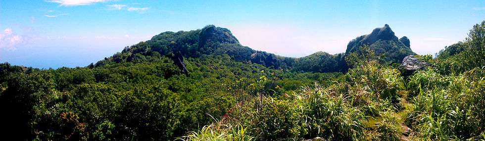
Mt. Hibok-Hibok is a popular hiking destination in Camiguin island. A permit from the DENR office in Mambajao is required. It normally takes 3–5 hours to reach the summit; the usual jump-off is Ardent Hot Springs in Mambajao. Views from the summit include the nearby White Island, Bohol to the north, Eastern Mindanao to the east and the island of Siquijor to the west. The mossy crater of Camiguin's past eruption can also be seen.[6]
Mt. Vulcan can be hiked by way of the Stations of the Cross or The Walkway in Bonbon, Catarman. On the trail are the statues depicting the Roman Catholic Stations of the Cross, which are 14 events in the crucifixion of Jesus, at intervals on the climb. They are a memorial to the dead from the last eruption in the 1950s.[7] Mt. Vulcan, which is locally called the Old Volcano, is a misnomer as it is actually the youngest volcano on the island, formed in the 1871 eruption.
See also
- List of active volcanoes in the Philippines
- List of potentially active volcanoes in the Philippines
- List of inactive volcanoes in the Philippines
- Philippine Institute of Volcanology and Seismology
References
- 1 2 3 "Camiguin". Global Volcanism Program. Smithsonian Institution. Retrieved 2008-11-04.
- ↑ "Hibok-Hibok, Philippines". Peakbagger.com. Retrieved 2013-03-11.
- ↑ "Camiguin - Synonyms and Subfeatures". Global Volcanism Program. Retrieved on 2012-03-25.
- 1 2 Becker, George F. (1901). "Report on the Geology of the Philippine Islands", p.42-43. Washington Government Printing Office, 1901.
- 1 2 "Philippine Volcanoes". ABS-CBN Broadcasting Corporation. 1996. Retrieved 2008-11-04.
- ↑ "PinoyMountaineer: Mount Hibok-Hibok". 18 August 2007. Retrieved 2007-10-25.
- ↑ Sago (2009-04-09). "Camiguin Island's Stations of the Cross". Let's Go Sago!. Retrieved on 2011-01-16.
External links
-
 Media related to Mount Hibok-Hibok at Wikimedia Commons
 - Philippine Institute of Volcanology and Seismology (PHIVOLCS) Mount Hibok-Hibok Page