Mouchnice
| Mouchnice | |||
|---|---|---|---|
| Municipality | |||
 | |||
| |||
 Mouchnice | |||
| Coordinates: 49°6′42″N 17°8′8″E / 49.11167°N 17.13556°ECoordinates: 49°6′42″N 17°8′8″E / 49.11167°N 17.13556°E | |||
| Country |
| ||
| Region | South Moravian | ||
| District | Hodonín | ||
| Area | |||
| • Total | 12.73 km2 (4.92 sq mi) | ||
| Elevation | 261 m (856 ft) | ||
| Population (2009) | |||
| • Total | 348 | ||
| • Density | 27/km2 (71/sq mi) | ||
| Postal code | 683 33 | ||
| Website | http://www.mouchnice.cz | ||

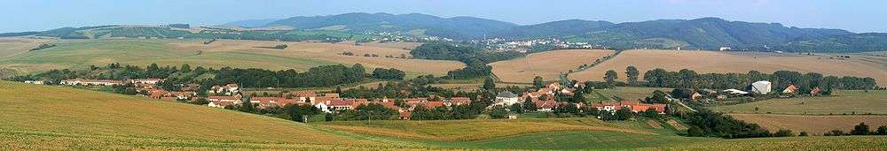
Mouchnice (German Mauchnitz) is a village and municipality (obec) in Hodonín District in the South Moravian Region of the Czech Republic.
The municipality covers an area of 12.73 square kilometres (4.92 sq mi), and has a population of 348 (as at 2 January 2009).
Mouchnice lies approximately 30 kilometres (19 mi) north of Hodonín, 40 km (25 mi) east of Brno, and 224 km (139 mi) south-east of Prague.
References
| Wikimedia Commons has media related to Mouchnice. |
This article is issued from Wikipedia - version of the 4/7/2016. The text is available under the Creative Commons Attribution/Share Alike but additional terms may apply for the media files.