Mostaganem Province
| Mostaganem Province ولاية مستغانم | |
|---|---|
| Province | |
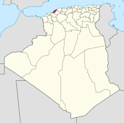 Map of Algeria highlighting Mostaganem | |
| Coordinates: 35°56′N 0°05′E / 35.933°N 0.083°ECoordinates: 35°56′N 0°05′E / 35.933°N 0.083°E | |
| Country |
|
| Capital | Mostaganem |
| Area | |
| • Total | 2,269 km2 (876 sq mi) |
| Population (2008)[1] | |
| • Total | 746,947 |
| • Density | 330/km2 (850/sq mi) |
| Time zone | CET (UTC+01) |
| Area Code | +213 (0) 45 |
| ISO 3166 code | DZ-27 |
| Districts | 10 |
| Municipalities | 32 |
Mostaganem (Arabic: ولاية مستغانم) is a province (wilaya) of Algeria. The capital is Mostaganem. Other localities include Ain Nouissi, Ain Tadles, Tazgait and Stidia.
Administrative divisions
The province is divided into 10 districts (daïras), which are further divided into 32 communes or municipalities.
Districts
Communes
- Achacha (Achaacha)
- Aïn Boudinar
- Aïn Nouïssy
- Aïn Sidi Chérif
- Aïn Tédelès (Ain Tedles)
- Benabdelmalek Ramdane (Abdelmalek Ramdane)
- Bouguirat
- El Hassaine
- Fornaka
- Hadjadj
- Hassi Mamèche (Hasi Mameche)
- Khadra
- Kheïr Eddine (Kheiredine)
- Mansourah
- Mazagran (Mazagrain, Mezghrane)
- Mesra
- Mostaganem
- Nékmaria
- Oued El Kheïr
- Ouled Boughalem
- Ouled Malah (Ouled Maalef)
- Safsaf (Saf Saf)
- Sayada
- Sidi Ali
- Sidi Bellater (Sidi Belatar)
- Sidi Lakhdar (Sidi Lakhdaara)
- Sirat
- Souaflia
- Sour
- Stidia
- Tazgait
- Touahria
References
- ↑ Office National des Statistiques, Recensement General de la Population et de l’Habitat 2008 Preliminary results of the 2008 population census. Accessed on 2008-07-02.
| Mostaganem District |  | |
|---|---|---|
| Hassi Mamèche District | ||
| Aïn Tedles District | ||
| Bouguirat District | ||
| Sidi Ali District | ||
| Achacha District | ||
| Aïn Nouïssy District | ||
| Mesra District | ||
| Kheïr Eddine District | ||
| Sidi Lakhdar District | ||
| ||
This article is issued from Wikipedia - version of the 3/11/2016. The text is available under the Creative Commons Attribution/Share Alike but additional terms may apply for the media files.