Mosman Park, Western Australia
| Mosman Park Perth, Western Australia | |||||||||||||
|---|---|---|---|---|---|---|---|---|---|---|---|---|---|
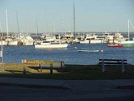 View of the Swan River and sign of Mosman Park, Western Australia | |||||||||||||
 Mosman Park | |||||||||||||
| Coordinates | 32°00′58″S 115°45′43″E / 32.016°S 115.762°ECoordinates: 32°00′58″S 115°45′43″E / 32.016°S 115.762°E | ||||||||||||
| Population | 8,598 (2011 census)[1] | ||||||||||||
| • Density | 2,000/km2 (5,180/sq mi) | ||||||||||||
| Established | 1890[2] | ||||||||||||
| Postcode(s) | 6012 | ||||||||||||
| Area | 4.3 km2 (1.7 sq mi) | ||||||||||||
| Location | 11 km (7 mi) SW of Perth CBD | ||||||||||||
| LGA(s) | Town of Mosman Park | ||||||||||||
| State electorate(s) | Cottesloe | ||||||||||||
| Federal Division(s) | Curtin | ||||||||||||
| |||||||||||||
Mosman Park is a western suburb of Perth, Western Australia on the north bank of the Swan River in the local government area of the Town of Mosman Park. It was historically known as Buckland Hill (1889-1909), then Cottesloe Beach (1909-1930) and again Buckland Hill (1930-1937). From 1937 it was named Mosman Park, derived from Mosman in Sydney, the birthplace of Richard Yeldon, a member of the Buckland Hill Road Board.[3] Mosman Park is now considered an affluent suburb, but prior to the 1970s was one of Perth's major industrial centres.
In 2010 the Australian Bureau of Statistics announced that Mosman Park had the second highest average value for private sector houses in 2008-09, at $1.579 million, ahead of Mosman in Sydney, which had the highest average value houses in New South Wales at $1.373 million.[4]
Geography
Mosman Park is bounded by the Indian Ocean and the Fremantle railway line to the west, a line south of Johnston Street to the north, and the Swan River to the east and south with approximately 5 km of river frontage. To the west of the railway line Mosman Park includes a section of approximately 600 metres of ocean frontage, south of the extension of Boundary Road and north of the extension of McCabe Street.
History
Mosman Park was established with the first survey of town lots in 1889 as Buckland Hill, taking its name from the prominent local hill that was a major maritime navigation mark for shipping from the earliest days of colonization.[5][6]
Mosman Park was a major industrial centre for the state with a General Motors car and truck assembly plant (1926-1972),[7] the Colonial Sugar Refinery,[8] the Mt Lyell Farmers' Fertilisers superphosphate works,[9] the W.A. Rope and Twine Works[10] and the West Australian Brushware Co. factory (one of the largest of its kind in Australia).[11] All were closed by the 1970s. Today, almost all of Mosman Park is residential, with significant parklands at Buckland Hill and along the river.[12]
In the 2011 Census, Mosman Park had a population of 8,598 people living in 3,988 dwellings, 60.4% of which were detached houses on separate lots. The ABS identified property, business services and health as the main occupations of residents. The largest employment sector within Mosman Park is education.[1]
Transport
Mosman Park is served by the Mosman Park and Victoria Street railway stations. Various public buses, including the CircleRoute, travel along Stirling Highway and through Mosman Park's eastern section.
Politics
Mosman Park is part of the federal division of Curtin. The federal seat is held by the conservative Liberal Party. It is regarded as a safe seat as it has been continually retained by the Liberal Party with the exception of former Liberal member Allan Rocher as an Independent politician between 1996 and 1998. For the parliament of Western Australia, the state electoral district of Cottesloe is also held by the Liberal Party.
Notable residents
- Angela Bennett, mining heiress and businesswoman
- Lang Hancock (1909-1992), iron ore mining developer
- Harriet Hooton (1875–1960), women's activist and editor
- John Hughes, businessman
- Rose Porteous, widow of Lang Hancock
- Ralph Sarich, orbital engine and orbital combustion process inventor
- Sir Albert Wolff (1899–1977), chief justice and lieutenant-governor of Western Australia
References
- 1 2 Australian Bureau of Statistics (31 October 2012). "Mosman Park (WA) (State Suburb)". 2011 Census QuickStats. Retrieved 9 February 2014.
- ↑ "News and Notes". The West Australian. 2 August 1890. p. 3. Retrieved 24 April 2014.
- ↑ "Heritage Images". Town of Mosman Park. Retrieved 1 June 2016.
- ↑ -->
- ↑ "Anchorage in Gage's Roads". The Inquirer. Perth, WA. 10 May 1843. p. 3. Retrieved 1 June 2016.
- ↑ "Fremantle Municipal Council". The Inquirer and Commercial News. Perth, WA. 16 October 1889. Retrieved 1 June 2016.
- ↑ "G.M.-Holden Plans Big Programme". The West Australian. 28 August 1951. p. 1. Retrieved 24 April 2014.
- ↑ "Two Accidents at Factory". The West Australian. 11 January 1949. p. 9. Retrieved 24 April 2014.
- ↑ "Accidental Fatal Injury". The West Australian. 16 May 1947. p. 19. Retrieved 24 April 2014.
- ↑ "Workers' Effort - Loan Representatives' Visits". The West Australian. 2 October 1945. p. 4. Retrieved 24 April 2014.
- ↑ "Swan Brand Brushware". The West Australian. 2 October 1934. p. 12. Retrieved 24 April 2014.
- ↑ 2006 S treetSmart directory, Department of Lands and Surveys, Perth.