Morongo Valley, California
| Morongo Valley | |
|---|---|
| census-designated place | |
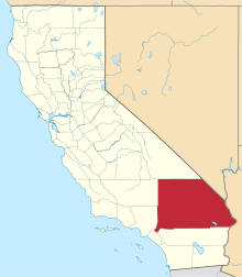
 Location in San Bernardino County and the state of California | |
 Morongo Valley Location in the United States | |
| Coordinates: 34°02′49″N 116°34′51″W / 34.04694°N 116.58083°WCoordinates: 34°02′49″N 116°34′51″W / 34.04694°N 116.58083°W[1] | |
| Country |
|
| State |
|
| County | San Bernardino |
| Area[2] | |
| • Total | 25.219 sq mi (65.317 km2) |
| • Land | 25.219 sq mi (65.317 km2) |
| • Water | 0 sq mi (0 km2) 0% |
| Elevation[1] | 2,582 ft (787 m) |
| Population (2010) | |
| • Total | 3,552 |
| • Density | 140/sq mi (54/km2) |
| Time zone | PST (UTC-8) |
| • Summer (DST) | PDT (UTC-7) |
| ZIP code | 92256 |
| Area codes | 442/760 |
| FIPS code | 06-49348 |
| GNIS feature ID | 1652755 |
Morongo Valley is a census-designated place (CDP) on State Route 62 in San Bernardino County, California, United States. The population was 3,552 at the 2010 census, up from 1,929 at the 2000 census.

Geography and climate
Morongo Valley is located on State Route 62, about 10 miles (16 km) west of Yucca Valley.
According to the United States Census Bureau, the CDP has a total area of 25.2 square miles (65 km2), all land.
Morongo Valley lies along the western edge of the Mojave Desert and near the northern edge of the Coachella Valley, and as such is generally dry. Monsoonal moisture leads to thunderstorms at times during the summer, but in the winter, Pacific storms bring most of the rain.
Demographics
2010
The 2010 United States Census[3] reported that Morongo Valley had a population of 3,552. The population density was 140.8 people per square mile (54.4/km²). The racial makeup of Morongo Valley was 3,076 (86.6%) White (79.1% Non-Hispanic White),[4] 40 (1.1%) African American, 73 (2.1%) Native American, 31 (0.9%) Asian, 4 (0.1%) Pacific Islander, 187 (5.3%) from other races, and 141 (4.0%) from two or more races. Hispanic or Latino of any race were 531 persons (14.9%).
The Census reported that 3,547 people (99.9% of the population) lived in households, 5 (0.1%) lived in non-institutionalized group quarters, and 0 (0%) were institutionalized.
There were 1,602 households, out of which 359 (22.4%) had children under the age of 18 living in them, 598 (37.3%) were opposite-sex married couples living together, 178 (11.1%) had a female householder with no husband present, 99 (6.2%) had a male householder with no wife present. There were 132 (8.2%) unmarried opposite-sex partnerships, and 26 (1.6%) same-sex married couples or partnerships. 554 households (34.6%) were made up of individuals and 203 (12.7%) had someone living alone who was 65 years of age or older. The average household size was 2.21. There were 875 families (54.6% of all households); the average family size was 2.87.
The population was spread out with 646 people (18.2%) under the age of 18, 266 people (7.5%) aged 18 to 24, 745 people (21.0%) aged 25 to 44, 1,346 people (37.9%) aged 45 to 64, and 549 people (15.5%) who were 65 years of age or older. The median age was 47.2 years. For every 100 females there were 105.6 males. For every 100 females age 18 and over, there were 106.0 males.
There were 2,004 housing units at an average density of 79.5 per square mile (30.7/km²), of which 1,159 (72.3%) were owner-occupied, and 443 (27.7%) were occupied by renters. The homeowner vacancy rate was 4.7%; the rental vacancy rate was 7.9%. 2,489 people (70.1% of the population) lived in owner-occupied housing units and 1,058 people (29.8%) lived in rental housing units.
According to the 2010 United States Census, Morongo Valley had a median household income of $32,337, with 25.3% of the population living below the federal poverty line.[5]
2000
As of the census[6] of 2000, there were 1,929 people, 811 households, and 473 families residing in the CDP. The population density was 249.5 inhabitants per square mile (96.4/km²). There were 960 housing units at an average density of 124.2 per square mile (48.0/km²). The racial makeup of the CDP was 91.9% White, 0.8% African American, 1.4% Native American, 0.4% Asian, 0.1% Pacific Islander, 3.4% from other races, and 2.1% from two or more races. Hispanic or Latino of any race were 9.3% of the population.
There were 811 households out of which 26.5% had children under the age of 18 living with them, 43.9% were married couples living together, 10.2% had a female householder with no husband present, and 41.6% were non-families. 33.7% of all households were made up of individuals and 11.8% had someone living alone who was 65 years of age or older. The average household size was 2.37 and the average family size was 3.04.
In the CDP the population was spread out with 25.2% under the age of 18, 6.3% from 18 to 24, 25.6% from 25 to 44, 27.8% from 45 to 64, and 15.1% who were 65 years of age or older. The median age was 41 years. For every 100 females there were 100.1 males. For every 100 females age 18 and over, there were 101.3 males.
The median income for a household in the CDP was $36,357, and the median income for a family was $36,643. Males had a median income of $37,091 versus $26,528 for females. The per capita income for the CDP was $19,624. About 12.2% of families and 19.4% of the population were below the poverty line, including 28.7% of those under age 18 and 19.0% of those age 65 or over.
Infrastructure
Local
Morongo Valley is unincorporated and is under the jurisdiction of San Bernardino County; it lies immediately north of the Riverside County line. The main commercial development of Morongo Valley lies along Highway 62 approximately 10 miles/16 km north of Interstate 10 and is the first San Bernardino County town travelers encounter when driving north from the Coachella Valley. A popular destination in Morongo Valley is the Big Morongo Canyon Preserve, where one can take hikes, go bird-watching or stroll along the walkways. The governing body of Morongo Valley is the Community Services District (CSD), which has five board members. The only school in Morongo Valley is Morongo Valley Elementary School (MVES), which is part of the Morongo Unified School District. MVES has an enrollment of a few hundred students.
State and federal representation
In the California State Legislature, Morongo Valley is in the 16th Senate District, represented by Republican Jean Fuller, and in the 42nd Assembly District, represented by Republican Chad Mayes.[7]
In the United States House of Representatives, Morongo Valley is in California's 8th congressional district, represented by Republican Paul Cook.[8]
Paradise Fire
In June 2005, a fire started on Paradise Avenue in western Morongo Valley. This fire quickly spread, torching about six thousand acres (24 km²). Luckily, only seven homes were burned. The fire also damaged some of the walkways in the Big Morongo Canyon Preserve, but all damage has been repaired and the entire preserve is once again open for birding and hiking.
Sawtooth Complex Fire
In July 2006, a fire started by dry lightning in Yucca Valley was almost 100 percent contained, however due to extremely low humidity, high temperatures, and 40 mile per hour gusts, the fire grew. The fire quickly spread from Yucca Valley through Pioneertown and Big Morongo. In fact, another small fire dubbed the Millard Complex fire merged with the Sawtooth Complex fire. Well over a hundred structures were burned in the two fires. Virtually no damage occurred in Morongo Valley itself.
Notable natives and residents
- Country music singer Leah Turner is originally from here.
- Native American actor Steve Reevis resides here.
References
- 1 2 "Morongo Valley". Geographic Names Information System. United States Geological Survey. Retrieved November 18, 2014.
- ↑ "2010 Census U.S. Gazetteer Files – Places – California". United States Census Bureau.
- ↑ "2010 Census Interactive Population Search: CA - Morongo Valley CDP". U.S. Census Bureau. Retrieved July 12, 2014.
- ↑ http://factfinder2.census.gov/faces/tableservices/jsf/pages/productview.xhtml?pid=DEC_10_DP_DPDP1. Missing or empty
|title=(help) - ↑ http://factfinder2.census.gov/faces/nav/jsf/pages/community_facts.xhtml#none. Missing or empty
|title=(help) - ↑ "American FactFinder". United States Census Bureau. Retrieved 2008-01-31.
- ↑ "Statewide Database". Regents of the University of California. Retrieved April 6, 2015.
- ↑ "California's 8th Congressional District - Representatives & District Map". Civic Impulse, LLC.
External links
- Morongo Valley Web Site
- Big Morongo Canyon Preserve
- U.S. Geological Survey Geographic Names Information System: Little Morongo Valley