Mooringsport, Louisiana
| Mooringsport, Louisiana | |
| Village | |
| Country | United States |
|---|---|
| State | Louisiana |
| Parish | Caddo |
| Elevation | 226 ft (68.9 m) |
| Coordinates | 32°41′13″N 93°57′42″W / 32.68694°N 93.96167°WCoordinates: 32°41′13″N 93°57′42″W / 32.68694°N 93.96167°W |
| Area | 1.17 sq mi (3.03 km2) |
| - land | 1.16 sq mi (3.00 km2) |
| - water | 0.01 sq mi (0.03 km2) |
| Population | 793 (2010) |
| Density | 682.7/sq mi (263.6/km2) |
| Timezone | CST (UTC-6) |
| - summer (DST) | CDT (UTC-5) |
| Area code | 318 |
 Location in Caddo Parish and the state of Louisiana. | |
.svg.png) Location of Louisiana in the United States | |
Mooringsport is a village in Caddo Parish, Louisiana, United States. The population was 793 at the 2010 census.[1] It is part of the Shreveport–Bossier City Metropolitan Statistical Area.
Geography
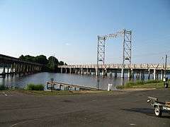
Mooringsport is located in western Caddo Parish at 32°41′13″N 93°57′42″W / 32.68694°N 93.96167°W (32.687029, -93.961630),[2] on the south shore of Caddo Lake. Louisiana Highway 1 bypasses the village 2 miles (3 km) to the east. Downtown Shreveport is 18 miles (29 km) to the southeast.
According to the United States Census Bureau, Mooringsport has a total area of 1.17 square miles (3.04 km2), of which 1.16 square miles (3.01 km2) is land and 0.012 square miles (0.03 km2), or 1.06%, is water.[1]
Demographics
| Historical population | |||
|---|---|---|---|
| Census | Pop. | %± | |
| 1920 | 992 | — | |
| 1930 | 802 | −19.2% | |
| 1940 | 748 | −6.7% | |
| 1950 | 709 | −5.2% | |
| 1960 | 864 | 21.9% | |
| 1970 | 830 | −3.9% | |
| 1980 | 911 | 9.8% | |
| 1990 | 873 | −4.2% | |
| 2000 | 833 | −4.6% | |
| 2010 | 793 | −4.8% | |
| Est. 2015 | 786 | [3] | −0.9% |
As of the census[5] of 2000, there were 833 people, 334 households, and 228 families residing in the village. The population density was 716.6 people per square mile (277.3/km²). There were 397 housing units at an average density of 341.5 per square mile (132.1/km²). The racial makeup of the village was 80.19% White, 17.77% African American, 0.36% Native American, 0.36% from other races, and 1.32% from two or more races. Hispanic or Latino of any race were 0.72% of the population.
There were 334 households out of which 34.1% had children under the age of 18 living with them, 47.6% were married couples living together, 18.6% had a female householder with no husband present, and 31.7% were non-families. 27.5% of all households were made up of individuals and 12.3% had someone living alone who was 65 years of age or older. The average household size was 2.49 and the average family size was 3.02.
In the village the population was spread out with 28.3% under the age of 18, 9.6% from 18 to 24, 27.4% from 25 to 44, 19.3% from 45 to 64, and 15.4% who were 65 years of age or older. The median age was 35 years. For every 100 females there were 93.3 males. For every 100 females age 18 and over, there were 86.6 males.
The median income for a household in the village was $32,177, and the median income for a family was $40,625. Males had a median income of $29,167 versus $21,875 for females. The per capita income for the village was $14,589. About 9.8% of families and 10.7% of the population were below the poverty line, including 10.7% of those under age 18 and 14.2% of those age 65 or over.
Notable people
- Lead Belly (Huddie William Ledbetter, 1888–1949), singer and guitarist born in Mooringsport
- Sam Caldwell, mayor of Shreveport from 1934–1946, born and reared in Mooringsport[6]
- Bill P. Keith, Texas author, lived in Mooringsport while he represented Caddo Parish in the Louisiana State Senate from 1980-1984
References
- 1 2 "Geographic Identifiers: 2010 Demographic Profile Data (G001): Mooringsport village, Louisiana". U.S. Census Bureau, American Factfinder. Retrieved August 14, 2014.
- ↑ "US Gazetteer files: 2010, 2000, and 1990". United States Census Bureau. 2011-02-12. Retrieved 2011-04-23.
- ↑ "Annual Estimates of the Resident Population for Incorporated Places: April 1, 2010 to July 1, 2015". Retrieved July 2, 2016.
- ↑ "Census of Population and Housing". Census.gov. Retrieved June 4, 2015.
- ↑ "American FactFinder". United States Census Bureau. Retrieved 2008-01-31.
- ↑ "Index to Politicians: Caldwell". politicalgraveyard.com. Retrieved December 20, 2010.
External links
Municipalities and communities of Caddo Parish, Louisiana, United States | ||
|---|---|---|
| Cities | 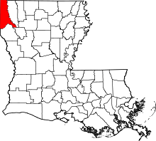 | |
| Towns | ||
| Villages | ||
| CDP | ||
| Other unincorporated communities | ||
| Ghost town | ||
| Footnotes | ‡This populated place also has portions in an adjacent parish or parishes | |