Moore's Prairie Township, Jefferson County, Illinois
| Moore's Prairie Township | |
|---|---|
| Township | |
|
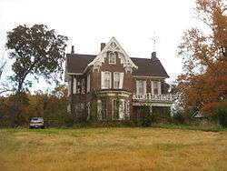
The C. H. Judd House, a historic site in the township | |
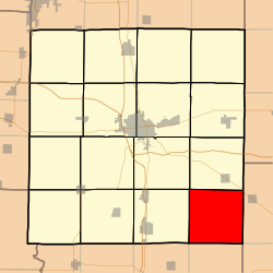 Location in Jefferson County | |
 Jefferson County's location in Illinois | |
| Coordinates: 38°10′N 88°45′W / 38.167°N 88.750°WCoordinates: 38°10′N 88°45′W / 38.167°N 88.750°W | |
| Country | United States |
| State | Illinois |
| County | Jefferson |
| Area | |
| • Total | 36.59 sq mi (94.8 km2) |
| • Land | 36.36 sq mi (94.2 km2) |
| • Water | 0.23 sq mi (0.6 km2) 0.63% |
| Elevation | 499 ft (152 m) |
| Population (2010) | |
| • Total | 347 |
| • Density | 9.5/sq mi (3.7/km2) |
| Time zone | CST (UTC-6) |
| • Summer (DST) | CDT (UTC-5) |
| ZIP codes | 62810, 62846 |
| GNIS feature ID | 0429392 |
Moore's Prairie Township is one of sixteen townships in Jefferson County, Illinois, USA. As of the 2010 census, its population was 347 and it contained 142 housing units.[1]
Geography
According to the 2010 census, the township has a total area of 36.59 square miles (94.8 km2), of which 36.36 square miles (94.2 km2) (or 99.37%) is land and 0.23 square miles (0.60 km2) (or 0.63%) is water.[1] The township is centered at 38°10'N 88°45'W (38.169,-88.754).
Adjacent townships
- Pendleton Township (north)
- Dahlgren Township, Hamilton County (east)
- Knights Prairie Township, Hamilton County (southeast)
- Northern Township, Franklin County (south)
- Ewing Township, Franklin County (southwest)
- Spring Garden Township (west)
- Dodds Township (northwest)
Cemeteries
- Cochrane Cemetery
- Four Graves Cemetery
- Grothoff Cemetery
- Wilbanks Cemetery
- Lowery Hill Cemetery
- One Grave Cemetery
- Shelton Cemetery
- Sugar Camp Cemetery
Major highways
School districts
- Hamilton County Community Unit School District 10
Political districts
- Illinois' 19th congressional district
- State House District 107
- State Senate District 54
References
- "Moore's Prairie Township, Jefferson County, Illinois". Geographic Names Information System. United States Geological Survey. Retrieved 2010-01-17.
- United States Census Bureau 2007 TIGER/Line Shapefiles
- United States National Atlas
- 1 2 "Population, Housing Units, Area, and Density: 2010 - County -- County Subdivision and Place -- 2010 Census Summary File 1". United States Census. Retrieved 2013-05-28.
External links
Municipalities and communities of Jefferson County, Illinois, United States | ||
|---|---|---|
| Cities | ||
| Villages | ||
| Townships | ||
| CDP | ||
| Other unincorporated communities |
| |
| Footnotes | ‡This populated place also has portions in an adjacent county or counties | |
This article is issued from Wikipedia - version of the 12/5/2013. The text is available under the Creative Commons Attribution/Share Alike but additional terms may apply for the media files.