Monyetleng
| Monyetleng | |
|---|---|
| Community Council | |
 Monyetleng Geographic Center of Community | |
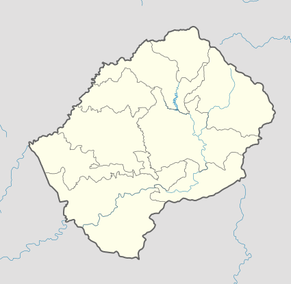
| Coordinates: 29°38′07″S 28°53′06″E / 29.63528°S 28.88500°E | |
| Country |
|
| District | Thaba-Tseka District |
| Elevation[1] | 7,162 ft (2,183 m) |
| Population (2006) | |
| • Total | 7,306 |
| Time zone | CAT (UTC+2) |
| Coordinates computed from Lesotho Villages file.[2] | |
Monyetleng is a community council located in the Thaba-Tseka District of Lesotho. Its population in 2006 was 7,306.[3]
Villages
The community of Monyetleng includes the villages of Bolia-'Mele, Botsola, Ha 'Mankereu, Ha Boomo, Ha K'henene, Ha Khanyetsi, Ha Komanyane, Ha Mokone, Ha Motake, Ha Motjolopane, Ha Motsoetsoe, Ha Rampeoane, Ha Seeiso, Ha Seelane, Ha Setala, Ha Teke (Hloahloeng), Ha Theko, Kh'olola, Khatoloto, Khochaneng, Khotsong, Kolobere, Lekhalong (Moreneng), Linotšing, Matsiring, Mokhoabong, Nokeng, Phahameng, Pontšeng and Taung.[4]
References
- ↑ GTOPO30 via GeoNames. Retrieved 2010-12-10.
- ↑ Google Earth Download Site Retrieved 2010-07-21.
- ↑ Statoids.com
- ↑ Lesotho Bureau of Statistics, Village List 2006.
External links
This article is issued from Wikipedia - version of the 11/9/2016. The text is available under the Creative Commons Attribution/Share Alike but additional terms may apply for the media files.