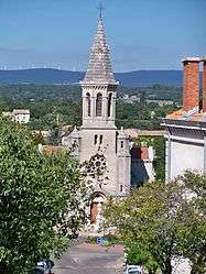
Montségur-sur-Lauzon
| Montségur-sur-Lauzon | |
|---|---|
 | |
 Montségur-sur-Lauzon | |
|
Location within Auvergne-Rhône-Alpes region  Montségur-sur-Lauzon | |
| Coordinates: 44°21′41″N 4°51′37″E / 44.3614°N 4.8603°ECoordinates: 44°21′41″N 4°51′37″E / 44.3614°N 4.8603°E | |
| Country | France |
| Region | Auvergne-Rhône-Alpes |
| Department | Drôme |
| Arrondissement | Nyons |
| Canton | Saint-Paul-Trois-Châteaux |
| Government | |
| • Mayor (2008–2014) | Jean-Jacques Rosier |
| Area1 | 18.24 km2 (7.04 sq mi) |
| Population (2008)2 | 1,147 |
| • Density | 63/km2 (160/sq mi) |
| Time zone | CET (UTC+1) |
| • Summer (DST) | CEST (UTC+2) |
| INSEE/Postal code | 26211 / 26130 |
| Elevation | 112–297 m (367–974 ft) |
|
1 French Land Register data, which excludes lakes, ponds, glaciers > 1 km² (0.386 sq mi or 247 acres) and river estuaries. 2 Population without double counting: residents of multiple communes (e.g., students and military personnel) only counted once. | |
Montségur-sur-Lauzon is a commune in the Drôme department in southeastern France.
Population
| Historical population | ||
|---|---|---|
| Year | Pop. | ±% |
| 1911 | 842 | — |
| 1962 | 634 | −24.7% |
| 1968 | 654 | +3.2% |
| 1975 | 767 | +17.3% |
| 1982 | 925 | +20.6% |
| 1990 | 987 | +6.7% |
| 1999 | 1,029 | +4.3% |
| 2008 | 1,147 | +11.5% |
See also
References
| Wikimedia Commons has media related to Montségur-sur-Lauzon. |
This article is issued from Wikipedia - version of the 10/28/2016. The text is available under the Creative Commons Attribution/Share Alike but additional terms may apply for the media files.