Montgomery County, Mississippi
| Montgomery County, Mississippi | |
|---|---|
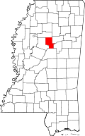 Location in the U.S. state of Mississippi | |
 Mississippi's location in the U.S. | |
| Founded | 1871 |
| Seat | Winona |
| Largest city | Winona |
| Area | |
| • Total | 408 sq mi (1,057 km2) |
| • Land | 407 sq mi (1,054 km2) |
| • Water | 0.9 sq mi (2 km2), 0.2% |
| Population | |
| • (2010) | 10,925 |
| • Density | 27/sq mi (10/km²) |
| Congressional district | 2nd |
| Time zone | Central: UTC-6/-5 |
| Website |
www |
Montgomery County is a county located in the U.S. state of Mississippi. As of the 2010 census, the population was 10,925.[1] Its county seat is Winona.[2] The county was either named in honor of Richard Montgomery, an American Revolutionary War general killed in 1775 while attempting to capture Quebec City, Canada, or for Montgomery County, Tennessee, from which an early settler came. In that latter case, it would have been indirectly named for John Montgomery, a settler in Montgomery County, Tennessee, who founded the city of Clarksville, Tennessee, in that county.
Geography
According to the U.S. Census Bureau, the county has a total area of 408 square miles (1,060 km2), of which 407 square miles (1,050 km2) is land and 0.9 square miles (2.3 km2) (0.2%) is water.[3] It is the fourth-smallest county in Mississippi by total area.
Major highways
Adjacent counties
- Grenada County (north)
- Webster County (northeast)
- Choctaw County (east)
- Attala County (south)
- Carroll County (west)
Demographics
| Historical population | |||
|---|---|---|---|
| Census | Pop. | %± | |
| 1880 | 13,348 | — | |
| 1890 | 14,459 | 8.3% | |
| 1900 | 16,536 | 14.4% | |
| 1910 | 17,706 | 7.1% | |
| 1920 | 13,805 | −22.0% | |
| 1930 | 15,009 | 8.7% | |
| 1940 | 15,703 | 4.6% | |
| 1950 | 14,470 | −7.9% | |
| 1960 | 13,320 | −7.9% | |
| 1970 | 12,918 | −3.0% | |
| 1980 | 13,366 | 3.5% | |
| 1990 | 12,388 | −7.3% | |
| 2000 | 12,189 | −1.6% | |
| 2010 | 10,925 | −10.4% | |
| Est. 2015 | 10,152 | [4] | −7.1% |
| U.S. Decennial Census[5] 1790-1960[6] 1900-1990[7] 1990-2000[8] 2010-2013[1] | |||
As of the 2010 United States Census, there were 10,925 people residing in the county. 53.0% were White, 45.5% Black or African American, 0.4% Asian, 0.1% Native American, 0.5% of some other race and 0.5% of two or more races. 0.9% were Hispanic or Latino (of any race).
As of the census[9] of 2000, there were 12,189 people, 4,690 households, and 3,367 families residing in the county. The population density was 30 people per square mile (12/km²). There were 5,402 housing units at an average density of 13 per square mile (5/km²). The racial makeup of the county was 54.25% White, 44.95% Black or African American, 0.08% Native American, 0.25% Asian, 0.02% Pacific Islander, 0.07% from other races, and 0.37% from two or more races. 0.85% of the population were Hispanic or Latino of any race.
According to the census[9] of 2000, the largest ancestry groups in Montgomery County were African 44.95%, English 42.1%, and Scots-Irish 1%.
There were 4,690 households out of which 32.60% had children under the age of 18 living with them, 48.50% were married couples living together, 18.80% had a female householder with no husband present, and 28.20% were non-families. 26.10% of all households were made up of individuals and 13.60% had someone living alone who was 65 years of age or older. The average household size was 2.57 and the average family size was 3.10.
In the county the population was spread out with 26.80% under the age of 18, 8.90% from 18 to 24, 25.30% from 25 to 44, 22.40% from 45 to 64, and 16.70% who were 65 years of age or older. The median age was 37 years. For every 100 females there were 86.40 males. For every 100 females age 18 and over, there were 81.10 males.
The median income for a household in the county was $25,270, and the median income for a family was $31,602. Males had a median income of $26,590 versus $17,639 for females. The per capita income for the county was $14,040. About 21.90% of families and 24.30% of the population were below the poverty line, including 34.80% of those under age 18 and 25.40% of those age 65 or over.
Education
- Public School Districts
- Private Schools
- Winona Christian School
Communities
Cities
- Winona (county seat)
Towns
Unincorporated communities
Ghost town
Notable residents
- Fannie Lou Hamer - Born in Montgomery County in 1917, moved to Sunflower County in 1919.[10]
See also
References
- 1 2 "State & County QuickFacts". United States Census Bureau. Retrieved September 4, 2013.
- ↑ "Find a County". National Association of Counties. Retrieved 2011-06-07.
- ↑ "2010 Census Gazetteer Files". United States Census Bureau. August 22, 2012. Retrieved November 6, 2014.
- ↑ "County Totals Dataset: Population, Population Change and Estimated Components of Population Change: April 1, 2010 to July 1, 2015". Retrieved July 2, 2016.
- ↑ "U.S. Decennial Census". United States Census Bureau. Retrieved November 6, 2014.
- ↑ "Historical Census Browser". University of Virginia Library. Retrieved November 6, 2014.
- ↑ "Population of Counties by Decennial Census: 1900 to 1990". United States Census Bureau. Retrieved November 6, 2014.
- ↑ "Census 2000 PHC-T-4. Ranking Tables for Counties: 1990 and 2000" (PDF). United States Census Bureau. Retrieved November 6, 2014.
- 1 2 "American FactFinder". United States Census Bureau. Retrieved 2008-01-31.
- ↑ Barnwell, p. 225 - Excerpt of: Mills, Kay This Little Light of Mine. In: Barnwell, Marion (editor) A Place Called Mississippi: Collected Narratives. University Press of Mississippi, 1997. ISBN 1617033391, 9781617033391.
 |
Grenada County | Webster County | | |
| Carroll County | |
Choctaw County | ||
| ||||
| | ||||
| Attala County |
Municipalities and communities of Montgomery County, Mississippi, United States | ||
|---|---|---|
| City | | |
| Towns | ||
| Unincorporated communities | ||
| Ghost town | ||
.svg.png)
Coordinates: 33°30′N 89°37′W / 33.50°N 89.61°W