Montgomery Township, New Jersey
| Montgomery Township, New Jersey | |
|---|---|
| Township | |
| Township of Montgomery | |
|
| |
 Map of Montgomery Township in Somerset County. Inset: Location of Somerset County highlighted in the State of New Jersey. | |
 Census Bureau map of Montgomery Township, New Jersey | |
| Coordinates: 40°25′42″N 74°40′36″W / 40.428334°N 74.676696°WCoordinates: 40°25′42″N 74°40′36″W / 40.428334°N 74.676696°W[1][2] | |
| Country |
|
| State |
|
| County | Somerset |
| Incorporated | February 21, 1798 |
| Named for | Colonel Richard Montgomery |
| Government[3] | |
| • Type | Township |
| • Body | Township Committee |
| • Mayor | Patricia Graham (R, term ends December 31, 2015)[4][5] |
| • Administrator | Donato Nieman[6] |
| • Clerk | Donna Kukla[7] |
| Area[1] | |
| • Total | 32.480 sq mi (84.123 km2) |
| • Land | 32.307 sq mi (83.674 km2) |
| • Water | 0.173 sq mi (0.449 km2) 0.53% |
| Area rank |
75th of 566 in state 4th of 21 in county[1] |
| Elevation[8] | 98 ft (30 m) |
| Population (2010 Census)[9][10][11] | |
| • Total | 22,254 |
| • Estimate (2015)[12] | 23,049 |
| • Rank |
115th of 566 in state 5th of 21 in county[13] |
| • Density | 688.8/sq mi (265.9/km2) |
| • Density rank |
414th of 566 in state 16th of 21 in county[13] |
| Time zone | Eastern (EST) (UTC-5) |
| • Summer (DST) | Eastern (EDT) (UTC-4) |
| ZIP code |
08502 - Belle Mead[14] 08558 - Skillman[15] 08540 - Princeton |
| Area code(s) | 908[16] |
| FIPS code | 3403547580[1][17][18] |
| GNIS feature ID | 0882168[1][19] |
| Website |
www |

Montgomery Township is a township in Somerset County, New Jersey, United States. As of the 2010 United States Census, the township's population was 22,254,[9][10][11] reflecting an increase of 4,773 (+27.3%) from the 17,481 counted in the 2000 Census, which had in turn increased by 7,869 (+81.9%) from the 9,612 counted in the 1990 Census.[20]
Montgomery Township was incorporated on February 21, 1798, as one of New Jersey's initial group of 104 townships by an act of the New Jersey Legislature, from what remained of Western precinct. Portions of the township were taken to form Princeton borough (February 11, 1813, in Mercer County, consolidated to form Princeton as of January 1, 2013), Princeton Township (April 9, 1838, also now consolidated into Princeton) and Rocky Hill (December 18, 1889).[21]
History
The area now known as Montgomery Township was inhabited for approximately 20,000 years by Lenni Lenape tribal groups. The current Native American population of Montgomery Township is just under 0.1% of the total population.[9]
The first European landowners in what was to become Montgomery Township, such as Johannas Van Home and Peter Sonmans, were speculators who did not live on the land, but sold large parts of what they owned to companies that subdivided it into farm-sized plots for those who did intend to settle. Many speculators and early settlers were of Dutch descent from the New Amsterdam area (especially Long Island), which, after the British ousted the Dutch (1664), was renamed New York in honor of the Duke of York (the future James II). The Township was originally known as the Western Precinct of Somerset County (i.e. west of the Millstone River). Before the creation of Mercer County in 1838, the southern border extended to Nassau Street in Princeton. In 1798 the Western Precinct was organized as Montgomery Township, named for Colonel Richard Montgomery, who fell fighting for the patriot cause in the Battle of Quebec at the start of the Revolution (1775).[22]
Most of the land is flat and fertile, running westward from the Millstone River to Province Line, which divides Somerset from Hunterdon County and once marked the division between East and West Jersey. Farms of 300 to 500 acres (2.0 km2) were common, some owners keeping a few slaves to work the land and serve in the household. The aim of the early settlers was to produce as many of the necessities of life as they could: subsistence farming, in other words. Each farm had a vegetable garden, orchard, pasturage and fields for grain, as well as a stand of timber to be selectively cut for fuel. What became known as the Harlingen Tract (1710) included part of Sourland Mountain. Each farm on the flatland was assigned a separate strip of woodland that ran up to the Hunterdon border, all crossing Rock Brook. At points along the stream mills were built either to saw lumber or to grind grain. Other early mill sites were at Rocky Hill on the Millstone River, Bridgepoint on Pike Brook and on Bedens Brook near Blawenburg.
Settlement began in the first quarter of the eighteenth century. When churches, schools, general stores, blacksmith shops and hotel/taverns were built, they tended to cluster at intersections or other important points. For example, the intersection where the Carrier Clinic now stands used to be called Plainville or Posttown, having in the nineteenth century a post office, store, school house, blacksmith and wheelwright shops, as well as a hotel/tavern where the circuit judge presided. Most people walked to where they wanted to go. Schools were generally spaced no further than four miles (6 km) apart in order that no child would have to go more than two miles (3 km) to get to one. Churches marked the most important centers. The Dutch Church's earliest congregations first gathered in farm houses. The first church building at Harlingen dates to around 1750 and was called the Church at Sourland. The church at Neshanic in Hillsborough Township was established in 1752. In the early years these two churches shared a single pastor, and up to about 1800 they conducted their services in the Dutch language. One such pastor was Martinus Van Harlingen, who gave his name to the village, to the church that now bears his name, and to the local Historical Society. The Blawenburg church, an offshoot of the one at Harlingen, dates to 1830 and was erected in three days.
During the Revolution, the Township was the scene of marches by both British and patriot forces and of clashes between them. In the century that followed the movement of goods and people was accelerated by increasingly swifter forms of transportation. First was the building of the Georgetown and Franklin Turnpike between Lambertville and New Brunswick (1820-22: Route 518). Next came the digging of the Delaware and Raritan Canal along the east side of the Millstone River (1834). Railroad construction followed with the Delaware and Boundbrook Railroad (later the Reading), which established depots at Skillman, Harlingen and Belle Mead (1875). In the early years of the twentieth century, the arrival of the automobile, of electricity and of the telephone brought further growth and change. In consequence, and over time, the one or two room schoolhouse was supplanted by the central school, post offices were consolidated and most of the hotels/taverns disappeared. The crossroad hamlets that once offered basic services of general store, blacksmith shops and the like disappeared also, many leaving only their names to mark a road or an area: Skillman, Bridgepoint and Dutchtown are examples.
The paving and realignment of roads, and the building of new ones, came toward the end of the transportation revolution. A new major north-south highway, Route 206, was created in 1927. Before that time Montgomery and Mount Lucas Roads were parts of the chief north-south route through the center of the Township. Farming continued despite many changes in the economy and in agricultural practices. In the late nineteenth century subsistence farming was giving way to specialized operations, such as dairying, poultry farming, and fruit orchards. As the twentieth century drew to a close even these ventures no longer offered the farmer an easy existence, given the rapidly appreciating value of the land, over against the low prices of products produced on it. As farms became less and less profitable, the land was converted to other uses. For example, in 1898 the facility for the treatment of epileptics was built on farmland between Blawenburg and Skillman. Since the Second World War, housing developments, shopping centers and business parks have sprung up, leaving as remnants of the long tradition of agriculture in Montgomery roadside stands, riding stables and the like.
As rapid growth throughout the Princeton area has spread suburban sprawl across the Township, the push to limit runaway development and to acquire open space has become an urgent concern of the community. In the last decade of the twentieth century, Montgomery's population nearly doubled, making it the fastest growing township in the county.
Geography
According to the United States Census Bureau, the township had a total area of 32.480 square miles (84.123 km2), including 32.307 square miles (83.674 km2) of land and 0.173 square miles (0.449 km2) of water (0.53%).[1][2]
Belle Mead (with a 2010 Census population of 216[23]), Blawenburg (280[24]), Harlingen (297[25]) and Skillman (242[26]) are unincorporated communities and census-designated places (CDPs) located within Montgomery Township.[27][28][29]
Other unincorporated communities, localities and place names located partially or completely within the township include Amwell, Bridgepoint, Dutchtown, Fairview, Plainville, Rocky Hill, Stoutsburg and Zion.[30]
The township borders Franklin Township, Hillsborough Township and Rocky Hill in Somerset County, East Amwell Township in Hunterdon County and both Hopewell Township and Princeton in Mercer County.[31]
Township residents are served by three post offices located wholly within the township's borders: Belle Mead with ZIP code 08502, Skillman with ZIP code 08558 and Blawenburg with ZIP code 08504. A portion of the southern section of the township is serviced by the Princeton post office with ZIP code 08540.
Demographics
| Historical population | |||
|---|---|---|---|
| Census | Pop. | %± | |
| 1790 | 1,875 | — | |
| 1810 | 2,282 | — | |
| 1820 | 2,495 | 9.3% | |
| 1830 | 2,834 | 13.6% | |
| 1840 | 1,482 | * | −47.7% |
| 1850 | 1,767 | 19.2% | |
| 1860 | 1,975 | 11.8% | |
| 1870 | 2,066 | 4.6% | |
| 1880 | 1,928 | −6.7% | |
| 1890 | 1,655 | * | −14.2% |
| 1900 | 1,243 | −24.9% | |
| 1910 | 1,637 | 31.7% | |
| 1920 | 2,082 | 27.2% | |
| 1930 | 2,648 | 27.2% | |
| 1940 | 3,360 | 26.9% | |
| 1950 | 3,819 | 13.7% | |
| 1960 | 3,851 | 0.8% | |
| 1970 | 6,353 | 65.0% | |
| 1980 | 7,360 | 15.9% | |
| 1990 | 9,612 | 30.6% | |
| 2000 | 17,481 | 81.9% | |
| 2010 | 22,254 | 27.3% | |
| Est. 2015 | 23,049 | [12][32] | 3.6% |
| Population sources: 1790-1920[33] 1840[34] 1850-1870[35] 1850[36] 1870[37] 1880-1890[38] 1890-1910[39] 1910-1930[40] 1930-1990[41] 2000[42][43] 2010[9][10][11] * = Lost territory in previous decade.[21] | |||
Census 2010
The 2010 United States Census counted 22,254 people, 7,635 households, and 6,077 families residing in the township. The population density was 688.8 per square mile (265.9/km2). The township contained 7,902 housing units at an average density of 244.6 per square mile (94.4/km2). The racial makeup of the township was 67.66% (15,057) White, 2.84% (633) Black or African American, 0.09% (19) Native American, 25.61% (5,700) Asian, 0.01% (2) Pacific Islander, 1.34% (298) from other races, and 2.45% (545) from two or more races. Hispanics or Latinos of any race were 4.57% (1,017) of the population.[9]
Out of a total of 7,635 households, 48.5% had children under the age of 18 living with them, 70.9% were married couples living together, 6.7% had a female householder with no husband present, and 20.4% were non-families. 17.7% of all households were made up of individuals, and 7.2% had someone living alone who was 65 years of age or older. The average household size was 2.90 and the average family size was 3.31.[9]
In the township, 30.8% of the population were under the age of 18, 5.0% from 18 to 24, 22.3% from 25 to 44, 32.0% from 45 to 64, and 9.9% who were 65 years of age or older. The median age was 40.8 years. For every 100 females the census counted 94.2 males, but for 100 females at least 18 years old, it was 89.1 males.[9]
The Census Bureau's 2006-2010 American Community Survey showed that (in 2010 inflation-adjusted dollars) median household income was $146,100 (with a margin of error of +/- $16,235) and the median family income was $167,889 (+/- $10,202). Males had a median income of $110,549 (+/- $4,286) versus $80,268 (+/- $15,872) for females. The per capita income for the borough was $62,642 (+/- $4,981). About 1.4% of families and 2.3% of the population were below the poverty line, including 1.7% of those under age 18 and 5.9% of those age 65 or over.[44]
Census 2000
As of the 2000 United States Census[17] there were 17,481 people, 5,803 households, and 4,781 families residing in the township. The population density was 535.9 people per square mile (206.9/km²). There were 6,130 housing units at an average density of 187.9 per square mile (72.6/km²). The racial makeup of the township was 84.55% White, 2.07% African-American, 0.09% Native American, and 11.52% Asian American. Hispanic or Latino of any race were 2.21% of the population.[42][43]
There were 5,803 households out of which 51.1% had children under the age of 18 living with them, 75.5% were married couples living together, 5.3% had a female householder with no husband present, and 17.6% were non-families. 14.2% of all households were made up of individuals and 3.5% had someone living alone who was 65 years of age or older. The average household size was 2.99 and the average family size was 3.33.[42][43]
In the township the population was spread out with 32.9% under the age of 18, 3.9% from 18 to 24, 31.9% from 25 to 44, 24.4% from 45 to 64, and 6.8% who were 65 years of age or older. The median age was 37 years. For every 100 females there were 97.4 males. For every 100 females age 18 and over, there were 93.8 males.[42][43]
The median income for a household in the township was $118,850, and the median income for a family was $129,150. 70.20% of the residents had a college education or better, and 89.8% are white collar. Males had a median income of $86,687 versus $55,441 for females. The per capita income for the township was $48,699. About 1.4% of families and 1.5% of the population were below the poverty line, including 1.2% of those under age 18 and 1.3% of those age 65 or over.[42][43]
Parks and recreation
Skillman Village
In 2007, the Township of Montgomery purchased a 256-acre (1.04 km2) parcel of land once known as the North Princeton Developmental Center from the State of New Jersey, located in Montgomery adjoining Skillman Road and Burnt Hill Road. In addition, the Township acquired from the State the adjacent wastewater treatment facility on 7 acres (28,000 m2), behind the State-owned Skillman Dairy Farm. The NPDC property, originally established in 1898 as the "New Jersey State Village for Epileptics," operated as a self-contained community that consisted of hospitals, housing, maintenance areas, schools, a power plant, a wastewater treatment facility and an on-site landfill. Later, it became the New Jersey Neuropsychiatric Institute. Most recently, and until 1998, the property was the New Jersey Department of Human Services' psychiatric care facility "North Princeton Developmental Center".
For years there were over 100 buildings on the Property, mostly in substandard, unsafe, unsanitary, dilapidated and/or obsolescent condition. Ninety-two of these buildings were abated and demolished summer 2007. The remaining handful of buildings have been boarded up in anticipation of possible reuse as part of redevelopment. Efforts are ongoing to remediate environmental conditions at the site and repair or demolish the dam and restore the lake. The property's environmental contamination must be remediated and brought into compliance with applicable laws and regulations.
The original plan for the land was development, as advocated by then mayor Louise Wilson. The Township prepared a redevelopment plan and solicited redevelopment proposals for a "Town Square" concept which would have created hundreds of new residential and commercial units. However, no developers submitted bids.
Throughout the rest of 2008 and all of the next few years, the debate over Skillman Village changed. The local Republican team led by Kacey Dyer and Mark Caliguire proposed selling all of the land to Somerset County to create a passive-use park. The public support of this idea was overwhelming, causing it to be one of the deciding factors of the 2008, 2009, and 2010 elections. Louise Wilson and her team were voted out of office (the Republicans took complete control of the Township Committee with the election of Ed Trzaska and Patricia Graham on November 2, 2010).
In October 2010, Somerset County agreed to purchase the land for a passive-use park for $14.1 million.
Skillman Park

Skillman Park is an area of open space in the Skillman section of Montgomery Township which is owned by Somerset County and maintained by the Somerset County Parks Department. In April 2015 a ribbon cutting ceremony was held by County officials to celebrate the park's opening.[45] County crews and contractors have created a new look and amenities at the passive recreation-focused park, on lands which have been restored from a variety of former uses.
A 2.2-mile (3.5 km), 12-foot-wide, paved multi-use loop trail has been built along much of the former facility's road and driveway network. New fencing, sign-age and landscaping have been installed at the park entrances. Much of the tree-lined road layout, designed by landscape architect and engineer Charles W. Leavitt in 1901, has been preserved. Old paving was removed so that the center of Larocque Circle will be open lawn with a small parking area. Main Boulevard has been repaved and parking has been added or improved in four locations.
Government
Local government
Montgomery Township is governed under the Township form of government. The five-member Township Committee is elected directly by the voters at-large in partisan elections to serve three-year terms of office on a staggered basis, with either one or two seats coming up for election each year as part of the November general election in a three-year cycle.[3][46] At an annual reorganization meeting, the Township Committee selects which of its members will serve as Mayor and Deputy Mayor for that year.
As of 2016, members of the Montgomery Township Committee are Mayor Patricia Graham (R, term on committee and as mayor ends December 31, 2016), Deputy Mayor Ed Trzaska (R, term on committee and as deputy mayor ends 2016), Mark Conforti (R, 2018), Christine Madrid (R, 2018) and Rich Smith (R, 2017).[4][47][48][49][50][51]
Municipal court
The Montgomery Township Municipal Court is held in neighboring Hillsborough Township in the courtroom within the Hillsborough Township Municipal Complex, as part of a shared services agreement between the two townships. The court hears all motor vehicle, disorderly persons offenses, weights/measures complaints, fish and game violations, local ordinance violations and citizen complaints.[52]
Emergency services
Montgomery Township is served by two all-volunteer fire companies, and an all volunteer rescue squad which provide the township with round the clock protection.
- Station 45 Fire - Company #1 covering Belle Mead and northern half of township.[53]
- Station 46 Fire - Company #2 covering Blawenburg and the southern half of township.[54]
- Station 47 Rescue - Montgomery EMS[55]
Federal, state and county representation
Montgomery Township is located in the 7th Congressional District[56] and is part of New Jersey's 16th state legislative district.[10][57][58]
New Jersey's Seventh Congressional District is represented by Leonard Lance (R, Clinton Township).[59] New Jersey is represented in the United States Senate by Cory Booker (D, Newark, term ends 2021)[60] and Bob Menendez (D, Paramus, 2019).[61][62]
For the 2016–2017 session (Senate, General Assembly), the 16th Legislative District of the New Jersey Legislature is represented in the State Senate by Christopher Bateman (R, Branchburg) and in the General Assembly by Jack Ciattarelli (R, Hillsborough Township) and Andrew Zwicker (D, South Brunswick). [63] The Governor of New Jersey is Chris Christie (R, Mendham Township).[64] The Lieutenant Governor of New Jersey is Kim Guadagno (R, Monmouth Beach).[65]
Somerset County is governed by a five-member Board of Chosen Freeholders, whose members are elected at-large to three-year terms of office on a staggered basis, with one or two seats coming up for election each year. At an annual reorganization meeting held in the beginning of January, the board selects a Director and Deputy Director from among its members.[66] As of 2016, Somerset County's Freeholders are Freeholder Director Patricia L. Walsh (R, Green Brook Township, term ends December 31, 2016)[67], Freeholder Deputy Director Peter S. Palmer (R, Bernardsville, 2017),[68] Patrick Scaglione (R, Bridgewater Township, 2018),[69] Mark Caliguire (R, Skillman in Montgomery Township, 2018),[70] and Brian D. Levine (R, Franklin Township, 2017),[71] Constitutional officers elected on a countywide basis are County Clerk Brett A. Radi (R, Somerville, 2017),[72] Sheriff Frank J. Provenzano (R, Raritan, 2016)[73][74] and Surrogate Frank Bruno (R, Branchburg, 2018).[75]
Politics
As of March 23, 2011, there were a total of 14,253 registered voters in Montgomery Township, of which 3,884 (27.3% vs. 26.0% countywide) were registered as Democrats, 3,297 (23.1% vs. 25.7%) were registered as Republicans and 7,068 (49.6% vs. 48.2%) were registered as Unaffiliated. There were 4 voters registered to other parties.[76] Among the township's 2010 Census population, 64.0% (vs. 60.4% in Somerset County) were registered to vote, including 92.6% of those ages 18 and over (vs. 80.4% countywide).[76][77]
In the 2012 presidential election, Democrat Barack Obama received 52.3% of the vote (5,549 cast), ahead of Republican Mitt Romney with 46.2% (4,904 votes), and other candidates with 1.4% (151 votes), among the 10,673 ballots cast by the township's 15,384 registered voters (69 ballots were spoiled), for a turnout of 69.4%.[78][79] In the 2008 presidential election, Democrat Barack Obama received 6,082 votes (55.3% vs. 52.1% countywide), ahead of Republican John McCain with 4,731 votes (43.0% vs. 46.1%) and other candidates with 123 votes (1.1% vs. 1.1%), among the 11,002 ballots cast by the township's 13,849 registered voters, for a turnout of 79.4% (vs. 78.7% in Somerset County).[80] In the 2004 presidential election, Republican George W. Bush received 5,086 votes (50.0% vs. 51.5% countywide), ahead of Democrat John Kerry with 4,950 votes (48.7% vs. 47.2%) and other candidates with 97 votes (1.0% vs. 0.9%), among the 10,171 ballots cast by the township's 11,980 registered voters, for a turnout of 84.9% (vs. 81.7% in the whole county).[81]
In the 2013 gubernatorial election, Republican Chris Christie received 66.3% of the vote (4,080 cast), ahead of Democrat Barbara Buono with 31.5% (1,937 votes), and other candidates with 2.2% (136 votes), among the 6,226 ballots cast by the township's 15,614 registered voters (73 ballots were spoiled), for a turnout of 39.9%.[82][83] In the 2009 gubernatorial election, Republican Chris Christie received 3,999 votes (53.7% vs. 55.8% countywide), ahead of Democrat Jon Corzine with 2,818 votes (37.9% vs. 34.1%), Independent Chris Daggett with 531 votes (7.1% vs. 8.7%) and other candidates with 61 votes (0.8% vs. 0.7%), among the 7,444 ballots cast by the township's 13,992 registered voters, yielding a 53.2% turnout (vs. 52.5% in the county).[84]
Education
The Montgomery Township School District is a comprehensive public school district that serves students in Kindergarten through twelfth grade. As of the 2012-13 school year, the district's five schools had an enrollment of 5,045 students and 378.3 classroom teachers (on an FTE basis), for a student–teacher ratio of 13.34:1.[85] Schools in the district (with 2012-13 enrollment data from the National Center for Education Statistics[86]) are Orchard Hill Elementary School[87] (grades K-2; 844 students), Village Elementary School[88] (3-4; 682), Montgomery Lower Middle School[89] (5-6; 794), Montgomery Upper Middle School[90] (7-8; 822) and Montgomery High School[91] (9-12; 1,740).[92][93][94]
With the addition of the Montgomery High School in 2005, students were transferred from the old high school, now the upper middle school, to the current one located on Route 601. In late 2008 the high school added a solar panel field to save on energy costs. The new Montgomery High School has an indoor pool as well as a brand new outdoor turf.
Montgomery Township was one of the fastest growing school districts in New Jersey. In September 1992, the K-12 enrollment was 1,590 compared to 4,924 in September 2005. This represents a tripling of enrollment in 13 years. However, since the 2005-06 school year, enrollment has been flat due to a dramatic slowing of residential development in town.[95]
Montgomery Township High School was the 33rd-ranked public high school in New Jersey out of 339 schools statewide in New Jersey Monthly magazine's September 2014 cover story on the state's "Education 2014: The State of Our Schools"[96] after being ranked 61st in 2012 out of 328 schools listed and 10th in 2010 out of 322 schools listed.[97]
Rocky Hill is a non-operating school district whose school children attend the Montgomery Township schools as part of a sending/receiving relationship.[22][98]
Transportation
Roads and highways
As of May 2010, the township had a total of 168.21 miles (270.71 km) of roadways, of which 138.40 miles (222.73 km) were maintained by the municipality, 23.98 miles (38.59 km) by Somerset County and 5.83 miles (9.38 km) by the New Jersey Department of Transportation.[99]
U.S. Route 206 (with CR 533 overlapping it for a brief stretch) is the main road that goes through Montgomery. The other main county road that goes through is CR 518.
Limited access roads are accessible outside the municipality, such as Interstate 287 in bordering Franklin Township and Interstate 95 in bordering Hopewell Township.
Public transportation
New Jersey Transit provides local bus service on the 605 route.[100]
Princeton Airport is located in the township.[101]
Notable people
People who were born in, residents of, or otherwise closely associated with Montgomery Township include:
- Wade Baldwin IV (born 1996), basketball player for the Memphis Grizzlies of the National Basketball Association.[102]
- Ben Bernanke (born 1953), former Chairman of the Federal Reserve, former resident and member of the Montgomery Township Board of Education.[103]
- Ira Black (1941–2006), neuroscientist and stem cell researcher who served as the first director of the Stem Cell Institute of New Jersey.[104]
- Yvonne Brill (1924–2013), rocket scientist.[105]
- John P. Lewis (1921–2010), academic and presidential advisor who was a strong advocate of aid to help build developing countries as a matter of foreign policy.[106]
- John Milhiser (born 1981), actor and comedian who has been a cast member on Saturday Night Live for the 2013–2014 season.[107]
- Upton Sinclair (1878–1968), wrote The Jungle 1906, while living on Province Line Road.[108]
- Mimi LaFollette Summerskill (1917–2008), educator, author, political activist and vineyard owner. .[109]
- Tom Verducci (born 1960), sportswriter for Sports Illustrated.[110]
- Tom Wilson (born 1967), Republican Party leader who served as the chairman of the New Jersey Republican State Committee from 2004 to 2009.[111]
References
- 1 2 3 4 5 6 2010 Census Gazetteer Files: New Jersey County Subdivisions, United States Census Bureau. Accessed May 21, 2015.
- 1 2 US Gazetteer files: 2010, 2000, and 1990, United States Census Bureau. Accessed September 4, 2014.
- 1 2 2012 New Jersey Legislative District Data Book, Rutgers University Edward J. Bloustein School of Planning and Public Policy, March 2013, p. 103.
- 1 2 Elected Officials 2016, Montgomery Township. Accessed August 1, 2016.
- ↑ 2016 New Jersey Mayors Directory, New Jersey Department of Community Affairs. Accessed June 14, 2016.
- ↑ Administration, Montgomery Township. Accessed August 1, 2016.
- ↑ Municipal Clerk, Montgomery Township. Accessed August 1, 2016.
- ↑ U.S. Geological Survey Geographic Names Information System: Township of Montgomery, Geographic Names Information System. Accessed March 8, 2013.
- 1 2 3 4 5 6 7 DP-1 - Profile of General Population and Housing Characteristics: 2010 for Montgomery township, Somerset County, New Jersey, United States Census Bureau. Accessed February 13, 2013.
- 1 2 3 4 Municipalities Grouped by 2011-2020 Legislative Districts, New Jersey Department of State, p. 8. Accessed January 6, 2013.
- 1 2 3 Profile of General Demographic Characteristics: 2010 for Montgomery township, New Jersey Department of Labor and Workforce Development. Accessed February 13, 2013.
- 1 2 PEPANNRES - Annual Estimates of the Resident Population: April 1, 2010 to July 1, 2015 - 2015 Population Estimates for New Jersey municipalities, United States Census Bureau. Accessed May 22, 2016.
- 1 2 GCT-PH1 Population, Housing Units, Area, and Density: 2010 - State -- County Subdivision from the 2010 Census Summary File 1 for New Jersey, United States Census Bureau. Accessed February 13, 2013.
- ↑ Look Up a ZIP Code for Belle Mead, NJ, United States Postal Service. Accessed February 13, 2013.
- ↑ Look Up a ZIP Code for Skillman, NJ, United States Postal Service. Accessed February 13, 2013.
- ↑ Area Code Lookup - NPA NXX for Montgomery, NJ, Area-Codes.com. Accessed October 5, 2014.
- 1 2 American FactFinder, United States Census Bureau. Accessed September 4, 2014.
- ↑ A Cure for the Common Codes: New Jersey, Missouri Census Data Center. Accessed February 13, 2013.
- ↑ US Board on Geographic Names, United States Geological Survey. Accessed September 4, 2014.
- ↑ Table 7. Population for the Counties and Municipalities in New Jersey: 1990, 2000 and 2010, New Jersey Department of Labor and Workforce Development, February 2011. Accessed February 13, 2013.
- 1 2 Snyder, John P. The Story of New Jersey's Civil Boundaries: 1606-1968, Bureau of Geology and Topography; Trenton, New Jersey; 1969. p. 224. Accessed October 29, 2012.
- 1 2 History, Montgomery Township. Accessed September 7, 2015. "Once a part of Leni Lenape Indian lands, later as a rural farmland during the colonial times and intertwined in the annals of Revolutionary War History, this 32.26 square miles of land called Montgomery Township was named after General Brigadier Richard Montgomery.... Rocky Hill, which was the first village in the township, is now a separately incorporated borough, whose children attend Montgomery Township schools."
- ↑ DP-1 - Profile of General Population and Housing Characteristics: 2010 Demographic Profile Data for Belle Mead CDP, New Jersey, United States Census Bureau. Accessed February 13, 2013.
- ↑ DP-1 - Profile of General Population and Housing Characteristics: 2010 Demographic Profile Data for Blawenburg CDP, New Jersey, United States Census Bureau. Accessed February 13, 2013.
- ↑ DP-1 - Profile of General Population and Housing Characteristics: 2010 Demographic Profile Data for Harlingen CDP, New Jersey, United States Census Bureau. Accessed February 13, 2013.
- ↑ DP-1 - Profile of General Population and Housing Characteristics: 2010 Demographic Profile Data for Skillman CDP, New Jersey, United States Census Bureau. Accessed February 13, 2013.
- ↑ GCT-PH1 - Population, Housing Units, Area, and Density: 2010 - County -- County Subdivision and Place from the 2010 Census Summary File 1 for Somerset County, New Jersey, United States Census Bureau. Accessed February 13, 2013.
- ↑ 2006-2010 American Community Survey Geography for New Jersey, United States Census Bureau. Accessed February 13, 2013.
- ↑ New Jersey: 2010 - Population and Housing Unit Counts - 2010 Census of Population and Housing (CPH-2-32), United States Census Bureau, August 2012. Accessed February 13, 2013.
- ↑ Locality Search, State of New Jersey. Accessed May 21, 2015.
- ↑ Areas touching Montgomery Township, MapIt. Accessed February 2, 2015.
- ↑ Census Estimates for New Jersey April 1, 2010 to July 1, 2015, United States Census Bureau. Accessed May 22, 2016.
- ↑ Compendium of censuses 1726-1905: together with the tabulated returns of 1905, New Jersey Department of State, 1906. Accessed July 16, 2013.
- ↑ Bowen, Francis. American Almanac and Repository of Useful Knowledge for the Year 1843, p. 231, David H. Williams, 1842. Accessed July 16, 2013. Source show population of 1,481 for 1840, one less than value shown in table.
- ↑ Raum, John O. The History of New Jersey: From Its Earliest Settlement to the Present Time, Volume 1, p. 259, J. E. Potter and company, 1877. Accessed February 13, 2013. "Montgomery township contained in 1850, 1,767 inhabitants; in 1860, 1,975 and in 1870, 2,066."
- ↑ Debow, James Dunwoody Brownson. The Seventh Census of the United States: 1850, p. 141. R. Armstrong, 1853. Accessed February 13, 2013.
- ↑ Staff. A compendium of the ninth census, 1870, p. 260. United States Census Bureau, 1872. Accessed February 13, 2013.
- ↑ Porter, Robert Percival. Preliminary Results as Contained in the Eleventh Census Bulletins: Volume III - 51 to 75, p. 99. United States Census Bureau, 1890. Accessed February 13, 2013.
- ↑ Thirteenth Census of the United States, 1910: Population by Counties and Minor Civil Divisions, 1910, 1900, 1890, United States Census Bureau, p. 338. Accessed February 13, 2013.
- ↑ Fifteenth Census of the United States : 1930 - Population Volume I, United States Census Bureau, p. 718. Accessed February 13, 2013.
- ↑ Table 6. New Jersey Resident Population by Municipality: 1930 - 1990, New Jersey Department of Labor and Workforce Development. Accessed June 28, 2015.
- 1 2 3 4 5 Census 2000 Profiles of Demographic / Social / Economic / Housing Characteristics for Montgomery township, Somerset County, New Jersey, United States Census Bureau. Accessed February 13, 2013.
- 1 2 3 4 5 DP-1: Profile of General Demographic Characteristics: 2000 - Census 2000 Summary File 1 (SF 1) 100-Percent Data for Montgomery township, Somerset County, New Jersey, United States Census Bureau. Accessed February 13, 2013.
- ↑ DP03: Selected Economic Characteristics from the 2006-2010 American Community Survey 5-Year Estimates for Montgomery township, Somerset County, New Jersey, United States Census Bureau. Accessed January 1, 2013.
- ↑ For more information see
- ↑ "Forms of Municipal Government in New Jersey", p. 7. Rutgers University Center for Government Studies. Accessed June 3, 2015.
- ↑ 2016 Municipal User Friendly Budget, Montgomery Township. Accessed August 1, 2016.
- ↑ Somerset County Directory 2016, Somerset County, New Jersey. Accessed July 31, 2016.
- ↑ Somerset County - General Election November 3, 2015 Winning Candidates, Somerset County, New Jersey. Accessed July 31, 2016.
- ↑ Somerset County - General Election November 4, 2014 Winning Candidates, Somerset County, New Jersey. Accessed July 31, 2016.
- ↑ Somerset County - General Election November 5, 2013 Winning Candidates, Somerset County, New Jersey. Accessed July 31, 2016.
- ↑ Municipal Court, Montgomery Township. Accessed May 30, 2015. "While maintaining separate books and records, Montgomery Township shares court personnel and facilities with Hillsborough Township as part of a shared services agreement to realize cost-savings for our taxpayers."
- ↑ Home Page, Montgomery Township Volunteer Fire Company No. 1. Accessed February 2, 2015.
- ↑ About / History, Montgomery Township Volunteer Fire Company #2. Accessed February 2, 2015.
- ↑ About MEMS, Montgomery Emergency Medical Services. Accessed February 2, 2015.
- ↑ Plan Components Report, New Jersey Redistricting Commission, December 23, 2011. Accessed January 6, 2013.
- ↑ 2016 New Jersey Citizen's Guide to Government, p. 61, New Jersey League of Women Voters. Accessed July 20, 2016.
- ↑ Districts by Number for 2011-2020, New Jersey Legislature. Accessed January 6, 2013.
- ↑ Directory of Representatives: New Jersey, United States House of Representatives. Accessed January 5, 2012.
- ↑ About Cory Booker, United States Senate. Accessed January 26, 2015. "He now owns a home and lives in Newark's Central Ward community."
- ↑ Biography of Bob Menendez, United States Senate, January 26, 2015. "He currently lives in Paramus and has two children, Alicia and Robert."
- ↑ Senators of the 114th Congress from New Jersey. United States Senate. Accessed January 26, 2015. "Booker, Cory A. - (D - NJ) Class II; Menendez, Robert - (D - NJ) Class I"
- ↑ Legislative Roster 2016-2017 Session, New Jersey Legislature. Accessed January 17, 2016.
- ↑ "About the Governor". State of New Jersey. Retrieved 2010-01-21.
- ↑ "About the Lieutenant Governor". State of New Jersey. Retrieved 2010-01-21.
- ↑ Somerset County Government: At Your Service, Somerset County, New Jersey. Accessed August 5, 2014.
- ↑ Patricia Walsh, Somerset County, New Jersey. Accessed January 18, 2016.
- ↑ Peter S. Palmer, Somerset County, New Jersey. Accessed January 18, 2016.
- ↑ Patrick Scaglione, Somerset County, New Jersey. Accessed January 18, 2016. A term-end year of 2015 is listed as of date accessed.
- ↑ Mark Caliguire, Somerset County, New Jersey. Accessed January 18, 2016. A term-end year of 2015 is listed as of date accessed.
- ↑ Brian Levine, Somerset County, New Jersey. Accessed January 18, 2016.
- ↑ Biography: Somerset County Clerk Brett A. Radi, Somerset County, New Jersey. Accessed August 5, 2014.
- ↑ Sheriff Frank J. Provenzano, Somerset County Sheriff's Office. Accessed August 5, 2014.
- ↑ Sheriff, Somerset County, New Jersey. Accessed August 5, 2014.
- ↑ Somerset County Surrogate, Somerset County, New Jersey. Accessed January 18, 2016. A term-end year of 2015 is listed as of date accessed.
- 1 2 Voter Registration Summary - Somerset, New Jersey Department of State Division of Elections, March 23, 2011. Accessed February 13, 2013.
- ↑ GCT-P7: Selected Age Groups: 2010 - State -- County Subdivision; 2010 Census Summary File 1 for New Jersey, United States Census Bureau. Accessed February 13, 2013.
- ↑ "Presidential General Election Results - November 6, 2012 - Somerset County" (PDF). New Jersey Department of Elections. March 15, 2013. Retrieved December 24, 2014.
- ↑ "Number of Registered Voters and Ballots Cast - November 6, 2012 - General Election Results - Somerset County" (PDF). New Jersey Department of Elections. March 15, 2013. Retrieved December 24, 2014.
- ↑ 2008 Presidential General Election Results: Somerset County, New Jersey Department of State Division of Elections, December 23, 2008. Accessed February 13, 2013.
- ↑ 2004 Presidential Election: Somerset County, New Jersey Department of State Division of Elections, December 13, 2004. Accessed February 13, 2013.
- ↑ "Governor - Somerset County" (PDF). New Jersey Department of Elections. January 29, 2014. Retrieved December 24, 2014.
- ↑ "Number of Registered Voters and Ballots Cast - November 5, 2013 - General Election Results - Somerset County" (PDF). New Jersey Department of Elections. January 29, 2014. Retrieved December 24, 2014.
- ↑ 2009 Governor: Somerset County, New Jersey Department of State Division of Elections, December 31, 2009. Accessed February 13, 2013.
- ↑ District information for Montgomery Township School District, National Center for Education Statistics. Accessed February 2, 2015.
- ↑ School Data for the Montgomery Township School District, National Center for Education Statistics. Accessed February 2, 2015.
- ↑ Orchard Hill Elementary School, Montgomery Township School District. Accessed February 2, 2015
- ↑ Village Elementary School, Montgomery Township School District. Accessed February 2, 2015.
- ↑ Montgomery Lower Middle School, Montgomery Township School District. Accessed February 2, 2015.
- ↑ Montgomery Upper Middle School, Montgomery Township School District. Accessed February 2, 2015.
- ↑ Montgomery High School, Montgomery Township School District. Accessed February 2, 2015.
- ↑ Contact Information, Montgomery Township School District. Accessed February 2, 2015.
- ↑ New Jersey School Directory for the Montgomery Township School District, New Jersey Department of Education. Accessed February 2, 2015.
- ↑ 2013-2014 Somerset County Public School Directory, Somerset County, New Jersey. Accessed February 2, 2015.
- ↑ 2010/2011 Budget Brochure, Montgomery Township School District.
- ↑ Schlager, Ken. "The Top New Jersey High Schools: Alphabetical", New Jersey Monthly, September 2, 2014. Accessed September 7, 2015.
- ↑ Staff. "The Top New Jersey High Schools: Alphabetical; Here are the 2012 Top High Schools ranking listed alphabetically.", New Jersey Monthly, August 16, 2012. Accessed September 7, 2015.
- ↑ Somerset County School Districts-Sending/Receiving/Regional, Somerset County, New Jersey Superintendent of Schools. Accessed February 2, 2015. "MONTGOMERY K-12 Receives K-12 from Rocky Hill"
- ↑ Somerset County Mileage by Municipality and Jurisdiction, New Jersey Department of Transportation, May 2010. Accessed July 18, 2014.
- ↑ Somerset County Bus / Rail Connections, New Jersey Transit, backed up by the Internet Archive as of January 28, 2010. Accessed February 13, 2013.
- ↑ Early History, Princeton Airport. Accessed February 13, 2013.
- ↑ Haley, John. "Boys basketball Tournament of Champions preview, St. Joseph (Metuchen): The Wade Baldwin Story", The Star-Ledger, March 19, 2014. Accessed July 4, 2016. "Living with his mother in Virginia from when he was four to eight years old, the two moved back to New Jersey when she was promoted again, moving to Montgomery."
- ↑ Chan, Sewell. 'Is Ben Bernanke Having Fun Yet?", The New York Times, May 15, 2010. Accessed February 2, 2015. "In 1985, he left Stanford for Princeton. His children — Joel, born in 1982, and Alyssa, born in 1986 — enrolled in public schools, and for six years he served on the school board in Montgomery Township, N.J."
- ↑ Pearce, Jeremy. "Dr. Ira B. Black, 64, Leader in New Jersey Stem Cell Effort, Dies", The New York Times, January 12, 2006. Accessed August 13, 2009.
- ↑ Martin, Douglas. "Yvonne Brill, a Pioneering Rocket Scientist, Dies at 88", The New York Times, March 31, 2013. Accessed March 31, 2013. "Matthew Brill said his mother died of complications of breast cancer. She lived in Skillman, N.J."
- ↑ Weber, Bruce. "Master of Public Administration", The New York Times, May 24, 2010. Accessed February 2, 2015. "John P. Lewis, who was an economic adviser to three presidents, largely on the subject of foreign aid, died Wednesday in Montgomery, N.J. He was 89 and lived at Stonebridge at Montgomery, a retirement community."
- ↑ Samuel, Neena. "John Milhiser Live from New York … Hofstra Alum Makes SNL Cast", News @ Hofstra, September 17, 2013. Accessed February 2, 2015. "Milhiser, a 2004 Film Studies and Production major from Belle Mead, New Jersey, will be a featured player in the show's upcoming 39th season, which premieres Sept. 28 with Tina Fey as host and Arcade Fire as musical guest."
- ↑ Mitchner, Stuart. "Upton Sinclair's The Jungle, Born in a Shack on Princeton Ridge", Town Topics (newspaper), May 23, 2012. Accessed February 13, 2013.
- ↑ DeVito, Carlo. East Coast Wineries: A Complete Guide from Maine to Virginia, p. 57. Rutgers University Press, 2004. ISBN 9780813533124. Accessed February 2, 2015. "LaFollette Vineyard and Winery; 64 Harlingen Rd., Belle Mead, NJ... Mimi LaFolette Summerskill is a prolific author, traveler, and activist."
- ↑ Caldwell, David. "All the Tools: Sports Illustrated's Tom Verducci brings intelligence and an instinct for the game to his coverage of baseball.", New Jersey Monthly, August 16, 2010. Accessed January 25, 2011. "Verducci lives in Montgomery Township in Somerset County with his wife, Kirsten, and their two sons, Adam and Ben, who both played baseball last spring at Montgomery Township High School."
- ↑ Goodnough, Abby. "So What Will He Do After November?" The New York Times, September 28, 1997. Accessed February 2, 2015. "A Republican Resume: AGE: 30; TOWN: Montgomery Township"
External links
 Media related to Montgomery Township, New Jersey at Wikimedia Commons
- Montgomery Township website
- Montgomery Township School District
- Montgomery Township School District's 2014–15 School Report Card from the New Jersey Department of Education
- School Data for the Montgomery Township School District, National Center for Education Statistics
- The Montgomery News website, the hometown newspaper
Municipalities and communities of Somerset County, New Jersey, United States | ||
|---|---|---|
| Boroughs | 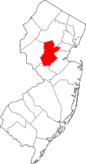 | |
| Townships | ||
| CDPs | ||
| Other unincorporated communities | ||
 |
Hillsborough Township | | ||
| East Amwell Township | |
Franklin Township | ||
| ||||
| | ||||
| Hopewell Township | Princeton | Rocky Hill |