Montgomery, Georgia
| Montgomery, Georgia | |
|---|---|
| Census-designated place | |
 Location in Chatham County and the state of Georgia | |
| Coordinates: 31°56′36″N 81°6′24″W / 31.94333°N 81.10667°WCoordinates: 31°56′36″N 81°6′24″W / 31.94333°N 81.10667°W | |
| Country | United States |
| State | Georgia |
| County | Chatham |
| Area | |
| • Total | 6.1 sq mi (15.7 km2) |
| • Land | 5.2 sq mi (13.5 km2) |
| • Water | 0.8 sq mi (2.2 km2) |
| Elevation | 16 ft (5 m) |
| Population (2010) | |
| • Total | 4,523 |
| • Density | 866/sq mi (334.5/km2) |
| Time zone | Eastern (EST) (UTC-5) |
| • Summer (DST) | EDT (UTC-4) |
| FIPS code | 13-52332[1] |
| GNIS feature ID | 0332411[2] |
Montgomery is a census-designated place (CDP) in Chatham County, Georgia, United States. The population was 4,523 at the 2010 census.[3] It is part of the Savannah Metropolitan Statistical Area.
Geography
Montgomery is located south of the center of Chatham County at 31°56′36″N 81°6′24″W / 31.94333°N 81.10667°W (31.943237, -81.106648).[4] It occupies a neck of land bordered on the west by the Vernon River, on the east by the Moon River, and on the south by the Burnside River, all of which are tidal. The northeast border of the CDP is formed by Georgia SR 204 Spur, which leads to Skidaway Island. Downtown Savannah is 13 miles (21 km) north of the Montgomery town center.
According to the United States Census Bureau, the CDP has a total area of 6.1 square miles (15.7 km2), of which 5.2 square miles (13.5 km2) is land and 0.85 square miles (2.2 km2), or 13.94%, is water.[3]
History
Montgomery is believed to be the location of an early settlement in the Savannah area (prior to General Oglethorpe's land grant in 1733) founded by three brothers, William, James, and Robert Montgomery, who were baronets, under a land grant of 1677. They failed to maintain a permanent settlement, due to poor location and disease, and so lost the English land grant. The brothers moved to the more established Virginia Colony. The name of the settlement continues in this area of Savannah as well as Montgomery Street and Montgomery Crossroad.
Demographics
| Historical population | |||
|---|---|---|---|
| Census | Pop. | %± | |
| 1990 | 4,327 | — | |
| 2000 | 4,134 | −4.5% | |
| 2010 | 4,523 | 9.4% | |
| source:[5] | |||
As of the census[1] of 2000, there were 4,134 people, 1,589 households, and 1,196 families residing in the CDP. The population density was 777.9 people per square mile (300.6/km²). There were 1,668 housing units at an average density of 313.9 per square mile (121.3/km²). The racial makeup of the CDP was 88.20% White, 9.29% African American, 0.10% Native American, 0.60% Asian, 0.34% Pacific Islander, 0.56% from other races, and 0.92% from two or more races. Hispanic or Latino of any race were 1.48% of the population.
There were 1,589 households out of which 35.1% had children under the age of 18 living with them, 59.7% were married couples living together, 11.6% had a female householder with no husband present, and 24.7% were non-families. 20.0% of all households were made up of individuals and 7.0% had someone living alone who was 65 years of age or older. The average household size was 2.60 and the average family size was 3.00.
In the CDP the population was spread out with 25.7% under the age of 18, 7.4% from 18 to 24, 29.6% from 25 to 44, 27.3% from 45 to 64, and 10.1% who were 65 years of age or older. The median age was 38 years. For every 100 females there were 96.2 males. For every 100 females age 18 and over, there were 92.5 males.
The median income for a household in the CDP was $52,889, and the median income for a family was $55,774. Males had a median income of $41,131 versus $25,750 for females. The per capita income for the CDP was $27,998. About 2.1% of families and 4.0% of the population were below the poverty line, including 3.2% of those under age 18 and 5.4% of those age 65 or over.
Known as the home of Green Bay Packers wide receiver Ty Montgomery.
References
- 1 2 "American FactFinder". United States Census Bureau. Retrieved 2008-01-31.
- ↑ "US Board on Geographic Names". United States Geological Survey. 2007-10-25. Retrieved 2008-01-31.
- 1 2 "Geographic Identifiers: 2010 Demographic Profile Data (G001): Montgomery CDP, Georgia". U.S. Census Bureau, American Factfinder. Retrieved July 24, 2014.
- ↑ "US Gazetteer files: 2010, 2000, and 1990". United States Census Bureau. 2011-02-12. Retrieved 2011-04-23.
- ↑ "CENSUS OF POPULATION AND HOUSING (1790-2000)". U.S. Census Bureau. Retrieved 2010-07-31.
Municipalities and communities of Chatham County, Georgia, United States | ||
|---|---|---|
| Cities | 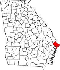 | |
| Towns | ||
| CDPs | ||
| Unincorporated communities | ||