Monteith POW camp
The POW Camp 23, Monteith was a Canadian-run POW camp during World War II, located in Monteith, Iroquois Falls, Ontario.
The camp was located about 80 kilometers north-east of Timmins, Ontario and about 700 km north of Toronto.
Before World War II, the camp was a lumber camp employing about 40 men. Board lumber was cut on site and shipped about 8 km to the rail line. In 1941, the camp was converted into a prisoner of war camp by the Canadian government. The prisoners included interned German nationals in addition to captured German soldiers. The German national internees, as distinct from prisoners of war, had largely been classified as "enemy aliens", many shipped from Britain after the fall of France in 1940 under Churchill's "collar the lot" edict. As most of these were in fact Jewish or political refugees from the Nazi regime (and so would have formally had their German citizenship withdrawn by the authorities there, thus being effectively stateless, even if this factor was not realised or recognised in the UK), after vetting many were allowed to return to Britain to join the armed forces.[1] The camp had no fences and very few guards because of its isolated location. There were no roads at all, only kilometres of bush and lakes. The prisoners would not escape because there was nowhere to go.
The Germans did their own cooking and laundry and worked 5 days a week cutting trees to be turned into lumber and using horse teams to get them to the mill. At one time there were about 3,000 prisoners in the camp.
At the end of the war, the POWs were returned to Germany, but some came back to the area after the war along with other German civilians.
Camp 23 became a provincial jail known as Monteith Correctional Complex.
References
- ↑ Elwell, Paul. "Paul Elwell's Story - Part 2- War and Internment". BBC - WW2 People's War.
External links
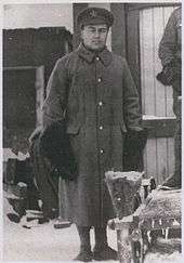
- Hans Höchersteiger papers, Division of Special Collections, University of Alabama Libraries. Höchersteiger was a prisoner here. See 'Correspondence, Outgoing - POW letters and postcards,' which contains 17 items in German.
Coordinates: 48°38′N 80°41′W / 48.64°N 80.68°W