Monte Conero
| Monte Conero | |
|---|---|
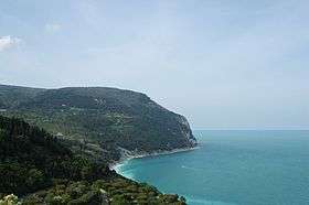 Monte Conero seen from Sirolo | |
| Highest point | |
| Elevation | 572 m (1,877 ft) |
| Coordinates | 43°32′0″N 13°36′0″E / 43.53333°N 13.60000°ECoordinates: 43°32′0″N 13°36′0″E / 43.53333°N 13.60000°E |
| Geography | |
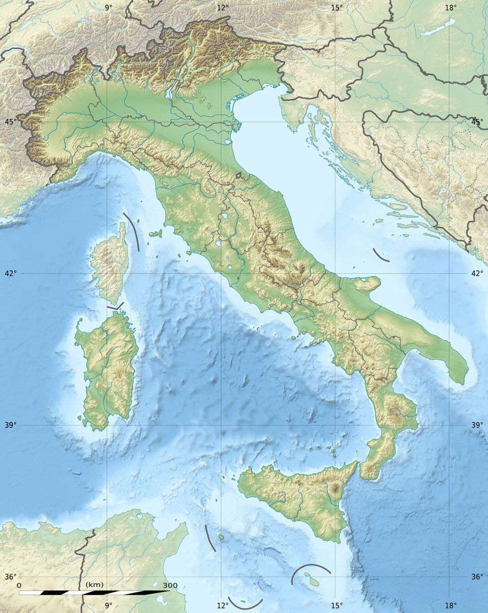 Monte Conero Italy | |
| Location | Marche, Italy |
Monte Conero (Mount Conero), also known as Monte d'Ancona; Italian pronunciation: [ˈkɔːnero], is a promontory in Italy, situated directly south of the port of Ancona on the Adriatic Sea.
The name Conero comes from the Greek name Komaròs and indicates the strawberry tree which is common on the slopes of the mountain. Mount Conero is 572 metres high and it is the only coastal high point on the Adriatic sea between Trieste and the Gargano massif in the region of Apulia.
Since 1987 it has been a state park and a protected ecological area (Regional Park) with 18 trails and several archeological/historical sites. Wildlife include Eurasian badger, beech marten, least weasel, yellow-bellied toad, peregrine falcon, kingfisher and pallid swift. Apart the strawberry tree, vegetation include oak, holm oak, Aleppo pine, Cupressus sempervirens and many others.
Other comuni near the mountain include Sirolo and Numana.
External links
- Parco del Conero website (Italian)