Montague, California
| Montague, California | |
|---|---|
| City | |
| City of Montague | |
 Location in Siskiyou County and the state of California | |
 Montague, California Location in the United States | |
| Coordinates: 41°43′38″N 122°31′35″W / 41.72722°N 122.52639°WCoordinates: 41°43′38″N 122°31′35″W / 41.72722°N 122.52639°W | |
| Country |
|
| State |
|
| County |
|
| Incorporated | January 28, 1909[1] |
| Named for | S. S. Montague |
| Area[2] | |
| • Total | 1.793 sq mi (4.644 km2) |
| • Land | 1.778 sq mi (4.605 km2) |
| • Water | 0.015 sq mi (0.039 km2) 0.85% |
| Elevation[3] | 2,539 ft (774 m) |
| Population (April 1, 2010) | |
| • Total | 1,443 |
| • Density | 800/sq mi (310/km2) |
| Time zone | Pacific Time Zone (UTC-8) |
| • Summer (DST) | PDT (UTC-7) |
| ZIP code | 96064 |
| Area code | 530 |
| FIPS code | 06-48690 |
| GNIS feature IDs | 277557, 2411140 |
| Website |
ci |
Montague is a city in Siskiyou County, California, United States. The population was 1,443 at the 2010 census, down from 1,456 at the 2000 census.
Name
When the Southern Pacific Railroad extension was built from Dunsmuir to the state line in 1886-87, the station was named for S.S. Montague, chief engineer of the Central Pacific Railroad.[4]
Geography
Montague is located at 41°43′38″N 122°31′35″W / 41.72722°N 122.52639°W (41.727168, -122.526468).[5]
According to the United States Census Bureau, the city has a total area of 1.8 square miles (4.6 km²), 99.15% of it land and 0.85% of it water.
Located 6 miles east of Interstate 5 at Yreka along California State Route 3, this is also the site of the interchange between the Yreka Western Railroad and the Central Oregon and Pacific Railroad. General aviation is served at Montague Airport, which also serves Yreka.
Climate
This region experiences warm (but not hot) and dry summers, with no average monthly temperatures above 71.6 °F. According to the Köppen Climate Classification system, Montague has a warm-summer Mediterranean climate, abbreviated "Csb" on climate maps.[6]
Demographics
| Historical population | |||
|---|---|---|---|
| Census | Pop. | %± | |
| 1890 | 250 | — | |
| 1910 | 274 | — | |
| 1920 | 453 | 65.3% | |
| 1930 | 507 | 11.9% | |
| 1940 | 463 | −8.7% | |
| 1950 | 579 | 25.1% | |
| 1960 | 782 | 35.1% | |
| 1970 | 890 | 13.8% | |
| 1980 | 1,285 | 44.4% | |
| 1990 | 1,415 | 10.1% | |
| 2000 | 1,456 | 2.9% | |
| 2010 | 1,443 | −0.9% | |
| Est. 2015 | 1,399 | [7] | −3.0% |
2010
The 2010 United States Census[9] reported that Montague had a population of 1,443. The population density was 804.8 people per square mile (310.7/km²). The racial makeup of Montague was 1,251 (86.7%) White, 4 (0.3%) African American, 67 (4.6%) Native American, 8 (0.6%) Asian, 1 (0.1%) Pacific Islander, 17 (1.2%) from other races, and 95 (6.6%) from two or more races. Hispanic or Latino of any race were 107 persons (7.4%).
The Census reported that 1,425 people (98.8% of the population) lived in households, 18 (1.2%) lived in non-institutionalized group quarters, and 0 (0%) were institutionalized.
There were 576 households, out of which 198 (34.4%) had children under the age of 18 living in them, 255 (44.3%) were opposite-sex married couples living together, 86 (14.9%) had a female householder with no husband present, 31 (5.4%) had a male householder with no wife present. There were 64 (11.1%) unmarried opposite-sex partnerships, and 1 (0.2%) same-sex married couples or partnerships. 159 households (27.6%) were made up of individuals and 49 (8.5%) had someone living alone who was 65 years of age or older. The average household size was 2.47. There were 372 families (64.6% of all households); the average family size was 2.95.
The population was spread out with 368 people (25.5%) under the age of 18, 119 people (8.2%) aged 18 to 24, 382 people (26.5%) aged 25 to 44, 390 people (27.0%) aged 45 to 64, and 184 people (12.8%) who were 65 years of age or older. The median age was 37.9 years. For every 100 females there were 95.3 males. For every 100 females age 18 and over, there were 96.2 males.
There were 633 housing units at an average density of 353.0 per square mile (136.3/km²), of which 371 (64.4%) were owner-occupied, and 205 (35.6%) were occupied by renters. The homeowner vacancy rate was 2.4%; the rental vacancy rate was 10.4%. 886 people (61.4% of the population) lived in owner-occupied housing units and 539 people (37.4%) lived in rental housing units.
2000
As of the census[10] of 2000, there were 1,456 people, 560 households, and 390 families residing in the city. The population density was 815.3 people per square mile (314.1/km²). There were 609 housing units at an average density of 341.0 per square mile (131.4/km²). The racial makeup of the city was 89.01% White, 0.07% African American, 5.08% Native American, 0.14% Asian, 0.07% Pacific Islander, 2.20% from other races, and 3.43% from two or more races. Hispanic or Latino of any race were 5.43% of the population.
There were 560 households out of which 36.3% had children under the age of 18 living with them, 50.4% were married couples living together, 14.5% had a female householder with no husband present, and 30.2% were non-families. 25.4% of all households were made up of individuals and 12.0% had someone living alone who was 65 years of age or older. The average household size was 2.57 and the average family size was 3.07.
In the city the population was spread out with 28.7% under the age of 18, 8.1% from 18 to 24, 27.0% from 25 to 44, 24.0% from 45 to 64, and 12.2% who were 65 years of age or older. The median age was 36 years. For every 100 females there were 97.0 males. For every 100 females age 18 and over, there were 91.5 males.
The median income for a household in the city was $22,991, and the median income for a family was $28,672. Males had a median income of $30,455 versus $22,250 for females. The per capita income for the city was $12,661. About 19.6% of families and 24.2% of the population were below the poverty line, including 34.0% of those under age 18 and 10.8% of those age 65 or over.
Government
In the California State Legislature, Montague is in the 1st Senate District, represented by Republican Ted Gaines,[11] and the 1st Assembly District, represented by Republican Brian Dahle.[12]
In the United States House of Representatives, Montague is in California's 1st congressional district, represented by Republican Doug LaMalfa.[13]
References
- ↑ "California Cities by Incorporation Date" (Word). California Association of Local Agency Formation Commissions. Retrieved August 25, 2014.
- ↑ "2010 Census U.S. Gazetteer Files – Places – California". United States Census Bureau.
- ↑ "Montague". Geographic Names Information System. United States Geological Survey. Retrieved February 9, 2015.
- ↑ Gudde, Erwin G. (1998). California place names : the origin and etymology of current geographical names (4th ed., rev. and enl. ed.). Berkeley: University of California Press. p. 245. ISBN 0520213165.
- ↑ "US Gazetteer files: 2010, 2000, and 1990". United States Census Bureau. 2011-02-12. Retrieved 2011-04-23.
- ↑ Climate Summary for Montague, California
- ↑ "Annual Estimates of the Resident Population for Incorporated Places: April 1, 2010 to July 1, 2015". Retrieved July 2, 2016.
- ↑ "Census of Population and Housing". Census.gov. Retrieved June 4, 2015.
- ↑ "2010 Census Interactive Population Search: CA - Montague city". U.S. Census Bureau. Retrieved July 12, 2014.
- ↑ "American FactFinder". United States Census Bureau. Retrieved 2008-01-31.
- ↑ "Senators". State of California. Retrieved March 10, 2013.
- ↑ "Members Assembly". State of California. Retrieved March 2, 2013.
- ↑ "California's 1st Congressional District - Representatives & District Map". Civic Impulse, LLC. Retrieved March 1, 2013.
External links
Municipalities and communities of Siskiyou County, California, United States | ||
|---|---|---|
| Cities | 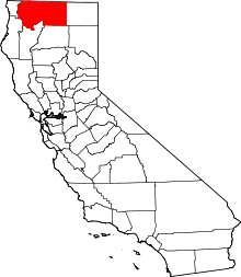 | |
| CDPs | ||
| Unincorporated communities | ||
| Indian reservation | ||
| Ghost towns | ||
| Footnotes | ‡This populated place also has portions in an adjacent county or counties | |