Mont Panié
| Mont Panié | |
|---|---|
 | |
| Highest point | |
| Elevation | 1,628 m (5,341 ft) [1] |
| Prominence | 1,628 m (5,341 ft) [1] |
| Listing | Ultra |
| Coordinates | 20°35′18″S 164°46′15″E / 20.58833°S 164.77083°ECoordinates: 20°35′18″S 164°46′15″E / 20.58833°S 164.77083°E [1] |
| Geography | |
 Mont Panié | |
| Parent range | Chaîne Centrale |
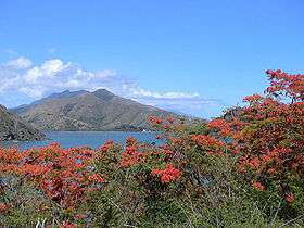
Mont Panié is a mountain on the island of Grande Terre in New Caledonia. At 1,628 metres (5,341 ft), it is the island's highest point. Mont Panié is situated in the Chaîne Centrale mountain range.
New Calendonia is a special collectivity of France located in the southwest Pacific Ocean. The second highest peak on the island, Mount Humboldt, is nearly as tall as Mont Panié, with an elevation of 1,618 metres (5,308 ft).
See also
References
- 1 2 3 "Australia, New Zealand, Oceania Ultra-Prominence Page" Peaklist.org. Retrieved 2012-01-13.
External links
This article is issued from Wikipedia - version of the 5/29/2015. The text is available under the Creative Commons Attribution/Share Alike but additional terms may apply for the media files.