Mont Alto, Pennsylvania
| Mont Alto, Pennsylvania | |
|---|---|
| Borough | |
|
Mont Alto, Pennsylvania | |
 Mont Alto  Mont Alto | |
| Coordinates: 39°50′36″N 77°33′18″W / 39.84333°N 77.55500°WCoordinates: 39°50′36″N 77°33′18″W / 39.84333°N 77.55500°W | |
| Country | United States |
| State | Pennsylvania |
| County | Franklin |
| Settled | 1762 |
| Incorporated | 1915 |
| Government | |
| • Type | Borough Council |
| • Mayor | John Esser |
| Area | |
| • Total | 0.57 sq mi (1.47 km2) |
| • Land | 0.57 sq mi (1.47 km2) |
| • Water | 0.0 sq mi (0.0 km2) |
| Elevation | 886 ft (270 m) |
| Population (2010) | |
| • Total | 1,705 |
| • Density | 3,000/sq mi (1,158.4/km2) |
| Time zone | Eastern (EST) (UTC-5) |
| • Summer (DST) | EDT (UTC-4) |
| ZIP code | 17237 |
| Area code(s) | 717 |
| Website |
www |

Mont Alto is a borough in Franklin County, Pennsylvania, United States. The population was 1,705 at the 2010 census,[1] up from 1,357 at the 2000 census.
History
John Funk built the first house in the borough (then unestablished) in 1817 on what is now Main Street. At this time the town was known as "Funkstown". Eventually the town of Altodale and the surrounding area, called Mont Alto, combined into what is now known as Mont Alto.[2]
In 1915 the town of Mont Alto was incorporated with a population of 800.
In the beginning of the 20th century, Mont Alto contained one of the largest sanatoriums in the area for treatment of tuberculosis.[3]
Geography
Mont Alto is located in southeastern Franklin County at 39°50′36″N 77°33′18″W / 39.84333°N 77.55500°W (39.843234, -77.555023).[4] It sits at the western base of South Mountain along the headwaters of the West Branch of Antietam Creek. Mont Alto State Park is located in the creek valley 1 mile (1.6 km) east of the borough.
Pennsylvania Route 997 passes through the center of town as Main Street; it leads north 5 miles (8 km) to U.S. Route 30 near Fayetteville and south 7 miles (11 km) to Waynesboro. Pennsylvania Route 233 runs east out of the borough as Park Street, leading northeast 9 miles (14 km) to US 30 at Caledonia State Park.
According to the United States Census Bureau, the borough has a total area of 0.57 square miles (1.47 km2), all of it land.[1]
Demographics
| Historical population | |||
|---|---|---|---|
| Census | Pop. | %± | |
| 1890 | 658 | — | |
| 1920 | 589 | — | |
| 1930 | 606 | 2.9% | |
| 1940 | 661 | 9.1% | |
| 1950 | 984 | 48.9% | |
| 1960 | 1,039 | 5.6% | |
| 1970 | 1,532 | 47.4% | |
| 1980 | 1,592 | 3.9% | |
| 1990 | 1,395 | −12.4% | |
| 2000 | 1,357 | −2.7% | |
| 2010 | 1,705 | 25.6% | |
| Est. 2015 | 1,733 | [5] | 1.6% |
| Sources:[6][7][8] | |||
As of the census[7] of 2000, there were 1,357 people, 541 households, and 413 families residing in the borough. The population density was 2,339.5 people per square mile (903.3/km²). There were 576 housing units at an average density of 993.1 per square mile (383.4/km²). The racial makeup of the borough was 97.72% White, 0.96% African American, 0.15% Native American, 0.81% Asian, 0.07% from other races, and 0.29% from two or more races. Hispanic or Latino of any race were 0.22% of the population.
There were 541 households, out of which 33.6% had children under the age of 18 living with them, 63.4% were married couples living together, 10.4% had a female householder with no husband present, and 23.5% were non-families. 20.1% of all households were made up of individuals, and 8.9% had someone living alone who was 65 years of age or older. The average household size was 2.51 and the average family size was 2.87.
In the borough the population was spread out, with 24.2% under the age of 18, 6.7% from 18 to 24, 33.8% from 25 to 44, 22.4% from 45 to 64, and 12.9% who were 65 years of age or older. The median age was 36 years. For every 100 females there were 95.8 males. For every 100 females age 18 and over, there were 91.1 males.
The median income for a household in the borough was $37,163, and the median income for a family was $41,705. Males had a median income of $32,169 versus $21,579 for females. The per capita income for the borough was $17,216. About 4.0% of families and 4.7% of the population were below the poverty line, including 5.9% of those under age 18 and 6.1% of those age 65 or over.
Colleges and universities
Penn State Mont Alto is located at the eastern end of the borough.
Points of interest
- Mont Alto Arboretum, on the campus of Penn State Mont Alto
- Mont Alto State Park
- Mont Alto Railroad
References
- 1 2 "Geographic Identifiers: 2010 Census Summary File 1 (G001), Mont Alto borough, Pennsylvania". American FactFinder. U.S. Census Bureau. Retrieved July 29, 2016.
- ↑ "Borough of Mont Alto - History". 2008-04-09.
- ↑ "Has Immunization From Consumption been found?" (PDF). New York Times. 1910-07-24. Retrieved 2010-02-09.
- ↑ "US Gazetteer files: 2010, 2000, and 1990". United States Census Bureau. 2011-02-12. Retrieved 2011-04-23.
- ↑ "Annual Estimates of the Resident Population for Incorporated Places: April 1, 2010 to July 1, 2015". Retrieved July 2, 2016.
- ↑ "Census of Population and Housing". U.S. Census Bureau. Retrieved 11 December 2013.
- 1 2 "American FactFinder". United States Census Bureau. Retrieved 2008-01-31.
- ↑ "Incorporated Places and Minor Civil Divisions Datasets: Subcounty Resident Population Estimates: April 1, 2010 to July 1, 2012". Population Estimates. U.S. Census Bureau. Retrieved 11 December 2013.
External links
Municipalities and communities of Franklin County, Pennsylvania, United States | ||
|---|---|---|
| Boroughs | 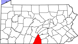 | |
| Townships | ||
| CDPs | ||
| Unincorporated communities | ||
| Footnotes | ‡This populated place also has portions in an adjacent county or counties | |