Monroe County, Mississippi
| Monroe County, Mississippi | |
|---|---|
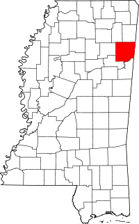 Location in the U.S. state of Mississippi | |
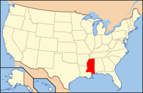 Mississippi's location in the U.S. | |
| Founded | 1821 |
| Named for | James Monroe |
| Seat | Aberdeen |
| Largest city | Amory |
| Area | |
| • Total | 772 sq mi (1,999 km2) |
| • Land | 765 sq mi (1,981 km2) |
| • Water | 7.0 sq mi (18 km2), 0.9% |
| Population | |
| • (2010) | 36,989 |
| • Density | 48/sq mi (19/km²) |
| Congressional district | 1st |
| Time zone | Central: UTC-6/-5 |
| Website |
www |
Monroe County is a county on the northeast border of the U.S. state of Mississippi next to Alabama. As of the 2010 census, the population was 36,989.[1] Its county seat is Aberdeen.[2]
History
The county is named in honor of James Monroe, fifth President of the United States.[3] Part of the county east of the Tomigbee River originally made-up part of the Alabama Territory, belonging to Marion County, until new lines of demarcation put it in the State of Mississippi in 1821.[4]
Geography
According to the U.S. Census Bureau, the county has a total area of 772 square miles (2,000 km2), of which 765 square miles (1,980 km2) is land and 7.0 square miles (18 km2) (0.9%) is water.[5]
Major highways
 U.S. Highway 45
 U.S. Highway 278
 Mississippi Highway 6
 Mississippi Highway 8
 Mississippi Highway 25
 Mississippi Highway 145
Adjacent counties
- Lowndes County (south)
- Clay County (southwest)
- Chickasaw County (west)
- Lee County (northwest)
- Itawamba County (north)
- Lamar County, Alabama (east)
Demographics
| Historical population | |||
|---|---|---|---|
| Census | Pop. | %± | |
| 1820 | 2,721 | — | |
| 1830 | 3,861 | 41.9% | |
| 1840 | 9,250 | 139.6% | |
| 1850 | 21,172 | 128.9% | |
| 1860 | 21,283 | 0.5% | |
| 1870 | 22,631 | 6.3% | |
| 1880 | 28,553 | 26.2% | |
| 1890 | 30,730 | 7.6% | |
| 1900 | 31,216 | 1.6% | |
| 1910 | 35,178 | 12.7% | |
| 1920 | 32,613 | −7.3% | |
| 1930 | 36,141 | 10.8% | |
| 1940 | 37,648 | 4.2% | |
| 1950 | 36,543 | −2.9% | |
| 1960 | 33,953 | −7.1% | |
| 1970 | 34,043 | 0.3% | |
| 1980 | 36,404 | 6.9% | |
| 1990 | 36,582 | 0.5% | |
| 2000 | 38,014 | 3.9% | |
| 2010 | 36,989 | −2.7% | |
| Est. 2015 | 35,827 | [6] | −3.1% |
| U.S. Decennial Census[7] 1790-1960[8] 1900-1990[9] 1990-2000[10] 2010-2013[1] | |||
As of the census[11] of 2000, there were 38,014 people, 14,603 households, and 10,660 families residing in the county. The population density was 50 people per square mile (19/km²). There were 16,236 housing units at an average density of 21 per square mile (8/km²). The racial makeup of the county was 68.37% White, 30.77% Black or African American, 0.10% Native American, 0.17% Asian, 0.01% Pacific Islander, 0.11% from other races, and 0.47% from two or more races. 0.69% of the population were Hispanic or Latino of any race.
There were 14,603 households out of which 34.70% had children under the age of 18 living with them, 52.00% were married couples living together, 17.20% had a female householder with no husband present, and 27.00% were non-families. 24.70% of all households were made up of individuals and 11.80% had someone living alone who was 65 years of age or older. The average household size was 2.57 and the average family size was 3.07.
In the county the population was spread out with 27.20% under the age of 18, 8.70% from 18 to 24, 27.60% from 25 to 44, 22.50% from 45 to 64, and 14.00% who were 65 years of age or older. The median age was 36 years. For every 100 females there were 89.70 males. For every 100 females age 18 and over, there were 84.70 males.
The median income for a household in the county was $30,307, and the median income for a family was $36,749. Males had a median income of $30,232 versus $20,411 for females. The per capita income for the county was $14,072. About 13.60% of families and 17.20% of the population were below the poverty line, including 22.30% of those under age 18 and 21.70% of those age 65 or over.
Communities
Cities
Towns
- Hatley
- Nettleton (partly in Lee County)
- Smithville
- Caledonia (mostly in Lowndes County)
Village
Unincorporated communities
Ghost towns
See also
References
- 1 2 "State & County QuickFacts". United States Census Bureau. Retrieved September 4, 2013.
- ↑ "Find a County". National Association of Counties. Retrieved 2011-06-07.
- ↑ Gannett, Henry (1905). The Origin of Certain Place Names in the United States. U.S. Government Printing Office. p. 212.
- ↑ John M. Allman III (ed.), "An Abbreviated History of Marion County, Ala.", The Marion County Historical & Genealogical Societies, Alabama Tracks vol. XI #4 1992. See online at:
- ↑ "2010 Census Gazetteer Files". United States Census Bureau. August 22, 2012. Retrieved November 6, 2014.
- ↑ "County Totals Dataset: Population, Population Change and Estimated Components of Population Change: April 1, 2010 to July 1, 2015". Retrieved July 2, 2016.
- ↑ "U.S. Decennial Census". United States Census Bureau. Retrieved November 6, 2014.
- ↑ "Historical Census Browser". University of Virginia Library. Retrieved November 6, 2014.
- ↑ "Population of Counties by Decennial Census: 1900 to 1990". United States Census Bureau. Retrieved November 6, 2014.
- ↑ "Census 2000 PHC-T-4. Ranking Tables for Counties: 1990 and 2000" (PDF). United States Census Bureau. Retrieved November 6, 2014.
- ↑ "American FactFinder". United States Census Bureau. Retrieved 2008-01-31.
 |
Lee County | Itawamba County | | |
| Chickasaw County | |
Lamar County, Alabama | ||
| ||||
| | ||||
| Clay County | Lowndes County |
Municipalities and communities of Monroe County, Mississippi, United States | ||
|---|---|---|
| Cities | | |
| Towns | ||
| Village | ||
| CDPs | ||
| Other unincorporated communities | ||
| Ghost towns | ||
| Footnotes | ‡This town also has portions in adjacent county or counties | |
.svg.png)
Coordinates: 33°53′N 88°29′W / 33.89°N 88.49°W