Monon Township, White County, Indiana
| Monon Township | |
|---|---|
| Township | |
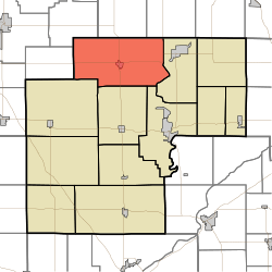 Location in White County | |
| Coordinates: 40°52′16″N 86°52′46″W / 40.87111°N 86.87944°WCoordinates: 40°52′16″N 86°52′46″W / 40.87111°N 86.87944°W | |
| Country | United States |
| State | Indiana |
| County | White |
| Government | |
| • Type | Indiana township |
| Area | |
| • Total | 63.94 sq mi (165.6 km2) |
| • Land | 63.42 sq mi (164.3 km2) |
| • Water | 0.51 sq mi (1.3 km2) 0.80% |
| Elevation | 679 ft (207 m) |
| Population (2010) | |
| • Total | 3,282 |
| • Density | 51.7/sq mi (20.0/km2) |
| ZIP codes | 46996, 47946, 47959, 47960, 47978 |
| GNIS feature ID | 453632 |
Monon Township is one of twelve townships in White County, Indiana, United States. As of the 2010 census, its population was 3,282 and it contained 2,032 housing units.[1]
Monon Township was established in 1836, and named after Big Monon Creek.[2]
Geography
According to the 2010 census, the township has a total area of 63.94 square miles (165.6 km2), of which 63.42 square miles (164.3 km2) (or 99.19%) is land and 0.51 square miles (1.3 km2) (or 0.80%) is water.[1]
Cities, towns, villages
Unincorporated towns
(This list is based on USGS data and may include former settlements.)
Adjacent townships
- Salem Township, Pulaski County (north)
- Beaver Township, Pulaski County (northeast)
- Liberty Township (east)
- Union Township (southeast)
- Honey Creek Township (south)
- Princeton Township (southwest)
- Milroy Township, Jasper County (west)
- Hanging Grove Township, Jasper County (northwest)
Cemeteries
The township contains these three cemeteries: Bedford, Monon and Wilson.
Airports and landing strips
- Garwood Memorial Airport
Landmarks
- Bedford Cemetery
- Monon Park
School districts
- North White School Corporation
Political districts
- Indiana's 4th congressional district
- State House District 25
- State Senate District 07
References
- United States Census Bureau 2007 TIGER/Line Shapefiles
- United States Board on Geographic Names (GNIS)
- IndianaMap
- 1 2 "Population, Housing Units, Area, and Density: 2010 - County -- County Subdivision and Place -- 2010 Census Summary File 1". United States Census. Retrieved 2013-05-10.
- ↑ Counties of White and Pulaski, Indiana: Historical and Biographical. F.A. Battey & Company. 1883. p. 163.
External links
Municipalities and communities of White County, Indiana, United States | ||
|---|---|---|
| City | ||
| Towns | ||
| Townships | ||
| CDPs | ||
| Other unincorporated communities | ||
This article is issued from Wikipedia - version of the 10/16/2016. The text is available under the Creative Commons Attribution/Share Alike but additional terms may apply for the media files.