Mong Pan
| Mong Pan | |
|---|---|
| Town | |
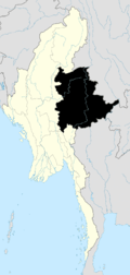
 Mong Pan Location in Burma | |
| Coordinates: 20°19′10″N 98°21′45″E / 20.31944°N 98.36250°ECoordinates: 20°19′10″N 98°21′45″E / 20.31944°N 98.36250°E | |
| Country |
|
| State | Shan State |
| Township | Mong Pan Township |
| Elevation | 815 m (2,674 ft) |
| Time zone | MST (UTC+6.30) |
Mong Pan, Mongpan[1] or Möngpan is a town and seat of Mong Pan Township in the southern Shan State of Burma. To the south it borders Mae Hong Son Province in Thailand and lies west of the Salween River. It lies along National Road 45.
History
This town was formerly the residence of the Sawbwa of Mongpan State. The four districts of Möng Tang, Möng Hang, Möng Kyawt and Möng Hta, located to the south on the east bank of the Salween belonged to the Cis-Salween Sawbwa of Möngpan. In 1888 there was trouble owing to the action of Siam, who attempted to take possession of them. Siamese troops were posted in the four districts. Siam also claimed a further district, Möng Hsat, but posted no troops there.[2]
References
- ↑
 This article incorporates text from a publication now in the public domain: Chisholm, Hugh, ed. (1911). "article name needed". Encyclopædia Britannica (11th ed.). Cambridge University Press.
 - ↑ The Pacification of Burma, by Sir Charles Haukes Todd Crosthwaite

This article is issued from Wikipedia - version of the 5/26/2016. The text is available under the Creative Commons Attribution/Share Alike but additional terms may apply for the media files.