Monaro Highway
| Monaro Highway Victoria–Australian Capital Territory | |
|---|---|
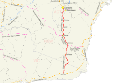 | |
| Map of the far southeast of Australia, with the Monaro Highway highlighted in red. | |
| General information | |
| Type | Highway |
| Length | 285.1 km (177 mi)[1] |
| Gazetted | 25 March 1938[2] |
| Route number(s) | |
| Tourist routes |
|
| Major junctions | |
| South end | |
| |
| North end | |
| Location(s) | |
| Major settlements | Cann River, Bombala, Nimmitabel, Cooma, Tuggeranong, South Canberra |
| Highway system | |
|
Highways in Australia National Highway • Freeways in Australia Highways in Victoria Highways in New South Wales Road infrastructure in Canberra | |
| |
The Monaro Highway is a highway that is located in Victoria, New South Wales and the Australian Capital Territory, in Australia.
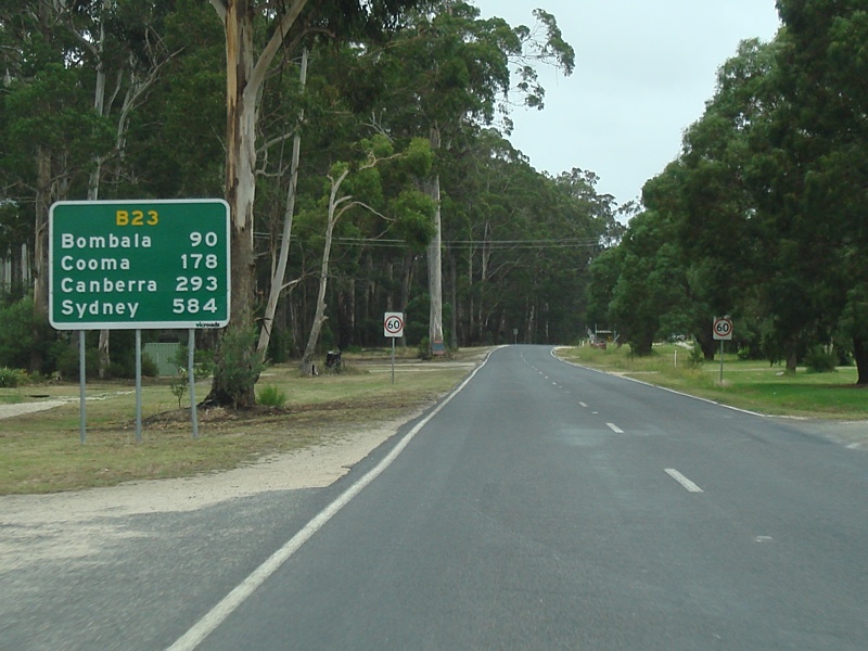
The 285-kilometre-long (177 mi) roadway links Cann River in Victoria to Canberra in the Australian Capital Territory (ACT) via the Monaro region. From its southern terminus, it follows the nearby Cann River upstream towards the New South Wales border through heavily forested terrain. Within New South Wales (NSW), it makes its way through further forest before reaching the pastures typical of the Monaro. There are multiple towns and villages along the highway, including Bombala, Nimmitabel, and Cooma. The terrain within the Monaro is largely hilly, and there are numerous crossings. The road also parallels the former Bombala railway line in several locations. Within the ACT, the road becomes a high volume roadway and serves the southern suburbs of Canberra.
Originally known as Cann Valley Road, the Victorian section was designated as a highway in 1960, and received the name Cann Valley Highway. The Monaro Highway name was applied to the road within Victoria in 1996. Within NSW, the highway was created in 1938 and designated as State Highway 19 within the Department of Main Roads. In 1958, It was named the Monaro Highway in both NSW and the ACT, though the same name had been in use by the Snowy Mountains Highway until 1955. The Monaro Highway has more recently had a grade-separated dual carriageway extension constructed within Canberra, as part of the Eastern Parkway construction project.
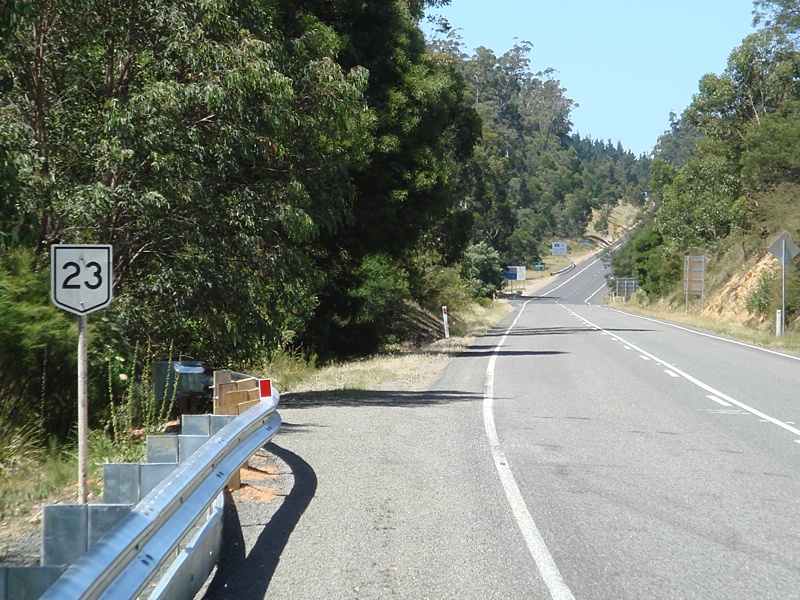
The Monaro Highway initially bore the National Route 23 route markers along its entire length, excluding the Eastern Parkway extension, which was instead part of Alternate National Route 23. Now that each jurisdiction has converted to alphanumeric markers, it instead carries the B23 route marker along almost its entire length, breaking the NSW convention of all 'B' routes having numbers above 50.
The extension currently does not have a route marker. There is a duplex along the highway where it additionally carries the B72 route marker between the two sections of the Snowy Mountains Highway. Within the ACT, a section of the road is also part of Tourist Drive 5.
Route description
Victoria

The Monaro Highway begins at the Princes Highway in Cann River in the East Gippsland region. After leaving the town, it heads north along a relatively flat area following the Cann River upstream through a locality known as Noorinbee. To the west is farmland between the road and river and a mountain range beyond and to the east are some smaller hills. The land to the east is largely part of Drummer State Forest. As the sides close in at the northern end of this wider valley area, the highway crosses to the west bank of the river highway and enters the Noorinbee North locality. Continuing north, the terrain is more hilly and forested and the alignment more closely parallels the winding river upstream to the area of Weeragua. At this point, the land to the west of the river is part of Buldah State Forest, and to the east is Coopracambra National Park. The road has now entered the Chandlers Creek locality and at Weeragua, the road crosses the west branch of the Cann River and continues further north along the east branch through a small farmland area. From here, it follows the river through more forest before coming to another small farmland area and crossing Chandlers Creek itself. The road once again enters forest as it follows the Cann River east branch to its upper end at the confluence of Fiddlers Green Creek and Flat Rock Creek, the latter of which the road follows through Coopracambra National Park to the New South Wales border.[1][3][4]
New South Wales

From the state border, the road continues north through forest, generally keeping Bondi State Forest to the west and South East Forest National Park to the east. The immediate landscape by the roadside also includes the occasional small tract of farmland at several points. There is a crossing over the Genoa River within the forest, and the road roughly follows it upstream. Upon exiting the large forested area that exists near the border, the road enters farmland. This farmland continues as a patchwork of pastures for the rest of the journey within New South Wales and is only interrupted by the occasional town. The road continues roughly northwest until it meets Delegate Road at a T-intersection just outside Bombala. Turning towards the northeast at the intersection, the road quickly reaches Bombala. Within the urban area, the road firstly takes on the name Maybe Street. It then turns northeast at Forbes Street and crosses over the Bombala River. After the bridge, the road returns to a northeast heading as Mahratta Street. This street continues for a short distance before a right angle bend to the northwest to match the same manoeuvre by the river. The road then becomes Stephen Street before returning to the Monaro Highway name at the edge of the urban area and concluding its zig-zag trajectory through Bombala.[1][6]
The road then travels in a north-easterly direction, crossing the Bombala River again and making its way towards Bibbenluke. The road bypasses the village just to its west and makes a further crossing of the Bombala River. Continuing north, the road winds its way towards a ridge near Native Dog Creek. After crossing the creek, the road climbs the ridge and continues northbound. At this point, the former Bombala railway line alignment winds along the western side and is visible in some locations. Eventually the road swings east and meets the western end of the eastern section of the Snowy Mountains Highway at another T-intersection. The Monaro Highway turns towards the northwest at this intersection and, after a short distance, crosses the Maclaughlin River. A little further along this heading, the road enters Nimmitabel. The highway takes on the name Bombala Street within the urban area and swings to the northeast through the small town. From here, the road continues northwest once again with the railway alignment never far to the west and sometimes paralleling the road. The road crosses several small creeks along this stretch of road. Before reaching Cooma, the road also passes to the west of Kuma Nature Reserve and crosses over the former Bombala railway line. Within the town of Cooma, the road initially takes up the name Bombala Street. Where this street meets Sharp Street at a 4-way roundabout, the highway turns east, while the western section of the Snowy Mountains Highway begins from the same point and heads west. Continuing east as Sharp Street, the road soon curves north and transitions back to the Monaro Highway. It then parallels the railway within the urban area and also passes by the Tadeusz Kościuszko Monument as it leaves the town.[1][6][8]

North of Cooma, the highway follows the same general path as the railway alignment as far as the area of Bunyan. From there, it continues along the same rough heading and crosses the Numeralla River just prior to its confluence with the Murrumbidgee River. The road then follows the Murrumbidgee downstream at some distance to its east. The highway continues on towards Bredbo and crosses the Bredbo River as it enters the village. The highway takes on the name Cooma Street through Bredbo and crosses over the railway yet again just north of the town. Further to the north, the road passes through Gungoandra Gap to the east of Round Hill. Mount Colinton is now visible to the highway's east, and a larger range known as the Clear Range is visible to west. The ridgeline of the Clear Range forms the eastern border of the ACT in this area. Heading further downstream, continuing the distant parallel of the Murrumbidgee, the road enters Michelago and crosses the railway a final few times as the railway winds through the area. It does not enter the urban area of Michelago itself and instead passes to the west of the village. North of Michelago the road and railway parallel each other very closely as they head towards the ACT border at the north end of the Clear Range. The road crosses the border just east of Cunningham Hill.[1][6]
Australian Capital Territory

From the territory border, the road passes into the rural southern reaches of the Tuggeranong District. In this area of the ACT, the railway line forms the eastern border of the territory, with the railway line itself situated on the NSW side. To the western side of the road flows Guises Creek, with a range of hills beyond it, Rose Hill and Mount Rob Roy being two of the more prominent peaks. As the road reaches the Tuggeranong urban area, it begins to parallel the urban area instead and forms part of the border of Tuggeranong's eastern suburbs. Approaching the Tharwa Drive intersection, the road becomes a dual carriageway. The road climbs onto a small ridge with views of the urban area to the west and the Tuggeranong Pine Plantation to the east. The road then descends towards the Jerrabomberra district border where it meets Isabella Drive, and then passes through the light industrial suburb of Hume, although the land to the west of the road is largely undeveloped. Within Hume, the road meets Lanyon Drive, which heads across the nearby border towards Jerrabomberra and Queanbeyan. The road then continues roughly north and crosses a largely open area of pasture. The SouthCare emergency helicopter is stationed to the east of the road not far after its intersection with Lanyon Drive, and further on, a prison is located to the west. Approaching the northern end of the pasture, Jerrabomberra Creek flows to the east. At the northern end is the Hindmarsh Drive interchange. The highway passes underneath Hindmarsh Drive and continues over Jerrabomberra Creek. A further interchange, passing over Canberra Avenue is a little further on, along with an overpass above the Canberra railway line branch, and an interchange above Newcastle Street. The road then doglegs across a wide flat and terminates at Morshead Drive, just across the Molonglo River.[1][6][10] In 2010 the average annual daily traffic count was approximately 43,000 vehicles per day, at this final section just prior to the northern terminus.[11]
History
Early roads
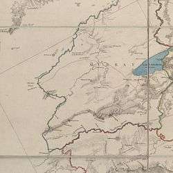
(Note: Top of image is roughly northwest)
A minor road appears in this region on Thomas Mitchell's 1834 map of the Nineteen Counties of New South Wales. Located within Murray county, the road continues from Bungendore towards the south before turning west crossing the Queanbeyan River near its confluence with the Molonglo River (The current location of Queanbeyan), and then heads south towards what was then known as the "Miccaligo Plains" (now Michelago). The road is then marked as continuing south beyond the border of the county; although no settlement could legally occur beyond the Nineteen Counties at that time, those who settled beyond this area were known as squatters. The detail of the road beyond Murray county is not plotted on the map. By 1844 the road had reached Cooma, and was extended to Bombala by 1852. Mapping from 1882 shows the road had extended all the way to the Victorian border, crossing near Delegate.[2][12]
Highway
Victoria
The Cann Valley Highway was designated a state highway on 10 August 1960, and was formerly known as Cann Valley Road.[13][14] The roadway was sealed along its entire length to the border in March 1985 as part of the Bicentennial Road Development Programme.[15] It was again renamed as the Monaro Highway on 25 October 1996 to match the highway to which it connects at the NSW border.[16] Within Victoria, VicRoads has classified the Monaro Highway as an arterial road, with the road number 6760.[17]
New South Wales

The roads of New South Wales were re-classified by the Main Roads Board (MRB) in their 1928 annual report. The following year, the MRB's hierarchical system which supported this listing was proclaimed with the passing of the Main Roads (Amendment) Act, April 1929.[18] The roads forming the future highway were given the following classifications:[2]
- Trunk Road 53 between the Victorian border and Nimmitabel (via Delegate).
- State Highway 4 between Nimmitabel and Cooma.
- Trunk Road 52 between Cooma and the ACT.
The Monaro Highway name was actually applied to State Highway 4 at that time, which ran from Tathra to Wagga Wagga.[19] It was decided to expand the main roads network over the following years, and in 1938 the Trunk Road sections of the future highway were reclassified as State Highway 19 by the Department of Main Roads (DMR) (which had succeeded the MRB in 1932[18]). State Highway 19 at this time connected to the Bonang Highway at the Victoria Border.[2] In 1955 it was decided to rename State Highway 4, and it was renamed as the Snowy Mountains Highway. As part of these changes the section of the State Highway 4 between Nimmitabel and Cooma was also redesignated to be part of State Highway 19. Three years later in 1958, the various roads classified as State Highway 19, were then named the Monaro Highway. In contrast with the Snowy Mountains Highway, the entire length of State Highway 19 was within the Monaro region.[2][20] During the mid to late 1960s the highway south of Nimmitabel was rerouted along a newly constructed roadway.[21][22][23] The former alignment is now known as Old Bombala Road.[2][6] The Snowy Mountains Highway was also realigned in this area as part of these works and connected to the Monaro Highway along the new alignment.[24] In November 1976, the alignment was changed so as not to pass through Delegate any longer. The highway now connected to what was then the Cann Valley Highway in Victoria. The former alignment was classified as Main Road 93 and is now known as Delegate Road for most of its length.[6][25] The State Highway terminology is no longer used, and as such the Monaro Highway is currently classified as Highway 19 (or HW19) by Roads and Maritime Services.[25]
Australian Capital Territory
In 1958 Federal government agreed to apply the Monaro Highway name to Cooma-Canberra road within the ACT. This gave the roadway a single name between Canberra and the Victorian border.[2][26] Originally, the highway ended where it met Jerrabomberra Avenue.[27][28] Plans were publicised during the mid-1980s for an upgrade of the existing Monaro Highway to dual-carriageway standard between Isabella Drive and Jerrabomberra Avenue, and an extension of the roadway to the north. These works were known as the Eastern Parkway.[29][30] These plans were then given the go ahead in a report tabled on 5 May 1987, the estimated costs were $50 million including upgrades to other nearby roadways.[31] Around the same time period a large service centre was proposed for near the Isabella Drive intersection, though it was quite controversial, and the developer pulled out.[32][33][34] Between 1988 and November 1989 the duplication was completed, and the roadway extended as far as Canberra Avenue.[35][36][37] After this the road was extended to its current terminus at Morshead Drive, although the northbound carriageway was originally routed over Dairy Flat Road until a southbound carriageway was constructed later on.[38] Further duplication was performed to other sections of the extension until all sections were completed in mid-2012.[39] The northern end of the Monaro Highway will connect to the southern end of the Majura Parkway following its expected completion in 2016.[40][41] Territory and Municipal Services has classified the Monaro Highway as an arterial road within the ACT Road Hierarchy.[42]
Route markers

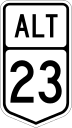


Route markers were first introduced in Australia in late 1954. Over the following decades they were progressively rolled out to the various highways around the nation, under a nationwide route numbering scheme.[43] The highway originally carried the National Route 23 route marker.[1][44] Although after the construction of the Eastern Parkway extension, the highway north of Canberra Avenue was signed with the Alternate National Route 23 route marker.[42] The section of the Monaro Highway between Steeple Flat and Cooma was also signed the National Route 18 shield in addition to the National Route 23 route marker used along the remainder of its length; this arrangement is known as a duplex or concurrency. This allowed one route to cover the Snowy Mountains Highway from end to end, as the Monaro Highway forms a link between that highway's two sections.[1][45]
After Victoria converted to alphanumeric route markers the Victorian section was signed as B23.[1][46] In 2013 the NSW and ACT conversion to alphanumeric routes occurred and the remainder of the highway (south of Hindmarsh Drive in the ACT) was then also signed as B23. This violates the convention in New South Wales, where numbered routes below 50 are prefixed with an 'A' and 'B' routes are numbered above 50; the violation was allowed so the number and letter would be consistent across state lines.
The route duplex along the Monaro Highway remains intact with B72 used in addition to B23 between Steeple Flat and Cooma, to link the two sections of the Snowy Mountains Highway. North of Hindmarsh Drive, the highway no longer carries a route marker.[47]
Junctions
| State/Territory | LGA/District | Location[3][6][10] | km[1] | mi | Destinations[1][3][6][10] | Notes[1] |
|---|---|---|---|---|---|---|
| Victoria | Shire of East Gippsland | Cann River | 0.0 | 0.0 | Monaro Highway terminus South end of B23 | |
| New South Wales | Snowy Monaro Regional Council | Bombala | 83.7 | 52.0 | Delegate Road (MR93) west – Delegate | T-intersection: northbound traffic turns east, southbound traffic turns south |
| 86.0 | 53.4 | Maybe Street (MR91) northeast – Cathcart (via Cathcart Road) Forbes Street southeast – Forbes | Four-way intersection: northbound traffic turns northwest, southbound traffic turns southwest | |||
| 86.3 | 53.6 | Mahratta Street southwest | T-intersection: northbound traffic turns northeast, southbound traffic turns southeast | |||
| Bibbenluke | 98.6 | 61.3 | Black Lake Road (MR563) east – Bibbenluke, Cathcart, Pambula | |||
| Ando | 106.3 | 66.1 | The Snowy River Way (MR394) west – Dalgety, Berridale, Jindabyne | |||
| Snowy Monaro Regional Council | Steeple Flat | 125.0 | 77.7 | Old Bombala Road west | Former Monaro Highway alignment | |
| 127.2 | 79.0 | T-intersection: northbound traffic turns west, southbound traffic turns east South end of B23/B72 duplex | ||||
| Nimmitabel | 135.2 | 84.0 | Old Bombala Road west | Former Monaro Highway alignment | ||
| 137.1 | 85.2 | Clarke Street east – Kybeyan (via Old Bega Road) | Former Snowy Mountains Highway alignment | |||
| Cooma | 172.3 | 107.1 | Polo Flat Road (RR7624) northeast | |||
| 173.5 | 107.8 | Bombala Street north | Four-way roundabout: northbound traffic turns east, southbound traffic turns west North end of B23/B72 duplex | |||
| 174.7 | 108.6 | Yareen Road (RR7625) east – Numeralla | ||||
| 177.3 | 110.2 | Polo Flat Road (RR7624) south – Polo Flat | ||||
| Australian Capital Territory | Tuggeranong | Theodore–Calwell–Richardson triple point | 268.1 | 166.6 | Tharwa Drive southwest – Tharwa Johnson Drive west – Tuggeranong Town Centre, Calwell | Roundabout with bypass lanes: northbound traffic passes through roundabout, southbound traffic may enter. Connections provided by secondary roundabout. |
| Gilmore | 273.4 | 169.9 | Isabella Drive west – Tuggeranong | Roundabout with bypass lanes: northbound traffic passes through roundabout, southbound traffic may enter | ||
| Jerrabomberra | Hume | 273.4 | 169.9 | Mugga Lane northwest | ||
| 275.5 | 171.2 | Lanyon Drive northeast – Hume, Jerrabomberra, Queanbeyan, Googong, Goulburn, and Sydney (Alternate Route) | ||||
| Jerrabomberra–Canberra Central boundary | Symonston–Narrabundah boundary | 280.4 | 174.2 | Diamond interchange North end of B23, continues on Hindmarsh Drive | ||
| Symonston–Narrabundah–Fyshwick triple point | 281.6 | 175.0 | Half diamond interchange: no onramp for northbound traffic, no offramp for southbound traffic | |||
| Canberra Central | Fyshwick | 282.6 | 175.6 | Newcastle Street east – Fyshwick Dairy Road west | Diamond interchange | |
| Canberra Central–Majura boundary | Fyshwick–Campbell–Pialligo triple point | 285.1 | 177.2 | Morshead Drive north/west – North Canberra, Gungahlin, Sydney (north), and City, Yass (west) | Y-junction: road splits into separate bidirectional carriageways to two terminii. Distance measured to eastern terminus. Total distance to western terminus: 285.0 kilometres (177.1 mi) | |
Listing includes: Terminii, declared roads, former alignments, grade separated interchanges, and intersections where a turn is required to remain on the highway. | ||||||
See also
- Highways in Australia
- Highways in New South Wales
- Highways in Victoria
- Road infrastructure in Canberra
References
- 1 2 3 4 5 6 7 8 9 10 11 12 Google (11 Aug 2013). "Monaro Highway" (Map). Google Maps. Google. Retrieved 11 Aug 2013.
- 1 2 3 4 5 6 7 "Monaro Highway" (PDF). Main Roads. NSW Department of Main Roads. December 1959. pp. 44–49. Retrieved 25 July 2013.
- 1 2 3 "Interactive Map". Land Channel. Department of Environment and Primary Industries. Retrieved 11 August 2013.
- ↑ "Forest Explorer Online". Department of Environment and Primary Industries. Retrieved 14 August 2013.
- ↑ "Google Maps". Google Street View. Google. March 2008. Retrieved 11 August 2013.
- 1 2 3 4 5 6 7 8 SIX Maps (Map). Cartography by NSW Department of Finance and Services, Sinclair Knight Merz, and Astrium GEO-Information Services. NSW Government - Land and Property Information. Retrieved 29 June 2013.
- ↑ "Google Maps". Google Street View. Google. March 2008. Retrieved 11 August 2013.
- ↑ "Tadeusz Kosciuszko Monument - Cooma Attraction". VisitNSW. Destination NSW - NSW Government. Retrieved 11 August 2013.
- ↑ "Google Maps". Google Street View. Google. February 2010. Retrieved 11 August 2013.
- 1 2 3 ACTMAPi (Map). Cartography by Environment and Sustainable Development Directorate. ACT Government. Retrieved 29 June 2013.
- ↑ "Attachment C - Development Options Assessment" (PDF). East Lake Electrical Infrastructure - Final EIS. Purdon Associates Pty Ltd, AECOM Australia Pty Ltd, ACTEW Corporation. June 2010. p. 211. Retrieved 28 October 2013.
- ↑ Map of the Colony of New South Wales (Map). Cartography by T.L. Mitchell. T.L. Mitchell. 1834. Retrieved 6 August 2013.
- ↑ A. Mahlstedt (10 August 1960). "Roads Corporation - Declaration of the Cann Valley Highway in the Shire of Orbost" (PDF). Victoria Government Gazette. Victorian Government. pp. 2743–2748. Retrieved 7 August 2013.
- ↑ Township of Cann River, Parish of Noorinbee, County of Croajingolong (Map). Cartography by Department of Crown Lands and Survey (Victoria). J.J. Gourley - Government Printer. 195-. Retrieved 24 August 2013. Check date values in:
|date=(help) - ↑ Rands, Paul (January 2010). "Plaque (Image)". Expressway. Retrieved 6 August 2013.
- ↑ Jordan, Colin (31 October 1996). "Roads Corporation - Renaming of Declared Road" (PDF). Victoria Government Gazette. Victorian Government. p. 2837. Retrieved 6 August 2013.
- ↑ "Register of Public Roads (Part A)" (PDF). VicRoads. October 2009. p. 947. Retrieved 27 August 2013.
- 1 2 Kass, Terry (February 2006). "RTA Thematic History" (PDF) (2nd ed.). Roads and Traffic Authority. pp. 37–39, 84. Retrieved 23 July 2013.
- ↑ "The New Roads Policy". The Canberra Times. ACT. 2 October 1928. p. 2. Retrieved 23 July 2013.
- ↑ "Snowy Mountains Highway" (PDF). Main Roads. NSW Department of Main Roads. December 1955. pp. 44, 51. Retrieved 23 July 2013.
- ↑ "Big road works to begin.". The Canberra Times. ACT. 5 February 1965. p. 18. Retrieved 24 August 2013.
- ↑ "District News - Helicopter will guide road builders.". The Canberra Times. ACT. 2 February 1966. p. 28. Retrieved 24 August 2013.
- ↑ "Road conditions for Christmas tourists.". The Canberra Times. ACT. 20 December 1966. p. 28. Retrieved 24 August 2013.
- ↑ "District News - Highway link to reduce snow problem.". The Canberra Times. ACT. 7 July 1966. p. 20. Retrieved 25 August 2013.
- 1 2 "Schedule of Classified Roads and Unclassified Regional Roads" (PDF). Roads and Maritime Services. August 2013. pp. 0, 3, 7. Retrieved 27 August 2013.
- ↑ "Monaro Highway New Name For Cooma Road.". The Canberra Times. ACT. 21 October 1958. p. 3. Retrieved 25 July 2013.
- ↑ "Estimates For Reconstructing Tharwa Road.". The Canberra Times. ACT. 20 October 1959. Retrieved 25 August 2013.
- ↑ "Dual section of highway opens.". The Canberra Times. ACT. 23 November 1989. p. 4. Retrieved 25 August 2013.
- ↑ "Comments invited on Eastern Parkway.". The Canberra Times. ACT. 7 December 1985. p. 1. Retrieved 25 August 2013.
- ↑ "Public invited to attend - Hearing today on City Plan changes". The Canberra Times. ACT. 23 April 1987. p. 3. Retrieved 25 August 2013.
- ↑ "$50m link for eastern Tuggeranong - New parkway is given go-ahead". The Canberra Times. ACT. 6 May 1987. p. 3. Retrieved 25 August 2013.
- ↑ "Major Tuggeranong tourism plan". The Canberra Times. ACT. 26 September 1987. p. 1. Retrieved 25 August 2013.
- ↑ "Tuggeranong to fight development.". The Canberra Times. ACT. 27 January 1989. p. 1. Retrieved 25 August 2013.
- ↑ "Developer out of $20m project". The Canberra Times. ACT. 18 July 1990. p. 5. Retrieved 25 August 2013.
- ↑ "Tenders to be called in June for next two packages included in Stage 1 - Eastern Parkway forges ahead". The Canberra Times. ACT. 23 April 1988. p. 12. Retrieved 25 August 2013.
- ↑ "Eastern Parkway stage 2 funded - Tuggeranong Budget boost". The Canberra Times. ACT. 25 August 1988. p. 3. Retrieved 25 August 2013.
- ↑ "Dual section of highway opens". The Canberra Times. ACT. 23 November 1989. p. 4. Retrieved 25 August 2013.
- ↑ "Eastern Parkway takes shape". The Canberra Times. ACT. 19 June 1991. p. 3. Retrieved 25 August 2013.
- ↑ "Monaro Highway strip due for opening today". The Canberra Times. ACT. 11 Sep 2012. p. 3.
- ↑ "Chapter 3 (The Proposal)" (PDF). Majura Parkway Final EIS Report. SMEC. 26 Feb 2010. pp. 3–4. Retrieved 28 June 2013.
- ↑ "Majura Parkway: FAQs". ACT Government. 10 April 2012. Retrieved 28 June 2013.
- 1 2 "Trunk Road Infrastructure Standard No. 03 - Traffic Management" (PDF). Territory and Municipal Services. October 2012. pp. 6–7, 39. Retrieved 24 August 2013.
- ↑ "It will be 'Highway 31'.". The Argus. Melbourne, Victoria. 13 August 1954. p. 5. Retrieved 28 July 2013.
- ↑ Rands, Paul (January 2010). "NR23 Trailblazer (Image)". Expressway. Retrieved 26 August 2013.
- ↑ Rands, Paul (January 2010). "Reassurance Directional Sign (Image)". Expressway. Retrieved 26 August 2013.
- ↑ Rands, Paul (February 2010). "Distance Sign (Image)". Expressway. Retrieved 26 August 2013.
- ↑ "Alpha numeric route number maps - Southern NSW" (PDF). NSW Government - Roads and Maritime Services. April 2013. Retrieved 27 July 2013.
External links
![]() Media related to Monaro Highway at Wikimedia Commons
Media related to Monaro Highway at Wikimedia Commons
| Controlled-access roads: | ||
|---|---|---|
| Limited-access roads: |
| |
| Major interchanges: | ||
| Proposed or cancelled |
| |
*Partially limited-access ^Partially controlled-access roadway under construction | ||