Moliterno
| Moliterno | ||
|---|---|---|
| Comune | ||
| Comune di Moliterno | ||
 | ||
| ||
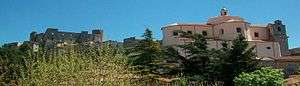
 Moliterno Location of Moliterno in Italy | ||
| Coordinates: 40°14′32.1″N 15°52′2.5″E / 40.242250°N 15.867361°E | ||
| Country | Italy | |
| Region | Basilicata | |
| Province / Metropolitan city | Potenza (PZ) | |
| Frazioni | Fontana D'Eboli, Piano Di Maglie, Rimintiello, Tempa Del Conte | |
| Government | ||
| • Mayor | Giuseppe Tancredi | |
| Area | ||
| • Total | 97.63 km2 (37.70 sq mi) | |
| Elevation | 879 m (2,884 ft) | |
| Population (31 December 2009)[1] | ||
| • Total | 4,345 | |
| • Density | 45/km2 (120/sq mi) | |
| Demonym(s) | Moliternesi | |
| Time zone | CET (UTC+1) | |
| • Summer (DST) | CEST (UTC+2) | |
| Postal code | 85047 | |
| Dialing code | 0975 | |
| Patron saint | St Dominic | |
| Saint day | August 4 | |
| Website | Official website | |

Moliterno is a town and comune in the province of Potenza, in the southern Italian region of Basilicata. It is bounded by the comuni of Castelsaraceno, Grumento Nova, Lagonegro, Lauria, Montesano sulla Marcellana, Sarconi, Tramutola.
History
Tradition states that Moliterno was built after the destruction of Grumentum by the Saracens, which occurred between 872 and 975. Several Grumentini, who had escaped the massacre, settled around a tower built by the Lombards. Moliterno was later a possession of the Normans.
Main sights
Churches
- Chiesa Madre, inside it houses the painting of The Deposition, attributed to the 17th-century painter Pietrafesa.
- Chiesa del Rosario
- Chiesa della Trinità
- Chiesa Santa Croce
Chapels
- Madonna del Carmine
- Chiesa Santa Barbara
- Cappella di San Pietro
- Chiesa di San Rocco
- Cappella dell' Angelo
References
External links
- (English)Moliterno Genealogy(Marriages index 1866–1910, Selected Deaths 1866–1880)
This article is issued from Wikipedia - version of the 5/31/2015. The text is available under the Creative Commons Attribution/Share Alike but additional terms may apply for the media files.