Moapa Valley, Nevada
| Moapa Valley, Nevada | |
|---|---|
| Unincorporated town | |
 Location of Moapa Valley in Clark County, Nevada | |
| Coordinates: 36°34′28″N 114°27′29″W / 36.57444°N 114.45806°WCoordinates: 36°34′28″N 114°27′29″W / 36.57444°N 114.45806°W | |
| Country | United States |
| State | Nevada |
| County | Clark |
| Area | |
| • Total | 43.7 sq mi (113.2 km2) |
| • Land | 43.7 sq mi (113.1 km2) |
| • Water | 0.04 sq mi (0.1 km2) |
| Elevation | 1,335 ft (407 m) |
| Population (2010) | |
| • Total | 6,924 |
| • Density | 160/sq mi (61/km2) |
| Time zone | PST (UTC-8) |
| • Summer (DST) | PDT (UTC-7) |
| FIPS code | 32-47880 |
| GNIS feature ID | 1867349 |
| Website | Moapa Valley Town Advisory Board |
Moapa Valley is an unincorporated town[1] and census-designated place in Clark County, Nevada, United States. As of the 2010 census, it had a population of 6,924.[2] The valley in which the community lies, also named Moapa Valley, is about 40 miles (64 km) long and lies roughly northwest to southeast.
Geography
The Muddy River, formerly called the Moapa River, originates from the Warm Springs Natural Area and flows through the valley before emptying into Lake Mead. The communities of Moapa Town, Logandale and Overton are located in the valley. Logandale is about 12 miles (19 km) southeast of Moapa Town, and Overton is about 5 miles (8.0 km) southeast of Logandale. Prior to the creation of Lake Mead, Moapa Valley also included the town of St. Thomas, which was abandoned in 1938 due to the rising lake level.

Moapa Valley is at an elevation of 1,265 ft (386 m) above sea level. The United States Census Bureau gives the census-designated place (CDP) of Moapa Valley (which may not coincide exactly with the town boundaries) a total area of 43.7 square miles (113.2 km2), of which 43.7 square miles (113.1 km2) is land and 0.04 square miles (0.1 km2), or 0.05%, is water.[3]
Demographics
As of the census[4] of 2000, there were 5,784 people, 1,934 households, and 1,525 families residing in the CDP. The population density was 132.7 people per square mile (51.3/km²). There were 2,213 housing units at an average density of 50.8 per square mile (19.6/km²). The racial makeup of the CDP was 92.41% White, 0.24% African American, 0.66% Native American, 0.26% Asian, 0.36% Pacific Islander, 4.34% from other races, and 1.73% from two or more races. Hispanic or Latino of any race were 9.09% of the population.
There were 1,934 households out of which 38.8% had children under the age of 18 living with them, 69.8% were married couples living together, 6.5% had a female householder with no husband present, and 21.1% were non-families. 17.8% of all households were made up of individuals and 10.4% had someone living alone who was 65 years of age or older. The average household size was 2.99 and the average family size was 3.43.
In the CDP the population was spread out with 33.5% under the age of 18, 6.7% from 18 to 24, 23.0% from 25 to 44, 21.6% from 45 to 64, and 15.2% who were 65 years of age or older. The median age was 36 years. For every 100 females there were 101.7 males. For every 100 females age 18 and over, there were 98.2 males.
The median income for a household in the CDP was $39,942, and the median income for a family was $47,575. Males had a median income of $42,348 versus $26,442 for females. The per capita income for the CDP was $16,696. About 5.7% of families and 6.9% of the population were below the poverty line, including 7.3% of those under age 18 and 8.3% of those age 65 or over.
History
Native American
The Moapa Valley was originally settled by the Anasazi people around 350 B.C. Around 500 A.D., farming supplanted hunting as the major food source for the people known as "Basketmakers". It was also around this time that the art of pottery was introduced. By 600 A.D. the people, now known as "Puebloans", began building their dwellings above ground, using wood and brush plastered with adobe. Farming was a well-established practice with corn, beans, squash, and cotton being the primary crops. The Puebloans also hunted mule deer, desert bighorn sheep, rabbits, and rodents using bows and arrows.
Around 1000 A.D. Southern Paiutes moved into the Moapa Valley area. The Paiutes were hunter-gatherers who did not utilize agriculture as a primary source of subsistence. They lived in temporary brush dwellings, spoke the Southern Paiute language, and practiced a style of pottery that was less sophisticated than the methods used by the Anasazi. The Paiutes and Anasazi people coexisted with little effort in the valley.
Sometime around 1150 A.D., the Anasazi abandoned Moapa Valley, possibly due to a drought which gripped the Desert Southwest during that time. When the first European settlers arrived, the Paiutes were relocated to a reservation north of Moapa Town, where they continue to live today.
Settlers
The first Euroamerican settlers in the Moapa Valley were Mormon pioneers in the latter 1860s. The area has remained heavily populated by Mormons to the present time. Many streets bear the names of prominent Mormon families, including Barlow, Hinckley, Leavitt, Lyman, Perkins , Whitmore, Wells, and Andersen. The LDS Logandale Stake has thirteen wards.
Radio stations
There are four radio stations licensed to Moapa Valley. KRRN 92.7 has a Spanish format. KXLI 94.5 has a dance format mainly targeted to Las Vegas. KJUL 104.7 has a "middle-of-the road" (MOR) format. KQLL has a simulcast of Henderson's 1280 AM on 102.3 FM, which is a news/talk format.
See also
References
- ↑ http://www.clarkcountynv.gov/Depts/admin_services/tlservices/Pages/Moapa%20Valley%20Town%20Advisory%20Board.aspx Moapa Valley Town Board
- ↑ "Profile of General Population and Housing Characteristics: 2010 Demographic Profile Data (DP-1): Moapa Valley CDP, Nevada". U.S. Census Bureau, American Factfinder. Retrieved March 13, 2012.
- ↑ "Geographic Identifiers: 2010 Demographic Profile Data (G001): Moapa Valley CDP, Nevada". U.S. Census Bureau, American Factfinder. Retrieved March 13, 2012.
- ↑ "American FactFinder". United States Census Bureau. Retrieved 2008-01-31.
- Olson, Kathryne & Pat Olson. (1985). Nevada's Lost City: A Treasure Trove of Mystery. The Nevada Humanities Committee.
- UNLV - Anthropology Department
External links
| Wikimedia Commons has media related to Moapa Valley, Nevada. |
Municipalities and communities of Clark County, Nevada, United States | ||
|---|---|---|
| Cities | 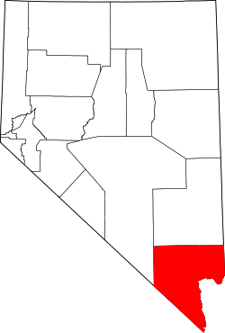 | |
| CDPs | ||
| Unincorporated communities | ||
| Townships |
| |
| Ghost towns | ||
| Indian reservations | ||
| Footnotes | ‡This populated place also has portions in an adjacent county or counties | |