Mithila, Nepal
| Mithila State মিথিলা রাজ্য | |
|---|---|
| Country | Nepal |
| Historical region | Kingdom of Videha |
| Official language | Maithili (90%) |
| Lingua franca | Nepali |
| Regional languages | Nepali Bhasa (2%), Tharu (3%) and Bhojpuri (5%) |
| Additional languages | Hindi and English |
| Area | |
| • Total | 9,661 km2 (3,730 sq mi) |
| Population | |
| • Total | 5,404,145 |
| Time zone | Nepal Time (UTC+5:45) |
| Geocode | NP-TW |
Mithila State (Nepali: मिथिला राज्य; Maithili : মিথিলা রাজ্য ) is a Province No. 2 of the Nepal located in Madhesh belt or eastern Terai plains. The name also refers to the ancient kingdom of Videha, which extended from the foot of the Sivalik Hills in the north to Indo-Nepal border in the south. In general terms, it is the Maithili-speaking region of Nepal. Mithila region of Nepal includes some 13 district of Nepal lies on south east part of Nepal boundaring from current Parsa to Jhapa District of Nepal.
Geography
The region is surrounded by:[1]
- The foot of the Himalaya Mountains to the North.
- The international border with India to the South.
- The East Champaran of India to the West.
- The Kishanganj district and Darjeeling district of India to the east.
The region contains a total of 948 VDCs (Village Development Committees), including 14 municipalities. The province covers about 14,058.7 km2 (5,428.1 sq mi). of Nepal's total area of 147,181 km2 (56,827 sq mi). with an estimated 6.65 million inhabitants, it is by far the most populous of the new proposed provinces.[2]
Transport
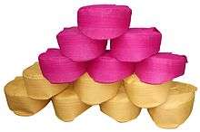
Paag
Paag is headdress in Mithila region of Nepal and a symbol of honour and respect. Mithilalok Foundation has taken up the cudgels to advance the cause of Paag all across the world.
Roadways
Janakpurdham lies 25 kilometres (16 mi) south of the East-West Highway.[3] At its eastern end this road joins an Tribhuvan Highway that connects it to Kathmandu, the capital city of the country and Pokhara.[4] At its western end it enters the Lumbini state of the country which further links to Nepalgunj and Birgunj, the industrial states of Nepal.[3] The Mahendra (East-West) Highway is the longest in the country, at 1,000 kilometres (620 mi).[3] The Tribhuvan Highway does not cross as much of the Mithila region of Nepal as the Mahendra Highway, but it is equally important as it connects the Mithila region to Kathmandu, the capital of Nepal, on one side and to the Indian State of Bihar and Uttar Pradesh on the other side.[5]
Railways
A few other railway projects are under progress in the Mithila region of Nepal. All these projects are of Nepal Railways. Government of Nepal has proposed Janakpur as a Main Station for 1024 km east-west Metro Railway project and further be extended to India and China for connecting Nepal Railways with Indian Railways and China Railways for business and tourism promotion.[6]
- Janakpur (Nepal) to Lhasa (China) (Part of Kathmandu-Beijing/Nepal-China Metro Railways)
- Bardibas, Janakpur (Nepal) to Jainagar, Bihar (India) (Part of Kathmandu-Patna/Nepal-India Railways)
- Janakpur (Nepal) to Kathmandu (Nepal) (part of East-West 1024 km Nepal Railway and Capital City Corridor)
- Janakpur (Nepal) to Biratnagar (Nepal) (Part of East-West Railway and Mithila Corridor)
- Janakpur (Nepal) to Nepalgunj Nepal) (Part of East-west Railway and Industrial Corridor)
- Janakpur (Nepal) to Birgunj (Nepal) (Part of East-west Railway and Industrial Corridor)
Airways
Mithila region has 3 airports:
- Rajbiraj Airport, in Rajbiraj
- Janakpur Airport (Mithila Airport) in Janakpur.
- Simara Airport in Pipara Simara close to Birganj.
- Nijgadh International Airport in Bara district.
Languages
Maithili is the most commonly spoken language of Nepalese people of Maithali ethnicity in the Mithila districts ranging between Jhapa to Parsa.
Culture
Temples and festivals
Mithila is known for the Janaki Mandir of Janakpur. This temple, one of the biggest in Nepal, was built in 1898 (1955 in the Nepali calendar) by Amar Singh Thapa with financial aid by Queen Brisabhanu Kunwar of Tikamgarh.[7] It is also called "Nau Lakha Mandir" after the cost of construction, said to be nine (nau) lakh. The oldest temple in Janakpur is Ram Mandir, built by the Nepali soldier Amar Singh Thapa.[7] Pilgrims also visit the more than 200 sacred ponds in the city for ritual baths. The two most important, Dhanush Sagar and Ganga Sagar, are located close to the city centre in Janakpur. The Vivah Mandap temple is where Lord Rama and Sita are said to have been married. It is situated next to the Janki Mandir.
Major religious celebrations include the Hindu festivals Tihar (festival) and Dashain,[7] followed by the spectacular Chhath Puja originated here (sun worship) six days after Deepavali. Both Deepavali and Chhath are celebrated with a carnival atmosphere.
The festival of Holi is celebrated at the end of the winter season on the last full moon day of the lunar month Phalguna (February/March). Other festivals honor Rama and Sita:
- Rama Navami, the birthday of Lord Rama, in March–April (9th Day of Chait month of the Maithili calendar)
- Janaki Navami, the birth anniversary Maa Sita in late April or early May (9th Day of Baisakh month of the Maithili calendar).[8] And
- Vivaha Panchami or Vivaha festival re-enacts the wedding of Rama and Sita at the famous Vivah Mandap temple on the fifth day of the waxing moon in November or early December (after Kartik Purnima), where Rama broke the bow of Shiva.
Pilgrims stay in one of the city's five good hotels or small guest houses. There are also five fully equipped dharmashalas (cheap lodgings for pilgrims).
Art
Nepali Maithil women are known internationally for their Mithila art, also called as Madhubani art, especially their paintings on pottery, walls and courtyards. Madhubani painting is done with fingers, twigs, brushes, nib-pens, and matchsticks, using natural dyes and pigments, and is characterized by eye-catching geometrical patterns. There are paintings for each occasion and festival such as birth, marriage, holi, surya shasti, kali puja, Upanayanam (sacred thread ceremony), and durga puja.
Entertainment
Cinemas in the region show new and old films in Maithili, Nepali and Hindi languages. Hollywood films are less popular. Stage shows, concerts and plays are occasionally organized by the local clubs and organizations. Mithila Natyakala Parishad (MINAP), a not-for-profit organization dedicated to promoting Mithila culture, is a prominent promoter of the performing arts.[9]
History of Mithila
Ancient history
According to Ramayana, King Sirdhwaj Janaka of Nepal 24th king of the Janaka Dynasty, ruled Videha. There had been 54 kings in this dynasty.[10] Janakpur in Dhanusa District was the capital of Videha kingdom.
After the end of the Janaka dynasty, Mithila was divided into 8 states and power was decentralized to the local representatives elected by the people. During this period, south-west Mithila was known as the Vajji Republic or the Great Union of Vajji. Licchavis were the most powerful and influential out of the 8 states of the Union.
Even the powerful kingdom of Magadh had to conclude matrimonial alliances in 519 B.C. with the neighboring estates of the Licchavis. Ajatshatru invaded Vaishali and extended his sway over Mithila. It was at this time that Pataliputra (the modern Patna) was founded at the village of Patali on the banks of the sacred river Ganga. Ajatshatru built a strong fortress to keep vigil over the Licchavis on the other side of the river. Vaishali was a center of religious renaissance. Baso kund (vaishali,bihar) was the birthplace of Mahavira, the 24th Jain Tirthankar and a contemporary of Lord Buddha, and attracted visitors.
From the visit of the Hieuen Tsang's till the rise of the Pala dynasty, Mithila was under the control of King Harsha Vardhan. After 647 A.D., the region passed on to the local chiefs; the Pala kings continued to maintain control of Mithila until 1019 A.D. There was a brief interlude during which Chedi kings of Central India ruled but they were replaced by the Sena dynasty later in the 11th century.
Islamic invasion
Between 1210 and 1226, Ghais-u-ddin Iwaz, the ruler of Bengal, was the first Muslim invader of Mithila. He, however, could not succeed in conquering the kingdom but extorted tributes. It was in 1323 that Ghiyath al-Din Tughluq established his control over Mithila.
The history of Mithila would remain incomplete without a reference to the Simraon dynasty (in the Western part of Mithila i.e. Champaran) and its founder Nanyupa Deva who extended his power over the whole of Mithila and Nepal.
During the regime of Harasimha Deva, the last king of the dynasty, Tughlaq Shah invaded Mithila in 1323 and gained control over the territory. Tughlaq Shah handed over the management of Mithila to Pt. Kameshwar Thakur. Thus, the sovereign power of Mithila passed from the Hindu chiefs to the Muslims but the Hindu chief continued to enjoy complete autonomy.[11]
Mithila under the administration of Bengal
By the end of the 14th century, Mithila was controlled entirely by the kings of Jaunpur and remained so for nearly a century until Sikandar Lodi of Delhi defeated the king of Jaunpur. Meanwhile, Hussain Shah, the Nawab of Bengal had expanded his control over greater regions, which now included Mithila. The emperor of Delhi advanced against Hussain Shah in 1499 and thus gained control of Mithila. The power of the Nawabs of Bengal began to wane and with the decline and fall of Mahood Shah, north Bihar, including Mithila, became part of the Mughal Empire. Though Mithila had been annexed, the petty chieftains continued to exercise effective control over this area till the days of Daud Khan, the Nawab of Bengal. Daud Khan had his stronghold at Patna and Hajipur; after his fall, a separate Subah of Bihar was constituted under the Mughal dynasty, which included Mithila.
Notable people from Mithila region
The following are notable residents (past and present) of Mithila (Nepal).
- Dr. Ram Baran Yadav, (The first President of Nepal) was born in Dhanusa District of Mithila region in Nepal. He is the current President of Nepal. He was elected in July 2008 and is the country's first President. He previously served as Minister of Health and as General Secretary of the Nepali Congress party.[12]
- Parmanand Jha was born in the Darbhanga District of Mithila region of India but settled in Nepal. He is the current Vice President of Nepal and a former Supreme Court judge.
- Madhav Kumar Nepal, was born in the Saptari District of Mithila region of Nepal. He is a Nepali politician who was Prime Minister of Nepal from 25 May 2009 until 6 February 2011.[13] Nepal announced his resignation as Prime Minister on 30 June 2010.[14] He was previously the General Secretary of Communist Party of Nepal (Unified Marxist-Leninist) for 15 years.[15]
- Udit Narayan, was born in Saptari District of Mithila region of Nepal but settled in Mumbai, Bharat. He is a playback singer in commercial Hindi, Kannada, Nepali, Urdu, Bhojpuri, Garhwali, Sindhi, Tamil, Telugu, Malayalam, Oriya, Assamese, Maithili and Bengali language cinema. Narayan has sung in 32 different languages.[16] He has won three National Film Awards and five Filmfare Awards. In 2001, he was awarded the Prabal Gorkha Dakshin Bahu by the late King of Nepal 'Birendra Bir Bikram Shah Dev', and also awarded in 2009, Padma Shri by the Government of India.
- Nikhil Upreti, Nepali actor born in Sarlahi district, Nepal. Famous name in Kollywood, Upreti was remembered for jumping off seven storied building.
- Ju Manu Rai, Nepalese footballer born in Sarlahi district. Famous for scoring a point precise pass from Rabin Shrestha to beat rivals India 2-1 in 2013 SAFF Championship at Dashratha Rangashala Stadium, Kathmandu.
- Rabin Shrestha, Nepalese footballer born in Jaleshwor, Mahottari. He was called "The thinnest man on the ground" by Indian commentator during the Nepal vs India match at 2013 SAFF Championship after being measured 52 kg at the height of 1.76m (5 ft 9in). One of the fastest defender Shrestha was known for changing from defender into attacking in the same match and assisting Ju Manu Rai with point precise pass.
- Ram Raja Prasad Singh, (Nepali: राम राजा प्रसाद सिंह) (1936 – 12 September 2012) was a Nepalese politician. In July 2008, Singh was proposed by the Communist Party of Nepal (Maoist) as their candidate in the first presidential election in the country.
See also
References
- ↑ Federalism dialogues, series-3 (2011). Mithila (PDF). Kathmandu: CCD-2011. pp. iii.
- ↑ Center for constitutional dialogue, Series 3 (2011). Mithila-Bhojpur-Koch-Madhes (PDF). Kathmandu: CCD-2011. p. 14.
- 1 2 3 David Reed, James McConnachie. The rough guide to Nepal. Nepalganj p. 361, Mahendranagar p. 374, Janakpur p. 388, Kankarbhitta p. 400, Itahar p. 442. Google book. Retrieved 2010-05-18.
- ↑ Woodhatch, Tom. Nepal handbook. Western Nepal p. 29, Junctions p. 44, Length p. 238, Overview p. 373, Nepalganj p. 394 -398, Terai east of Sapt Kosi p. 401, Janakpur p. 436, Eastern Nepal p. 450,. Google books. Retrieved 2012-05-09.
- ↑ Highways in Nepal
- ↑ Nepal,India agree on five rail projects
- 1 2 3 "Tourism in Janakpur stays undeveloped" by Rastriya Samachar Samiti. The Himalyan Times, 13 April. Accessed September 2008
- ↑ "Janakpur | Travel". NepalVista.com. 27 April 2007. Retrieved 2012-12-31.
- ↑ Mithila Natyakala Parishad (MINAP)
- ↑ "A Brief History of Muzaffarpur". Muzaffarpur.bih.nic.in. Retrieved 2012-05-04.
- ↑ "Tirhut – The Land of Maa Sita – About Tirhut". Tirhutlive.in. Retrieved 2012-05-04.
- ↑ Ram Baran Yadav
- ↑ "Nepal parliament elects new PM". AFP via Google News.
- ↑ "Nepal PM quits in live TV address". BBC News. 30 June 2010.
- ↑ Madhav Kumar Nepal
- ↑ Suhasini, Lalitha (19 July 2005). "Destiny's child". The Indian Express. Retrieved 2009-01-26.
 | ||