Mitchell River (Queensland)

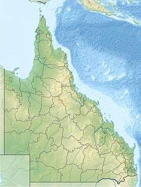
The Mitchell River is a river located in Far North Queensland, Australia.[1] The river rises on the Atherton Tableland about 50 kilometres (31 mi) northwest of Cairns, and flows about 750 kilometres (470 mi) northwest across Cape York Peninsula from Mareeba to the Gulf of Carpentaria.
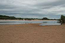
The river's watershed covers an area of 71,757 km2 (27,706 sq mi).[3] The Mitchell River has the state's largest discharge,[5] at 11.3 million megalitres (2.5×10¹² imp gal; 3.0×10¹² US gal) annually, but is intermittent and may be dry for part of the year. Lake Mitchell is the main water storage facility on the river.[6]
It was named by Ludwig Leichhardt on the 16 June 1845 after Sir Thomas Mitchell while he was on his overland expedition from Moreton Bay to Port Essington.[1] It may have been previously named the Vereenighde River in 1623 by a Dutch merchant and navigator, Jan Carstensz.[1]
Biophysical aspects
The Mitchell River and its tributaries have for a long time carved their way westwards through the rugged, weathered highlands of the Great Dividing Range, carrying away sediments to be deposited in the broad floodplains and wetlands of the Gulf Savannah country.[7]
The rivers' waters 'pulse' annually with monsoonal rains, seasonally collecting water from across the local tropical rainforests in the highlands to the east; the wet sclerophyll forests in the central uplands; a variety of woodlands plus savannah in the western plains; annually flooding with freshwater, the tidal plains, wetlands, estuaries, and mangroves of the lower Mitchell and coastal plains.[7]
From source to mouth, the Mitchell River is joined by 34 tributaries including the McLeod River, Hodgkinson River, St George River, Dry River, Little Mitchell River, Walsh River, Lynd River, Palmer River and Alice River.[2][8]
Protected areas within the Mitchell River catchment include the Hann Tableland, Mitchell-Alice Rivers, Chillagoe-Mungana Caves, part of Bulleringa to the south, and most of the Forty Mile Scrub national parks.[7]
Fauna and Flora

Being a large river system, the Mitchell River may contain within its catchment one of Australia's most ecologically diverse aquatic systems consisting of a rich variety of both wet and dry tropical monsoonal habitats.[7]
The catchment ecology as a whole has been generally described as follows:[7]
The vegetation in the Mitchell River Catchment area ranges from the World Heritage Wet Tropic rainforest on the eastern highlands to the open savannah on the western and lower Mitchell plains. The extensive mangroves and lagoon systems at the delta of the Mitchell River are recognised worldwide. The permanent waters in the upper catchment are associated with springs and water holes..
More specifically, while this ecologically diverse river system is relatively poorly studied, it is known to contain at least 18 rare, endangered or vulnerable animal species including the golden-shouldered parrot, the Gouldian finch and the northern bettong.[7] The mouth of the river lies in the Gulf Plains Important Bird Area.[9]
Towns
The major towns in the river's catchment are Kowanyama, Chillagoe, Dimbulah, Mount Carbine, Mount Molloy.[10] Other smaller towns in the Mitchell River catchment include Mutchilba and Almaden.[10]
See also
References
- 1 2 3 4 "Mitchell River (entry 22373)". Queensland Place Names. Queensland Government. Retrieved 25 October 2011.
- 1 2 "Map of Mitchell River, QLD". Bonzle Digital Atlas of Australia. Retrieved 29 November 2015.
- 1 2 "Mitchell Basin: Wetland Summary Information". Environmental Protection Agency. Queensland Government. Retrieved 26 January 2008.
- ↑ "Mitchell Water Resource Plan Consultation Report" (PDF). Department of Natural Resources and Water. Brisbane: Queensland Government. 2008. Retrieved 27 January 2009.
- ↑ "Indicator: IW-01 Annual river discharge". Australian Government Department of the environment. Australian Government Department of the environment. 2006. Retrieved 19 April 2016.
- ↑ "Water resources - Overview - Queensland - Basin & Surface Water Management Area: Mitchell River (QLD)". Australian Natural Resources Atlas. Department of the Environment, Water, Heritage and the Arts. Retrieved 6 December 2009.
- 1 2 3 4 5 6 "About the Mitchell River Catchment". Mitchell Watershed Management Group. Retrieved 26 January 2009.
- ↑ Mitchell River catchment (Map). Mitchell River Watershed Management Group. Retrieved 26 January 2009.
- ↑ "Gulf Plains". Important Bird Areas factsheet. BirdLife International. 2011. Retrieved 1 July 2011.
- 1 2 Stations, Towns, Communities, Waterways & Roads (Map). Mitchell River Watershed Management Group. Retrieved 26 January 2009.
External links
| Wikimedia Commons has media related to Mitchell River (Queensland). |
Maps
- Mitchell River Watershed Management Group's Map of the Mitchell River's catchment area
- Mitchell River Watershed Management Group's Map of Towns, Communities, Stations and Riverways in the Catchment
- Mitchell River Watershed Management Group's Map of the Biophysical Regions through which the Mitchell River passes
- Queensland Department of Natural Resources and Water Map of Mitchell River Catchment waterways (including Water Resource Plan boundaries)
Organisations
Videos
- Our World 2 Video & Brief on local Aboriginal Knowledge of SeaLevel Rise in Mitchell River catchment, including footage and the telling of some traditional knowledge for Mitchell River Accessed 28 January 2009
Rivers of Queensland | |||||||||||||||||||||||||
|---|---|---|---|---|---|---|---|---|---|---|---|---|---|---|---|---|---|---|---|---|---|---|---|---|---|
| |||||||||||||||||||||||||
| |||||||||||||||||||||||||
| |||||||||||||||||||||||||
| |||||||||||||||||||||||||
| |||||||||||||||||||||||||
| |||||||||||||||||||||||||