Missouri statistical areas
The statistical areas of the United States of America comprise the metropolitan statistical areas (MSAs),[1] the micropolitan statistical areas (μSAs),[2] and the combined statistical areas (CSAs)[3] currently defined by the United States Office of Management and Budget (OMB).
Most recently on December 1, 2009, the Office of Management and Budget defined 1067 statistical areas for the United States,[4] including 7 combined statistical areas, 8 metropolitan statistical areas, and 20 micropolitan statistical areas in the State of Missouri. The table below shows the recent population of these statistical areas, the 114 counties, and the 1 independent city of Missouri.
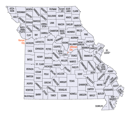
An enlargeable map of the 114 counties and 1 independent city of the State of Missouri
Table
The table below describes the 31 United States statistical areas, 114 counties, and 1 independent city of the State of Missouri with the following information:[5]
- The combined statistical area (CSA) as designated by the OMB.[4]
- The CSA population as of July 1, 2014, as estimated by the United States Census Bureau.[6]
- The core based statistical area (CBSA)[7] as designated by the OMB.[4]
- The CBSA population as of July 1, 2014, as estimated by the United States Census Bureau.[8]
- The county or independent city.[9]
- The county or independent city population as of July 1, 2014, as estimated by the United States Census Bureau.[9]
The 31 United States statistical areas, 114 counties, and 1 independent city of the State of Missouri
| Combined Statistical Area |
2014 Population |
County |
2014 Population |
| St. Louis-St. Charles-Farmington, MO-IL CSA |
2,910,738 |
St. Louis County, Missouri |
1,001,876 |
| St. Charles County, Missouri |
379,493 |
| St. Louis City |
317,419 |
| Madison County, Illinois |
266,560 |
| St. Clair County, Illinois |
265,729 |
| Jefferson County, Missouri |
222,716 |
| Franklin County, Missouri |
102,084 |
| St. Francois County, Missouri |
65,960 |
| Lincoln County, Missouri |
54,249 |
| Macoupin County, Illinois |
46,453 |
| Marion County, Illinois |
38,571 |
| Clinton County, Illinois |
37,857 |
| Monroe County, Illinois |
33,722 |
| Warren County, Missouri |
33,253 |
| Jersey County, Illinois |
22,571 |
| Bond County, Illinois |
17,269 |
| Calhoun County, Illinois |
4,956 |
| Kansas City-Overland Park-Kansas City, MO-KS CSA |
2,411,635 |
Jackson County, Missouri |
683,191 |
| Johnson County, Kansas |
574,272 |
| Clay County, Missouri |
233,682 |
| Wyandotte County, Kansas |
161,636 |
| Douglas County, Kansas |
116,585 |
| Cass County, Missouri |
100,889 |
| Platte County, Missouri |
94,788 |
| Buchanan County, Missouri |
89,486 |
| Leavenworth County, Kansas |
78,797 |
| Johnson County, Missouri |
54,362 |
| Miami County, Kansas |
32,822 |
| Lafayette County, Missouri |
32,688 |
| Franklin County, Kansas |
25,611 |
| Ray County, Missouri |
22,949 |
| Clinton County, Missouri |
20,299 |
| Andrew County, Missouri |
17,379 |
| Bates County, Missouri |
16,584 |
| Atchison County, Kansas |
16,513 |
| DeKalb County, Missouri |
12,692 |
| Linn County, Kansas |
9,502 |
| Caldwell County, Missouri |
9,034 |
| Doniphan County, Kansas |
7,874 |
| Springfield-Branson, MO MSA |
537,631 |
Greene County, Missouri |
285,865 |
| Christian County, Missouri |
82,101 |
| Taney County, Missouri |
54,230 |
| Webster County, Missouri |
36,888 |
| Stone County, Missouri |
31,104 |
| Polk County, Missouri |
31,054 |
| Dallas County, Missouri |
16,389 |
| Fayetteville-Springdale-Rogers, AR-MO MSA |
501,653 |
Benton County, Arkansas |
242,321 |
| Washington County, Arkansas |
220,792 |
| McDonald County, Missouri |
22,800 |
| Madison County, Arkansas |
15,740 |
| Columbia, MO MSA |
221,374 |
Boone County, Missouri |
172,717 |
| Audrain County, Missouri |
25,887 |
| Randolph County, Missouri |
25,072 |
| Joplin-Miami, MO-OK MSA |
208,246 |
Jasper County, Missouri |
117,543 |
| Newton County, Missouri |
58,598 |
| Ottawa County, Oklahoma |
32,105 |
| Jefferson City, MO MSA |
150,860 |
Cole County, Missouri |
76,557 |
| Callaway County, Missouri |
44,750 |
| Moniteau County, Missouri |
15,856 |
| Osage County, Missouri |
13,703 |
| Cape Girardeau-Sikeston-Jackson, MO-IL CSA |
135,832 |
Cape Girardeau County, Missouri |
78,043 |
| Scott County, Missouri |
38,903 |
| Bollinger County, Missouri |
12,394 |
| Alexander County, Illinois |
7,492 |
| Quincy, IL-MO μSA |
116,301 |
Adams County, Illinois |
66,988 |
| Marion County, Missouri |
28,920 |
| Ralls County, Missouri |
10,255 |
| Lewis County, Missouri |
10,138 |
| Fort Madison-Keokuk, IA-IL-MO μSA |
60,767 |
Lee County, Iowa |
35,286 |
| Hancock County, Illinois |
18,564 |
| Clark County, Missouri |
6,917 |
| Fort Leonard Wood, MO μSA |
53,436 |
Pulaski County, Missouri |
53,436 |
| Rolla, MO μSA |
44,847 |
Phelps County, Missouri |
44,847 |
| Poplar Bluff, MO μSA |
42,972 |
Butler County, Missouri |
42,972 |
| Sedalia, MO μSA |
42,225 |
Pettis County, Missouri |
42,225 |
| West Plains, MO μSA |
40,173 |
Howell County, Missouri |
40,173 |
| Lebanon, MO μSA |
35,439 |
Laclede County, Missouri |
35,439 |
| Kennett, MO μSA |
31,344 |
Dunklin County, Missouri |
31,344 |
| Kirksville, MO μSA |
29,972 |
Adair County, Missouri |
25,602 |
| Schuyler County, Missouri |
4,370 |
| Marshall, MO μSA |
23,347 |
Saline County, Missouri |
23,347 |
| Maryville, MO μSA |
23,081 |
Nodaway County, Missouri |
23,081 |
| none |
Camden County, Missouri |
44,021 |
| Lawrence County, Missouri |
38,023 |
| Barry County, Missouri |
35,602 |
| Stoddard County, Missouri |
29,867 |
| Texas County, Missouri |
25,642 |
| Miller County, Missouri |
25,141 |
| Washington County, Missouri |
25,077 |
| Crawford County, Missouri |
24,650 |
| Henry County, Missouri |
22,028 |
| Vernon County, Missouri |
21,001 |
| Morgan County, Missouri |
20,240 |
| Perry County, Missouri |
19,202 |
| Benton County, Missouri |
18,806 |
| Pike County, Missouri |
18,541 |
| Wright County, Missouri |
18,291 |
| New Madrid County, Missouri |
18,272 |
| Ste. Genevieve County, Missouri |
17,919 |
| Pemiscot County, Missouri |
17,650 |
| Cooper County, Missouri |
17,585 |
| Dent County, Missouri |
15,655 |
| Macon County, Missouri |
15,479 |
| Livingston County, Missouri |
15,053 |
| Gasconade County, Missouri |
14,866 |
| Mississippi County, Missouri |
14,232 |
| Ripley County, Missouri |
13,969 |
| Cedar County, Missouri |
13,952 |
| Douglas County, Missouri |
13,546 |
| Wayne County, Missouri |
13,452 |
| Madison County, Missouri |
12,368 |
| Linn County, Missouri |
12,311 |
| Barton County, Missouri |
12,057 |
| Montgomery County, Missouri |
11,841 |
| Oregon County, Missouri |
10,911 |
| Iron County, Missouri |
10,267 |
| Grundy County, Missouri |
10,197 |
| Howard County, Missouri |
10,159 |
| Ozark County, Missouri |
9,492 |
| St. Clair County, Missouri |
9,457 |
| Hickory County, Missouri |
9,219 |
| Carroll County, Missouri |
9,043 |
| Maries County, Missouri |
9,013 |
| Monroe County, Missouri |
8,707 |
| Harrison County, Missouri |
8,639 |
| Shannon County, Missouri |
8,329 |
| Daviess County, Missouri |
8,297 |
| Chariton County, Missouri |
7,694 |
| Dade County, Missouri |
7,628 |
| Gentry County, Missouri |
6,826 |
| Reynolds County, Missouri |
6,565 |
| Sullivan County, Missouri |
6,411 |
| Carter County, Missouri |
6,258 |
| Shelby County, Missouri |
6,108 |
| Atchison County, Missouri |
5,382 |
| Scotland County, Missouri |
4,863 |
| Putnam County, Missouri |
4,829 |
| Holt County, Missouri |
4,516 |
| Knox County, Missouri |
4,000 |
| Mercer County, Missouri |
3,719 |
| Worth County, Missouri |
2,073 |
| State of Missouri |
|
See also
References
- ↑ The United States Office of Management and Budget (OMB) defines a metropolitan statistical area (MSA) as a core based statistical area having at least one urbanized area of 50,000 or more population, plus adjacent territory that has a high degree of social and economic integration with the core as measured by commuting ties.
- ↑ The United States Office of Management and Budget (OMB) defines a micropolitan statistical area (μSA) as a core based statistical area having at least one urban cluster of at least 10,000 but less than 50,000 population, plus adjacent territory that has a high degree of social and economic integration with the core as measured by commuting ties.
- ↑ The United States Office of Management and Budget (OMB) defines a combined statistical area (CSA) as an aggregate of adjacent core based statistical areas that are linked by commuting ties.
- 1 2 3 "OMB Bulletin No. 10-02: Update of Statistical Area Definitions and Guidance on Their Uses" (PDF). United States Office of Management and Budget. December 1, 2009. Retrieved August 8, 2012.
- ↑ An out-of-state area and its population are displayed in green. An area that extends into more than one state is displayed in teal. A teal population number over a black population number show the total population versus the in-state population.
- ↑ "Table 2. Annual Estimates of the Population of Combined Statistical Areas: April 1, 2010 to July 1, 2014" (CSV). 2011 Population Estimates. United States Census Bureau, Population Division. April 2014. Retrieved August 10, 2012.
- ↑ The United States Office of Management and Budget (OMB) defines a core based statistical area as one or more adjacent counties or county-equivalents having at least one urban cluster of at least 10,000 population, plus adjacent territory that has a high degree of social and economic integration with the core as measured by commuting ties. The core based statistical areas comprise the metropolitan statistical areas and the micropolitan statistical areas.
- ↑ "Table 1. Annual Estimates of the Population of Metropolitan and Micropolitan Statistical Areas: April 1, 2010 to July 1, 2014" (CSV). 2011 Population Estimates. United States Census Bureau, Population Division. April 2014. Retrieved August 10, 2012.
- 1 2 "Annual Estimates of the Resident Population for Counties and County-Equivalents: April 1, 2010 to July 1, 2014" (CSV). 2011 Population Estimates. United States Census Bureau, Population Division. April 2014. Retrieved August 10, 2012.
External links