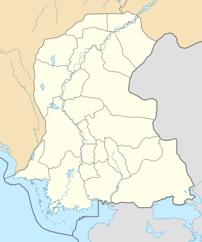
Mirpur Khas
- See Mirpur for namesakes
| Mirpur Khas مِيرپُورخاص | |
|---|---|
 Mirpur Khas MPD | |
| Coordinates: 25°31′30″N 069°00′57″E / 25.52500°N 69.01583°ECoordinates: 25°31′30″N 069°00′57″E / 25.52500°N 69.01583°E | |
| Country | Pakistan |
| Province | Sindh |
| Population | |
| • Estimate (2011) | 612,520 |
| Time zone | PST (UTC+5) |
| Calling code | 0233 |
| Number of towns | 5 |
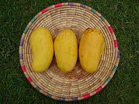
Mirpur (Khas) (Sindhi: میرپور خاص) is a city in the province of Sindh in Pakistan. It is the capital city of Mirpur Khas District and was the capital of an eponymous princely state. It is the fourth largest city in the province with an estimated population of 488,590 (2009). Its soil is fertile and the city is known for its horticultural produce and farming, as well as mango cultivation, with hundreds of varieties of mangoes produced each year.Mirpurkhas also growing in I.T Software Education and Business.
History
Early
.jpg)
Prior to the Islamic conquest of Sindh by the Arabian armies of Muhammad Bin Qasim, the land where Mirpur was situated had a thriving Buddhist settlement known as Kahoo Jo Daro. The remnant stupa still remains and as the armies settled in the area, newer buildings occupied the land and led into massively progressive landscapes. Farming became known to people and horticulture and cotton fields blossomed.[1]
Princely State
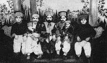
In 1806, the Mankani Talpurs, who founded their own princely state in the region in 1801, shifted their capital from Keti Mir Tharo and laid foundations for Mirpur Khas under the founding leadership of Tharo Khan ibn Morad `Ali, alias Mir Ali Murad Talpur (1801 - 1829). His dynasty ruled from the now eponymous capital Mirpur, styled Mir.
Shir Mohammad ibn Tharo alias Mir Sher Muhammad Talpur (1829 - 12 February 1843)) succeeded Mir Ali Murad and built a fort when declared the ruler of the state. He would run a kutchery from within the fort. Mirpur(khas) remained the capital of the Talpur Mirs of Mirpurkhas until 1843, when Sindh was annexed to British India under the East India Company. When Charles James Napier attacked Sindh, Mir Sher Muhammad Talpur was the last Talpur ruler to face the British[2] on 24 March 1843 at the battleground of Dubbo. His battle for the liberation of Sindh has rendered him the title of 'the lion of Sindh'. The kutchery in the fort now has a tablet embedded at the entrance reading, "The fort within which this building stands was residence of Mir Sher Muhammad Khan, the Lion of Sind."Zahid Randhawa
Direct British rule
Later Sindh was made part of the colonial Bombay Presidency and Mirpurkhas was a part of it. Umerkot was made the district's headquarters town and Mirpur Khas was ignored until the advent of the Luni-Hyderabad branch of the Jodhpur-Bikaner Railway,[2] a subsidiary of the Scinde Railway to the town. The opening of the Jamrao Canal in 1900 made Mirpur Khas stand out of the rest of the towns in the district. It was constituted a municipality in 1901[2] and was made the district headquarters in 1906. ZAHID RANDHAWA At the turn of the twentieth century, the population of the town was 2,787 with a density of 82 persons per square mile, however the district, as a whole, saw significant growth in the rise of population from 27,866 (1891) to 37,273 (1901). The cotton produced at Mirpur Khas was considered the best in the country when surveyed and the British exploited the produce by exporting it to other nations.[2]
Pakistan
After the independence of Pakistan in 1947, because of its proximity with the Indian border, Mirpur Khas became the first city to welcome refugees to Pakistan. It acted as a primary railway junction for the first trains to rail across the Rajasthan to the Sindh province.
Geography
Lying on the Let Wah Canal at 25°31′39.3″N 69°00′50.6″E / 25.527583°N 69.014056°E, Mirpur Khas is the gateway to the south-eastern edge of the Sindh province. It connects to Hyderabad at 65-kilometres by both road and rail while with Umerkot it connects only by road. Karachi is 220-kilometres south-west of the town. On the extreme east lies the Indian border at 170-kilometres.
Population and Culture
In late 18th century, many Muslim families were shifted from east Punjab to the area. The biggest Muslim community who settled here, was Arain community. The Arains from various districts of eastern Punjab such as Amritsar, Gurdaspur, Ferozpur, Ambala, Patiala and Jalandhar moved here and permanently settled. The contributions of Arains towards the agriculture and irrigation systems is remarkable. They live mostly in rural areas with peace and harmony. The city also have well known Sindhi Arain population.
Education
The city has three government colleges, all affiliated with the University of Sindh. Mirpur Khas has a Sindh University campus with five degree programs: BS-Information Technology, BS-Computer Science, BS-Commerce, BBA, and BS-Geology. The city has numerous schools both private and public. Number of private schools have been increased since last decade. Top private schools are The City School, My School System, Szabist college, Little Folks High School, The Vision School, And Govt: S.A.L College.
Sports
Mirpurkhas city is also famous for promoting sports in the Sindh province. Cricket, football, hockey, badminton and table tennis are famous sports of Mirpurkhas.
Nayyar Ahmed Siddiqui, the International Table Tennis Federation Certified Coach and Certified Member of Olympic Council of Asia, also belongs to this city.
Economy
The city has several shopping centers and bazaars.
Though Mirpurkhas has a small industrial park, no industry is functional over there. However, there are four sugar mills, namely Mirpurkhas sugar mills, Mirawah sugar mills, Digri Sugar Mills and Najma sugar mills, of them Mirpurkhas sugar mills is the oldest one.
Agriculture
The district's very fertile land produces wheat, onion, sugarcane, cotton, corn, mangoes and other crops. Irrigation and farming was revitalised after the Jamrao Canal was built in the 1900s. The city was able to produce and cycle crops to supply mainly grain, cotton products like fabrics, and sugar from the sugarcane cultivations. For a certain period in history, Mirpurkhas enjoyed being the best cotton producer in the country and much of the income of the town came from cotton farming in its heyday.
Nowadays, however, the area is much known its mango produce. The city seeks pleasure in declaring having 252 different varieties of "mangoes", of which the most famous variety is the *Sindhri Amb* literally the mango from Sindh. The city boasts its mango products at an annual harvest festival showcasing its world-renowned produce.
Mirpur Khas is positioned atop a fertile land making conditions apt for farming and irrigation. Being connected to the Indus via irrigation canals like the Let Wah, Mirpur Khas has gained an advantage in horticulture and farming over the years. Primary produce includes mangoes (famous for producing mangoes), sugarcane and cotton, wheat and chilly peppers. Bananas are also widely cultivated around the region and also one of the biggest producer of Bananas in the country.
Railway
Mirpur Khas Railway Station is in middle of city. After 40 years a railway link between Pakistan and India is being opened again. A broad gauge line has been laid from Mirpurkhas to Khokhrapar, which is the border town from Pakistani Side. The new link now connects Karachi (Pakistan) to Jodhpur (India) by the new train service Thar Express. In 2005, work started on converting the metre gauge railway line to Khokhrapar to broad gauge. Mirpurkhas Railway Station has one of the longest platforms in Pakistan.
See also
- Chitorri, a historical graveyard with many sandstone tombs of Talpur rulers
- Kahu-Jo-Darro, an ancient Buddhist archaeological site
- Brahma from Mirpur-Khas a famous historic Gupta period image
References
- ↑ "Archaeological heritage situation in Sindh". World Sindhi Congress. Retrieved 2008-05-25.
- 1 2 3 4 Hunter, William Wilson, Sir. Imperial Gazetteer of India. volume 17. Clarendon Press (Oxford, 1908–1931). p. 365. Retrieved 2008-05-25.
External links
- WorldSatesmen - Pakistan - Princely States
 Media related to Mirpur Khas at Wikimedia Commons
 Mirpur Khas travel guide from Wikivoyage